Dominican Republic North Coast Adventures
- Posted: November 05, 2020
- By: andylibrande
- In: Activity Categories, Caribbean Islands, Location Categories, Travel
 0
0
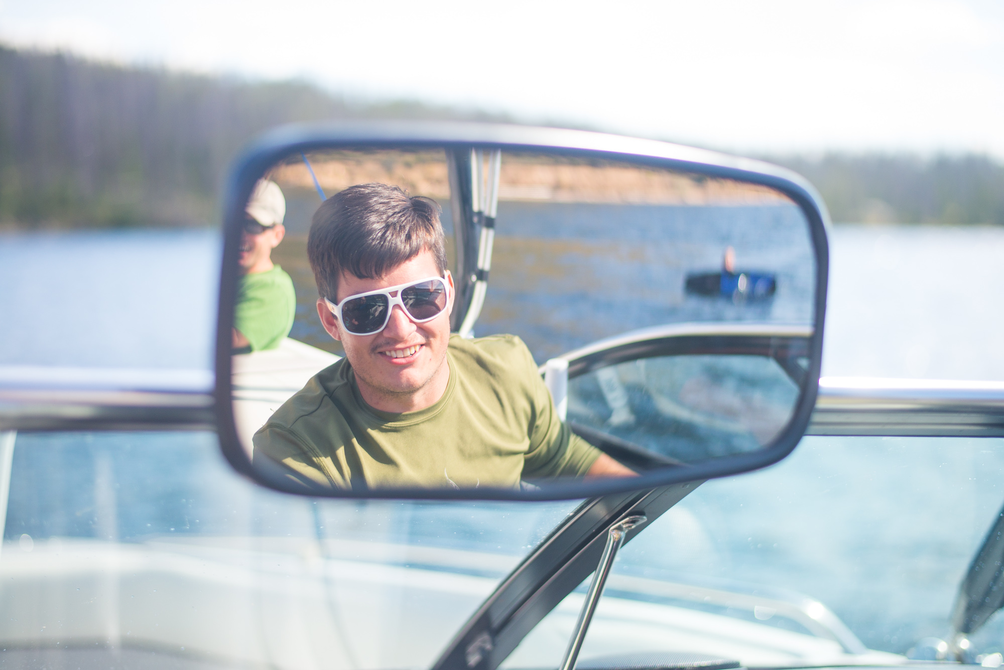
When: Dec 6th thru Dec 13th 2015
What: Explore the North Coast of Dominican and then head to Punta Cana for a wedding
Who: Andy+Caitlin joined with Bret and Matt for North Coast. In Punta Cana we met-up with ~15 friends!
Trip Overview:
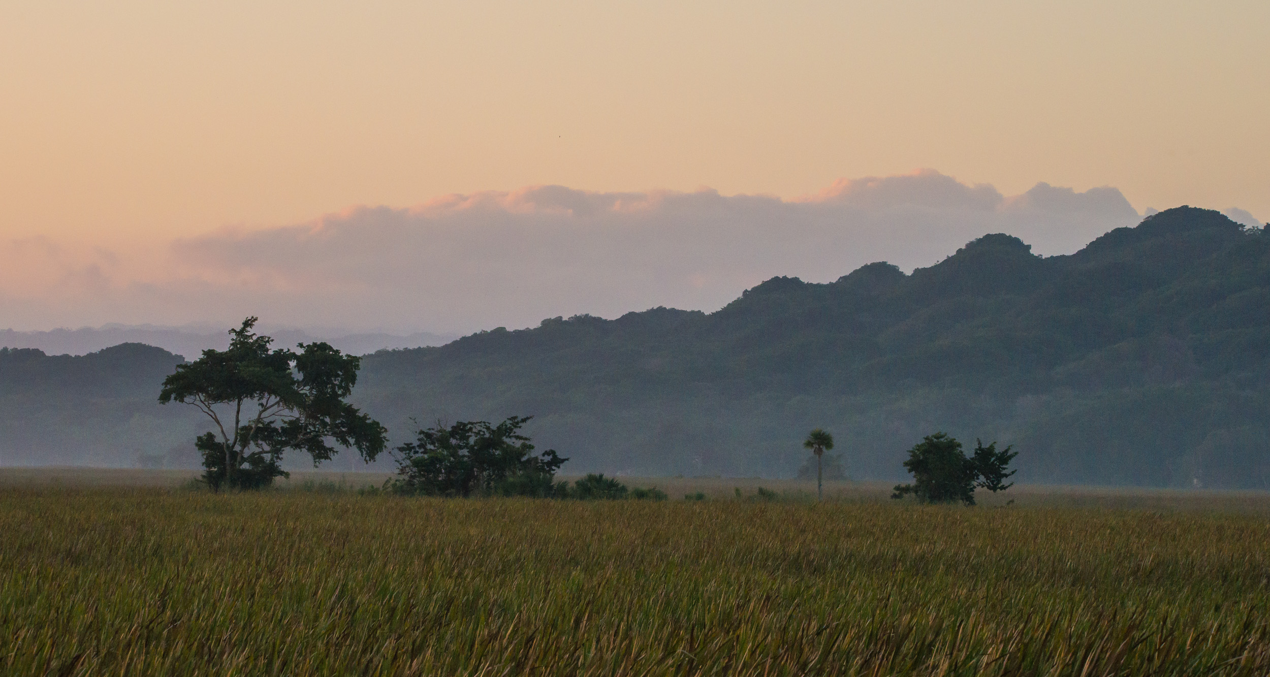
North Coast of Dominican is way too much fun and full of adventure. We went cliff jumping at 27 Charcos which was crazy + fun + scary which is always a great combo. Huge ziplines at Monkey Jungle which allowed us to explore the island in a different way (not to mention the cute monkeys when we were done). Crazy culture everywhere with brightly colored houses, insane motorbikes, and lots of locals trying to enjoy the good life!
- 4 nights in Cabrete
- 3 Nights in Punta Cana for a friend’s Wedding!!
- Full day of driving from Cabrete to Punta Cana along the North Coast
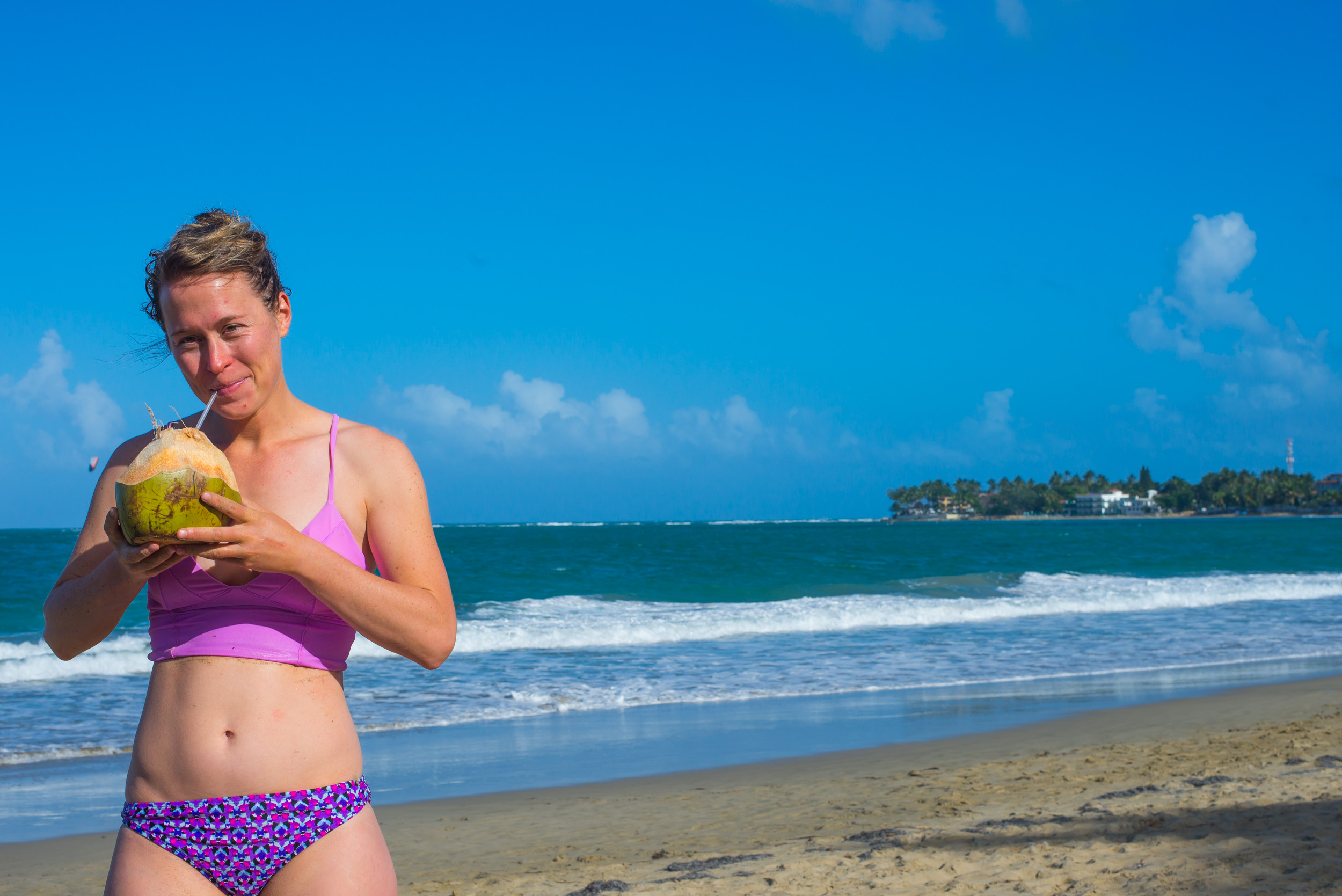
Cabarete:
Enjoying a coconut drink on the beach at Cabarete:
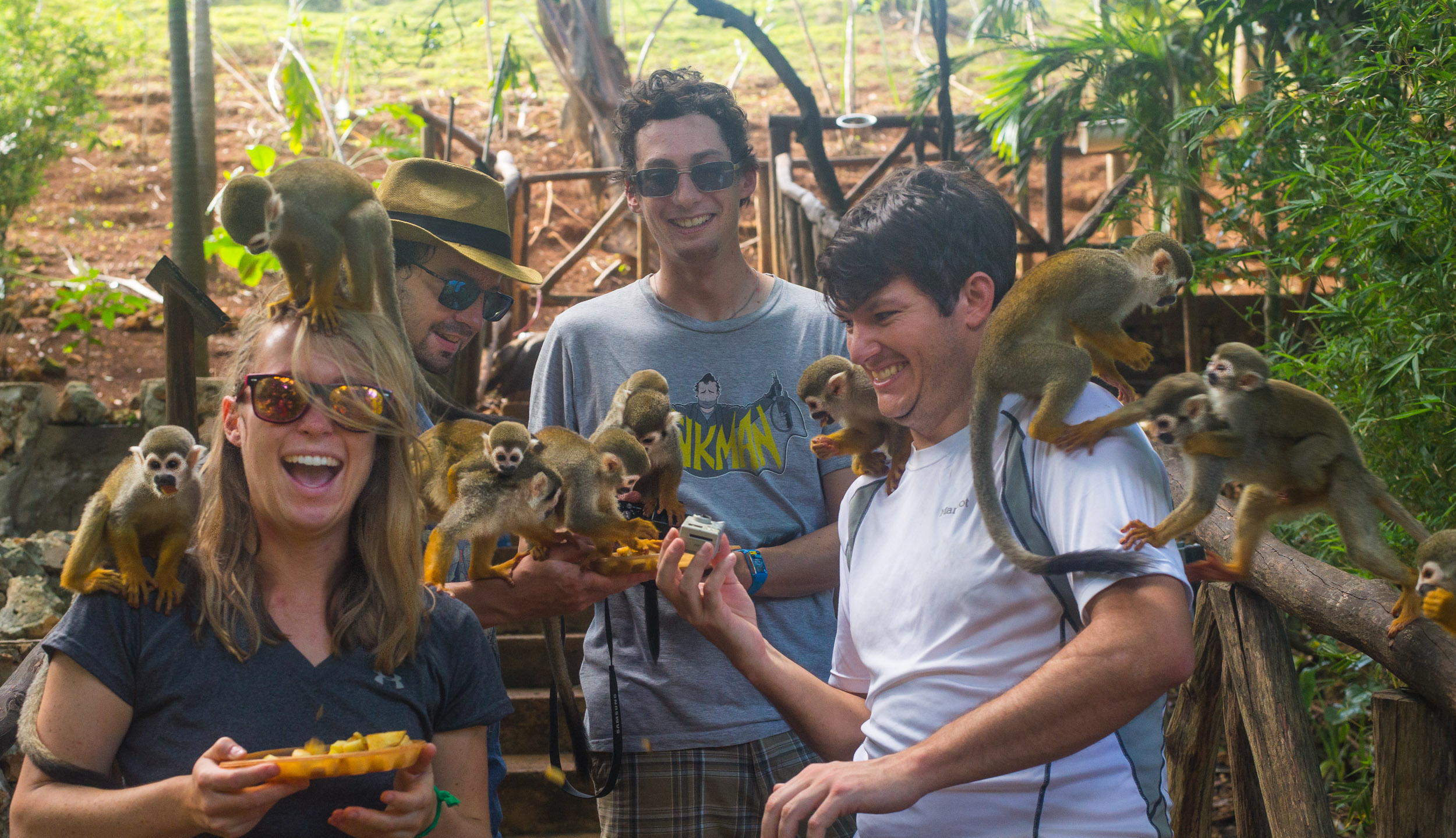
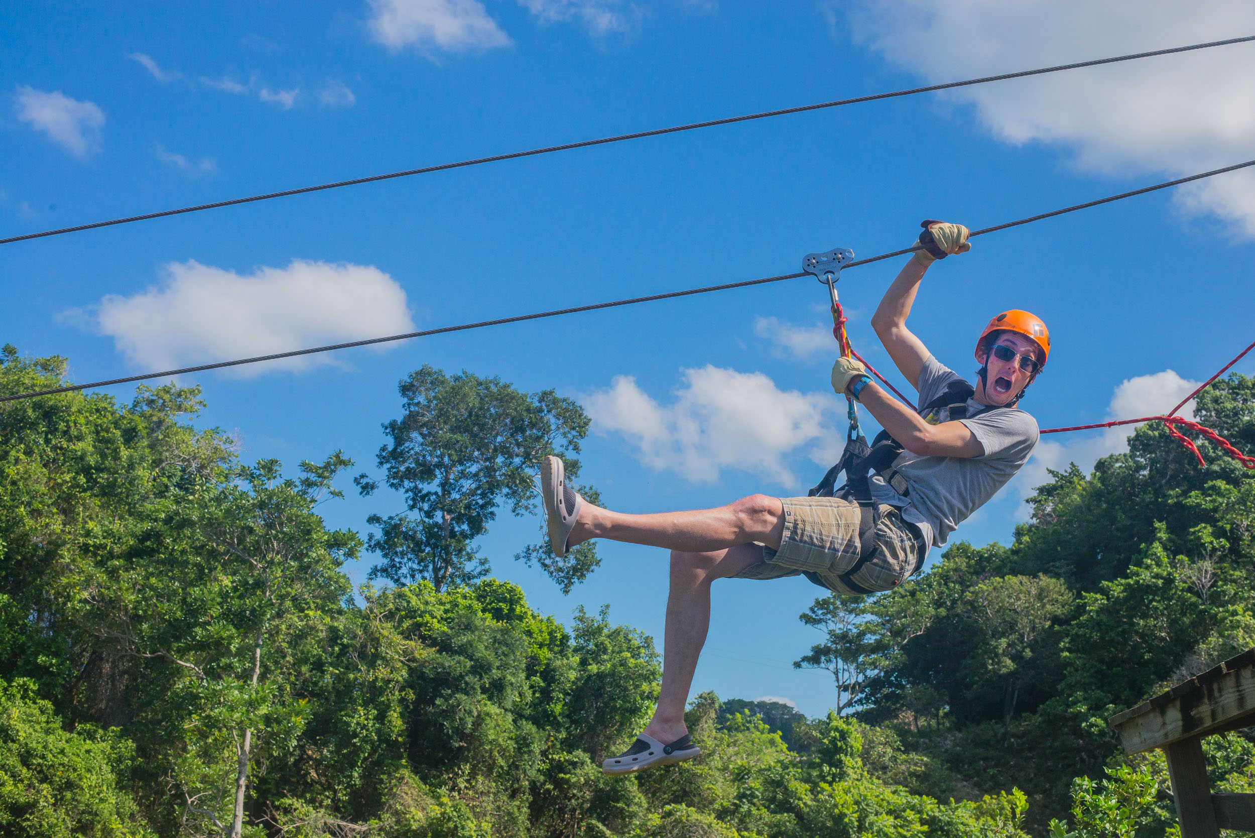
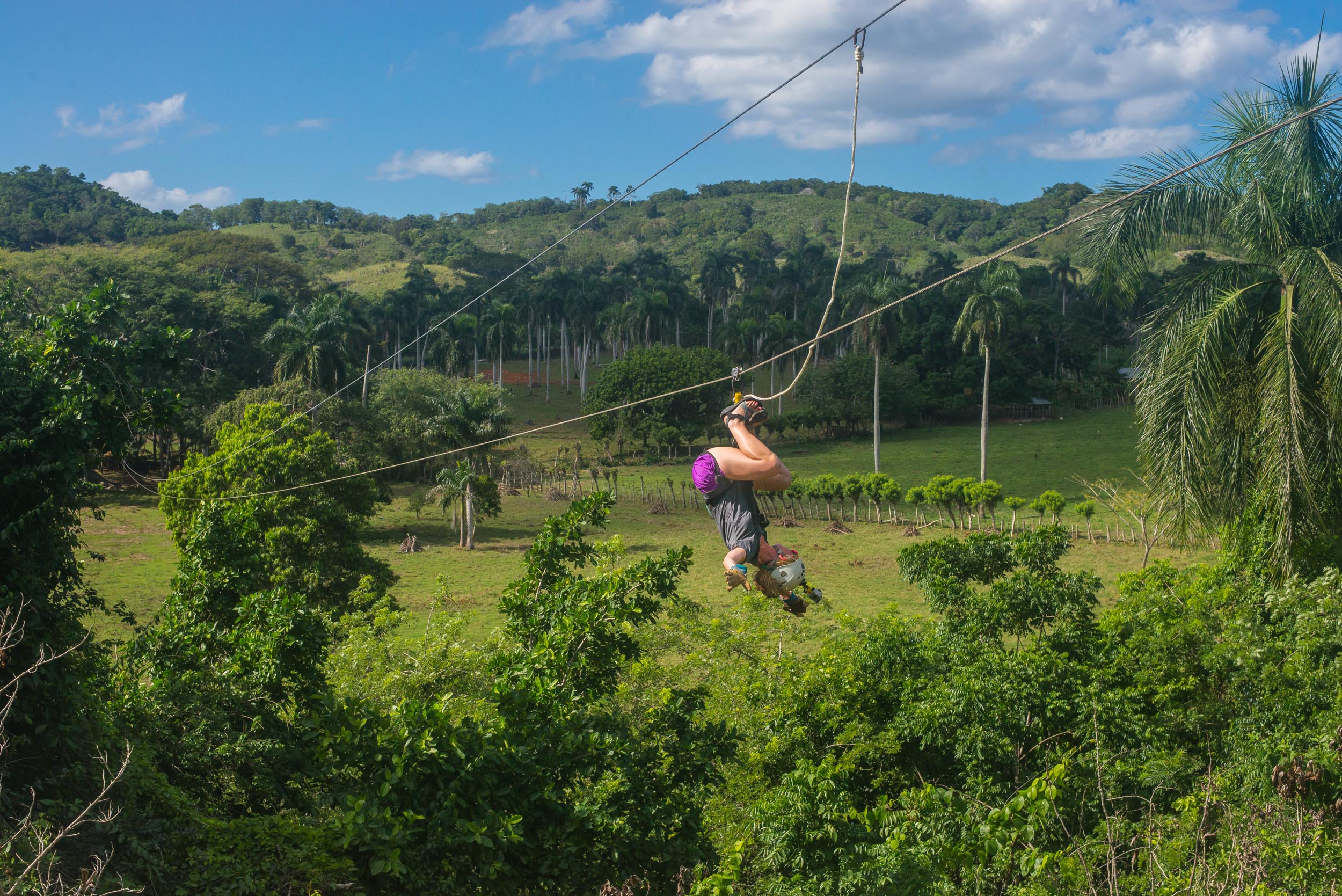
Monkey Jungle Zip Line and Monkey Park:
Way too much fun especially when you finish zip lining and play with monkeys for a couple hours. It was a quite day when we were there so the only ones zip lining and then the only ones inside the cages at the Monkey Jungle. Don’t miss out here:
Our awesome guides:
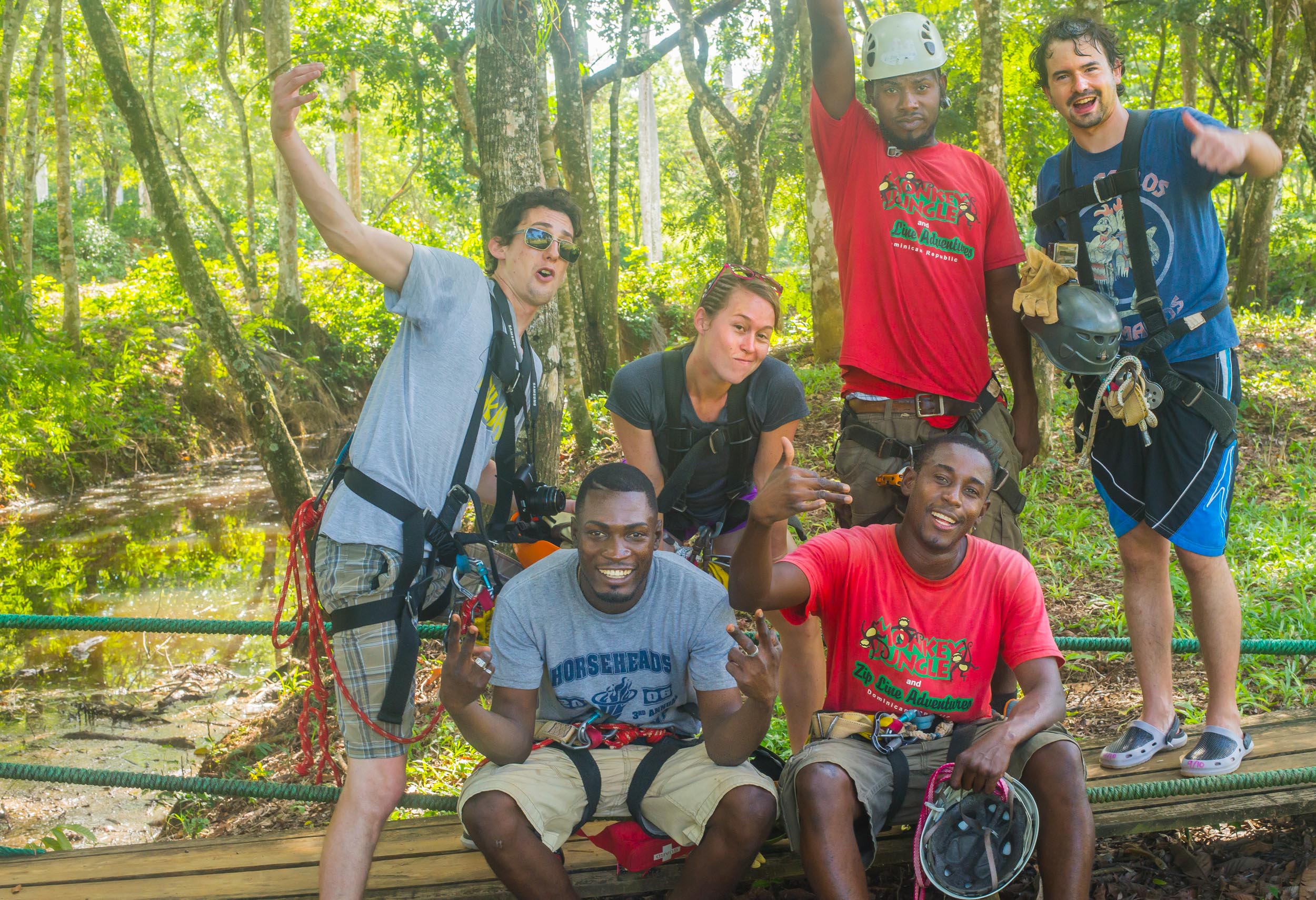
One aspect which was interesting was talking to a number of people who were displaced due to the earthquake in Haiti back in 2010 and now many of them are working in Dominican Republic. Several of our guides were from Haiti and many vendors were as well; you could tell the struggles that they had endured over the past few years.
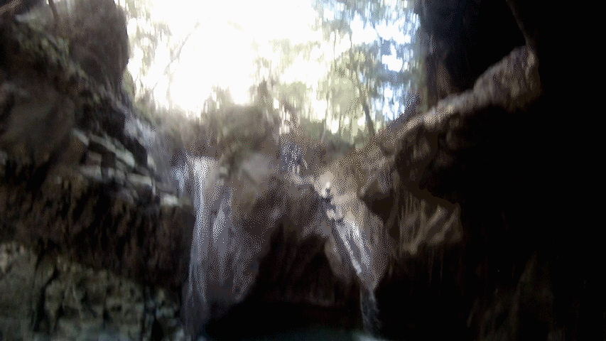
27 Charcos: 27 Waterfalls of Damajagua
https://www.tripadvisor.com/Attraction_Review-g147290-d627325-Reviews-Damajaqua_Cascades_27_Waterfalls-Puerto_Plata_Puerto_Plata_Province_Dominican_Repu.html
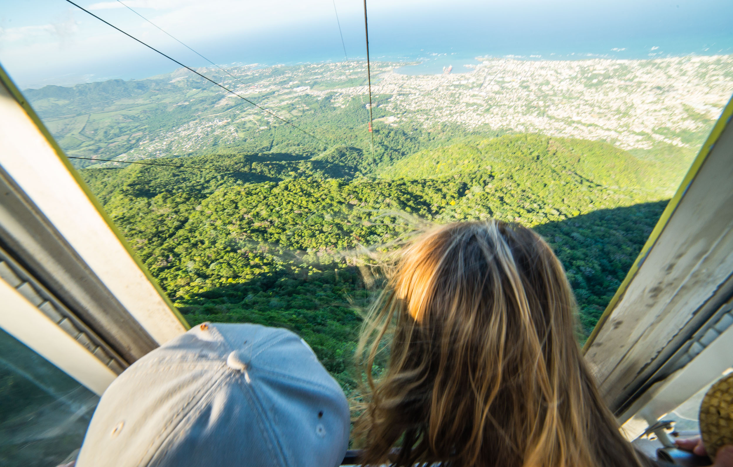
Teleferico Cable Car in Puerto Plata:
On the way home from 27 Charcos we stopped and rode the Cable Car up to the top for some beautiful sights. Some free-lance tour guide accompanied us and we really didn’t realize what was going on until we were in it; however, at the top in this unique forest, he showed us many interesting plants, leaves from grapefruit, etc, and told us a bit about the history of the area. Great pit stop:
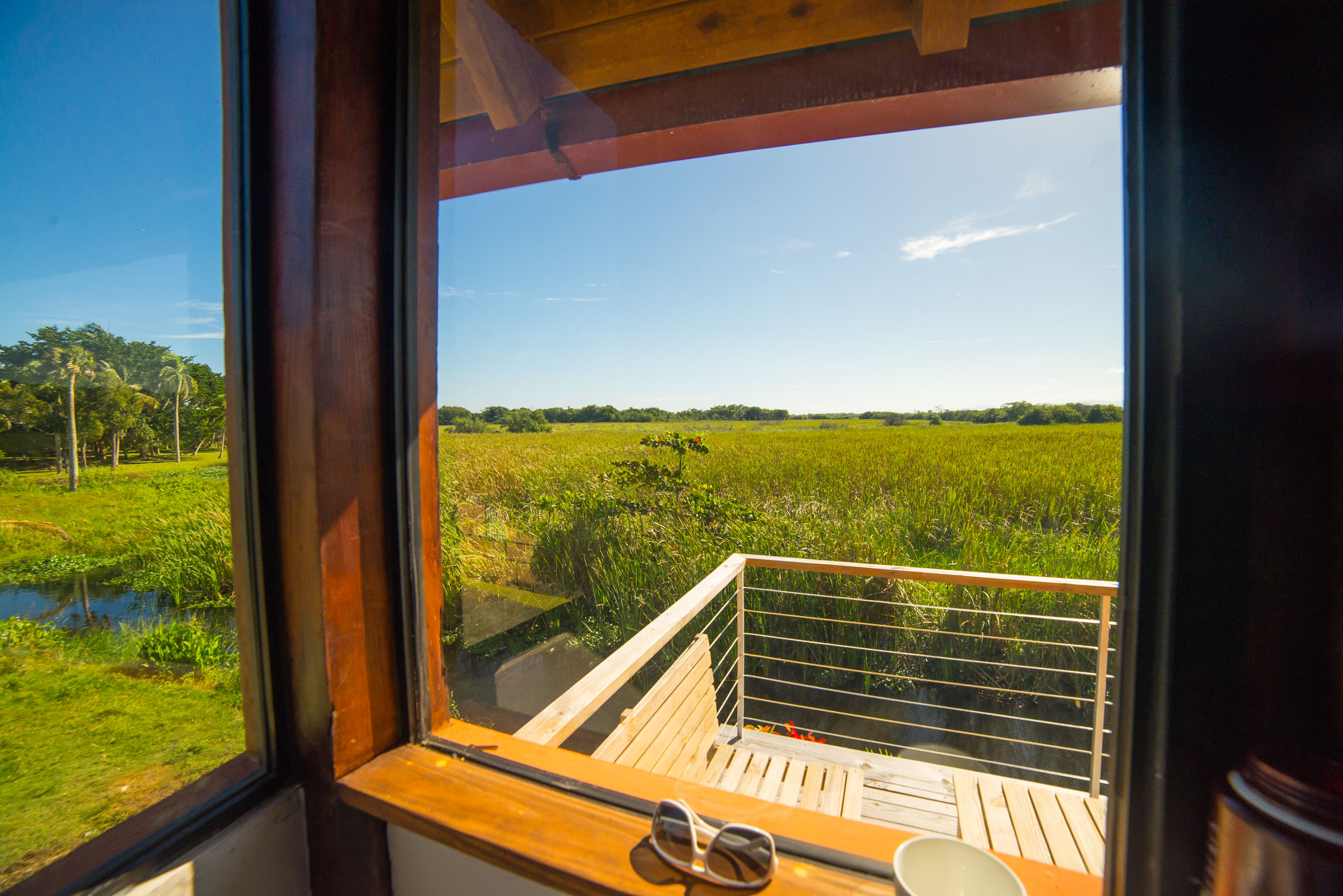
Staying in Cabarete in an AIRBNB:
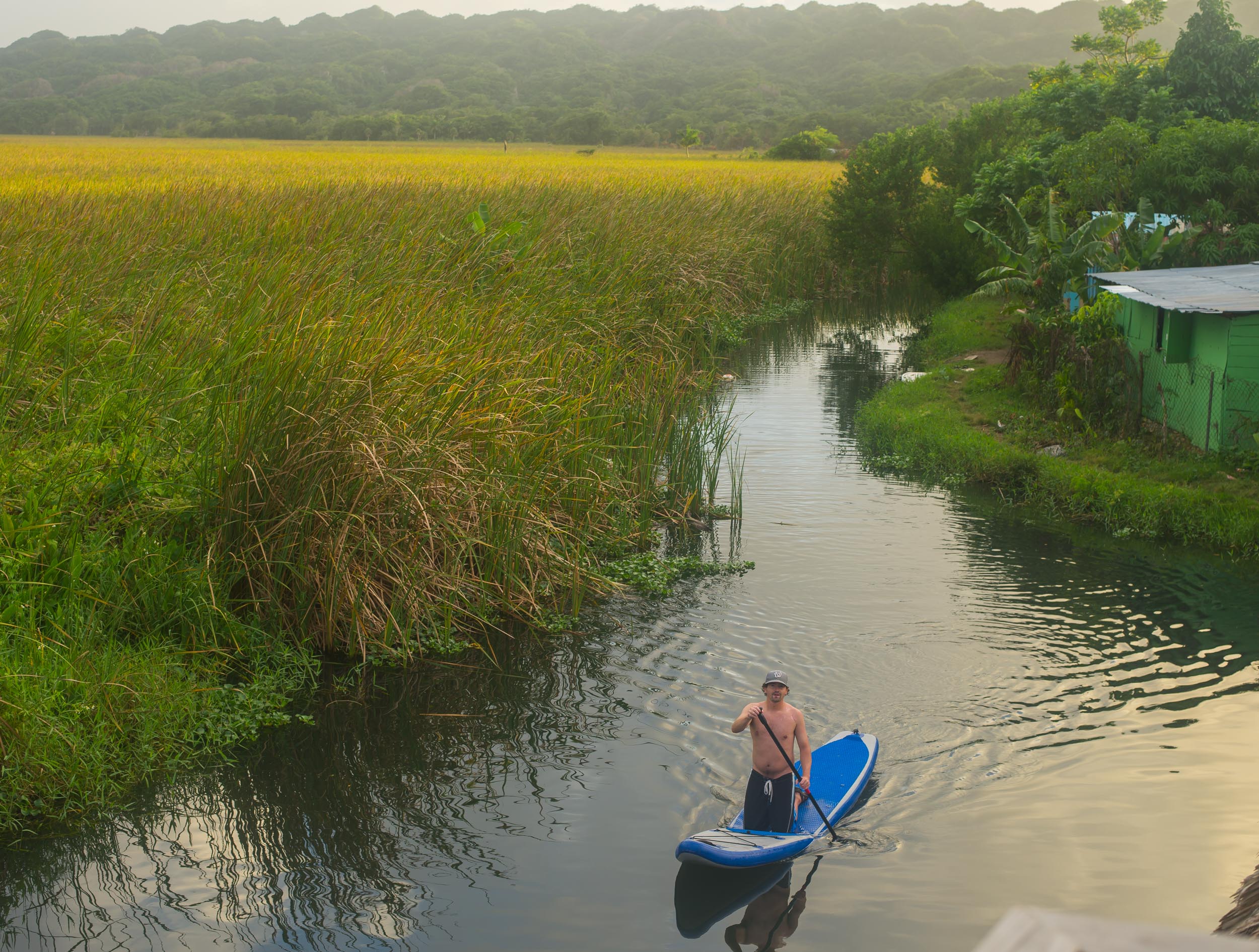
Favorite part about the North Coast of Dominican is that all of the hotels are small and boutique and there are a lot of rental houses. We stayed in one that was ~10min walk from the beach in the middle of what locals called the “barrio” where all of the local houses are. The neighbors were all really friendly and the canal behind the house you could paddleboard and canoe on!
Driving from Cabarete to Punta Cana:
Exciting. Dominican Republic is like a video game with your life when driving 🙂
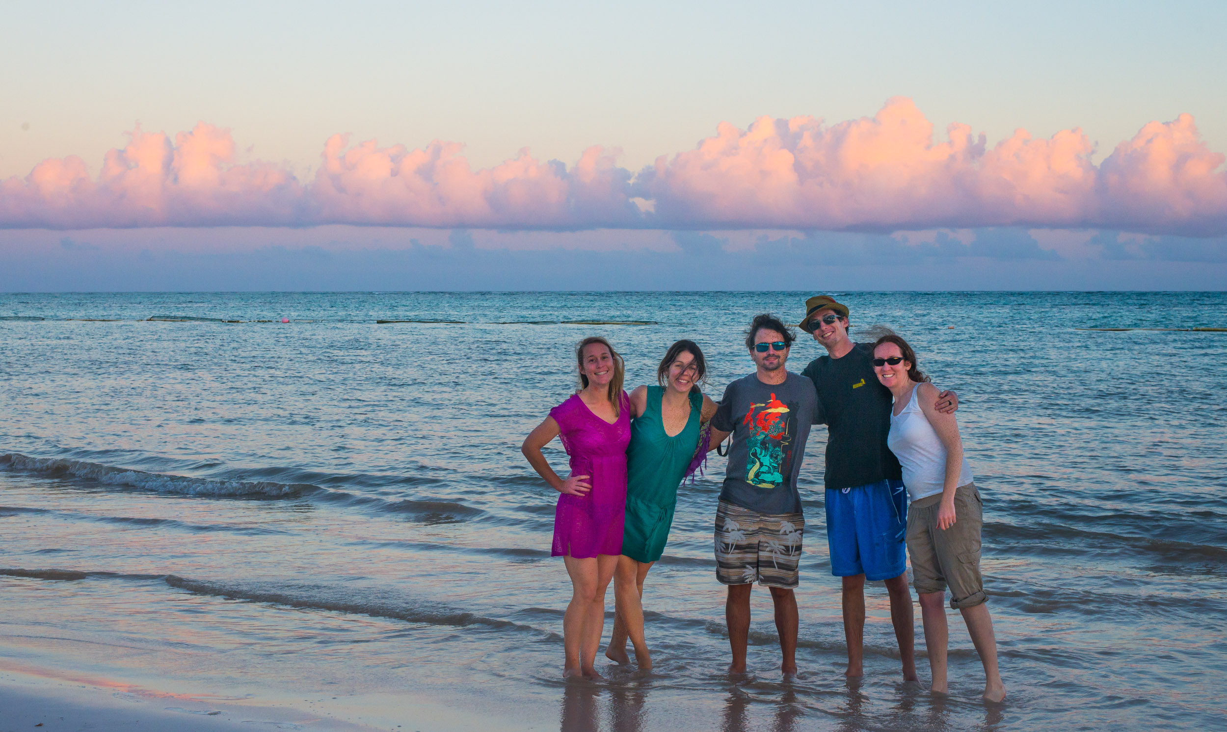
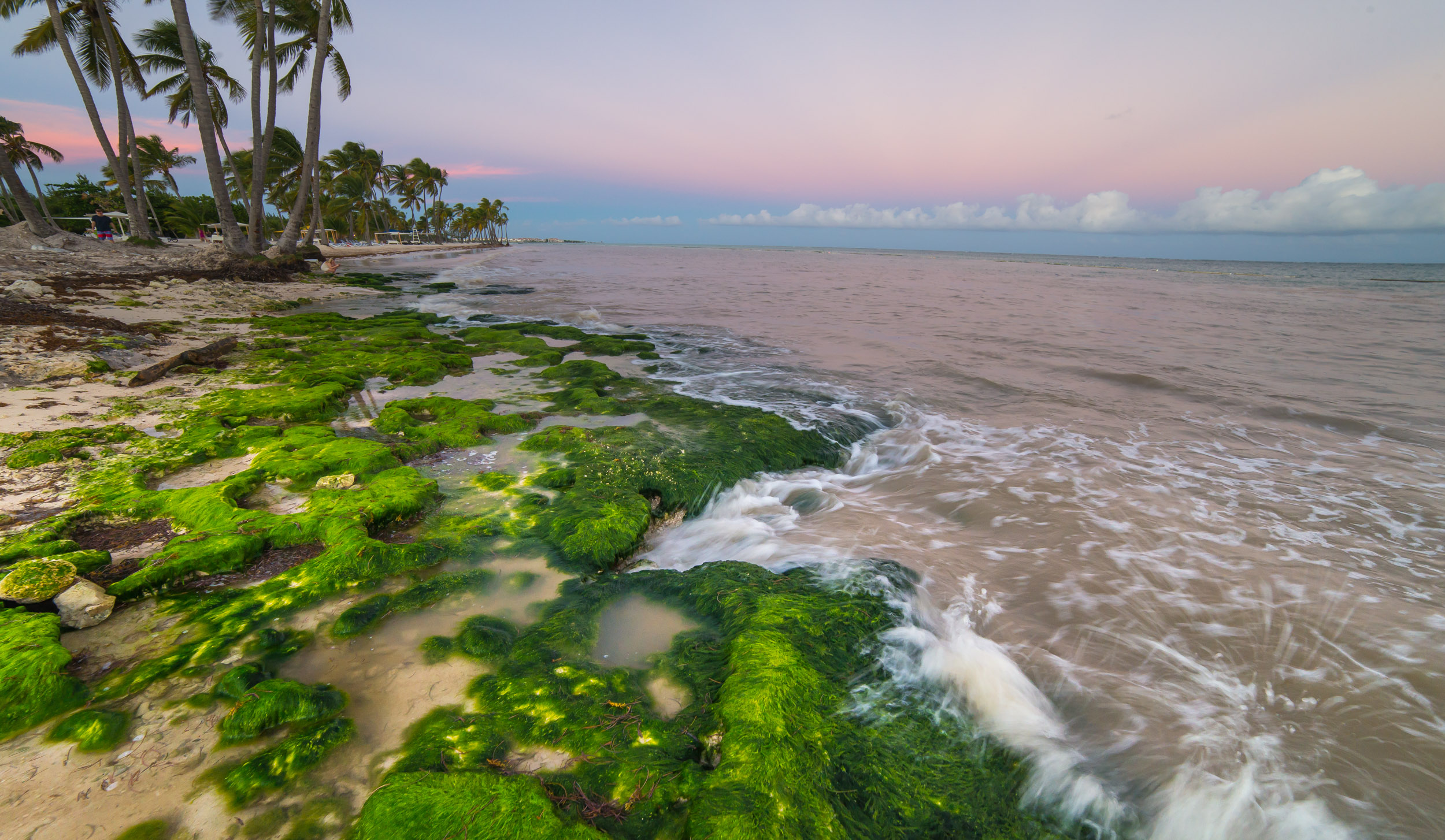
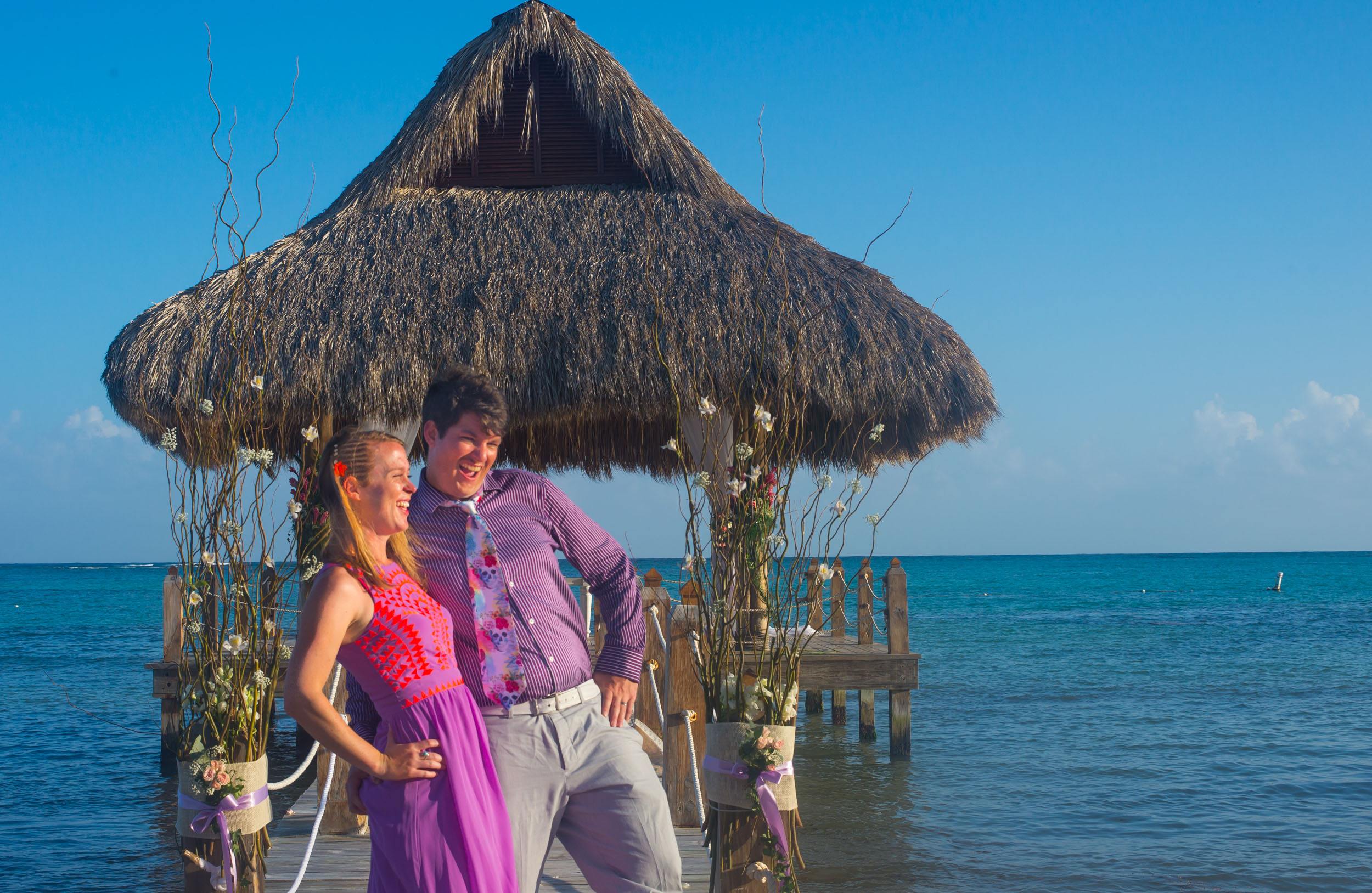
Punta Cana Wedding:
Punta Cana is beautiful but a complete 180 from the rest of the island. If you enjoy American style, isolated resorts with minimal dining options this is your place. I preferred everywhere else that we went due to the cultural elements which make the Dominican special, however, the beauty and practicality of location made up for the tourist feeling!
CABO Trip: East Cape – Seafood – Sunrises
- Posted: April 20, 2016
- By: andylibrande
- In: Activity Categories, Location Categories, Mexico, Travel, Water Sports
- 0
When: Depart Denver on a plane at 9am Friday April 17th, Arrive 1am to the Beach in Cabo (direct flights kick ass!), 3 nights in CABO
What: Andy’s 30th BDAY (I once heard it is best to celebrate a 30th out of the country…I couldn’t agree more!)
Who: Andy+Caitlin
A quick weekend trip to the less explored East Cape of the Baja was a perfect adventure for my birthday weekend. While Cabo San Lucas is know for tourism, and cruise-ships, it is beautiful but usually crowded (we have visited Cabo before!). The other city, San Jose Del Cabo is known for Art and traditional plazas. We were about 25 mins outside of town staying on the road that turns into the East Cape. A place that is usually reserved for Surfers and Divers heading into Cabo Pulmo National Park and the remote lands. Our trip was focused on seeking deserted beaches and delicious seafood!!
This was our 2nd trip to the Baja area and you can read about the 1st trip here with additional photos here.
Food was devoured (in order of consumption): As always food in Mexico is the best!
- Lunch: Buzzards Bar and Grill; Fish Tacos
- Dinner: Meson del Angel; Tuna Steak + Crazy traditional stuffed pepper + blueberry mojoitos + Ice-Cream “sushi” roll + Marachi singing Happy B-Day (we ate here before!)
- Breakfast: Mango Margaritas + Mexican Pastries + Sunrise
- Lunch: Flora Farms; Seafood Pesto Pizza + Pork-link sandwich (all food grown on the farm locally)
- Dinner: Tequila’s restaurant; Fresh Fish + Shrimp + Octopus appetizer + more Marachi singers
- Breakfast: Pastries + Sunrise
- Lunch: on the beach in the middle of nowhere: Chips+black beans+cured meats+margaritas+plums+avocado+cerveza
- Dinner: La Palapa in Cabo Pulmo; Aguachili Scallops (huge plate of scallops with lime+chili), Two Lobster Tails, Seafood Tacos, and another order of Scallops for dessert (because they were that good!). This seaside open air restaurant is right in the middle of Cabo Pulmo and delivered the best seafood of the trip!
- Breakfast: remaining tequila+fruit+pastry+ Final Sunrise
- Lunch: Jumbo plate of ceviche, Red Snapper fried whole+Jumbo Shrimp

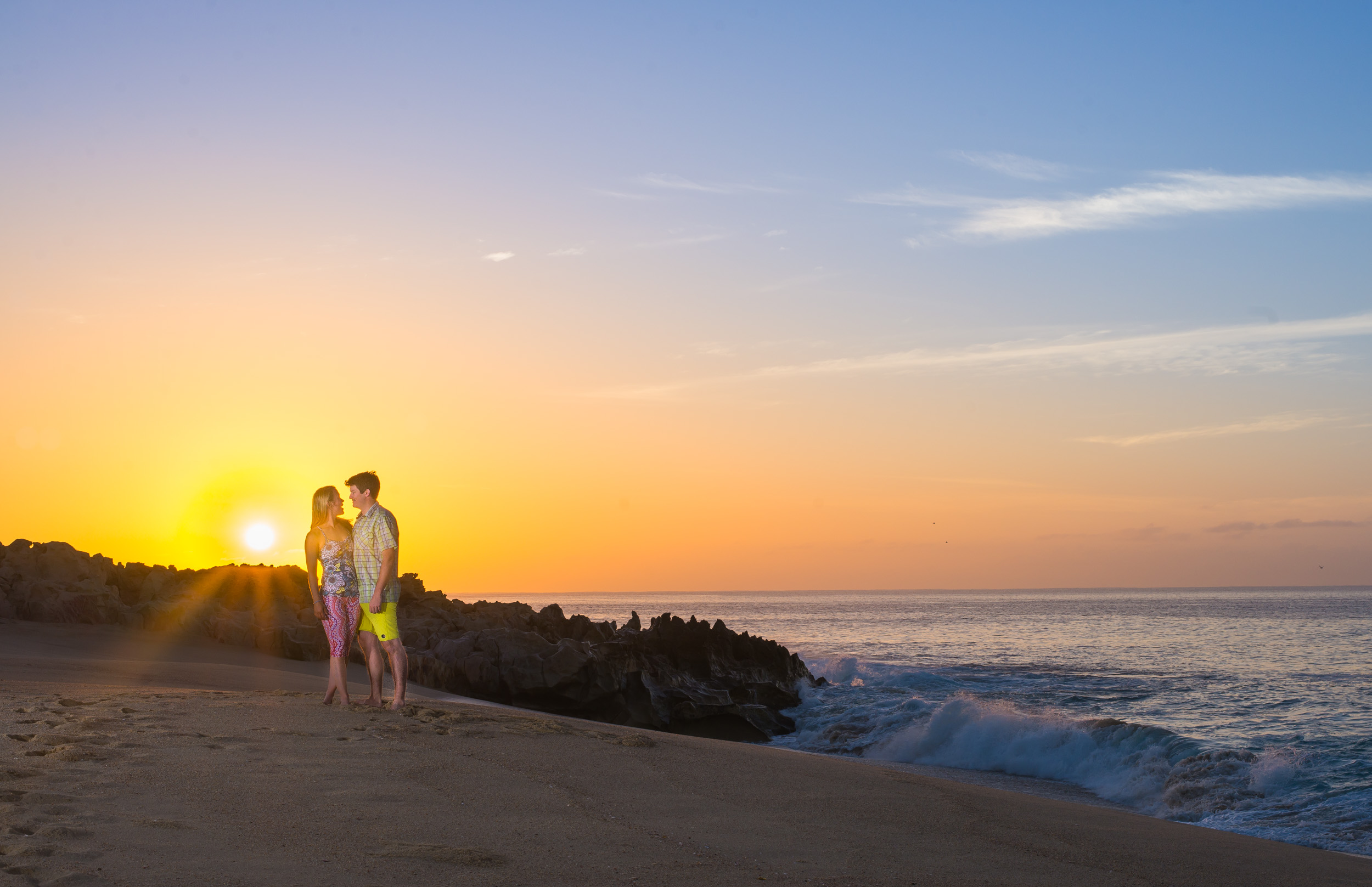
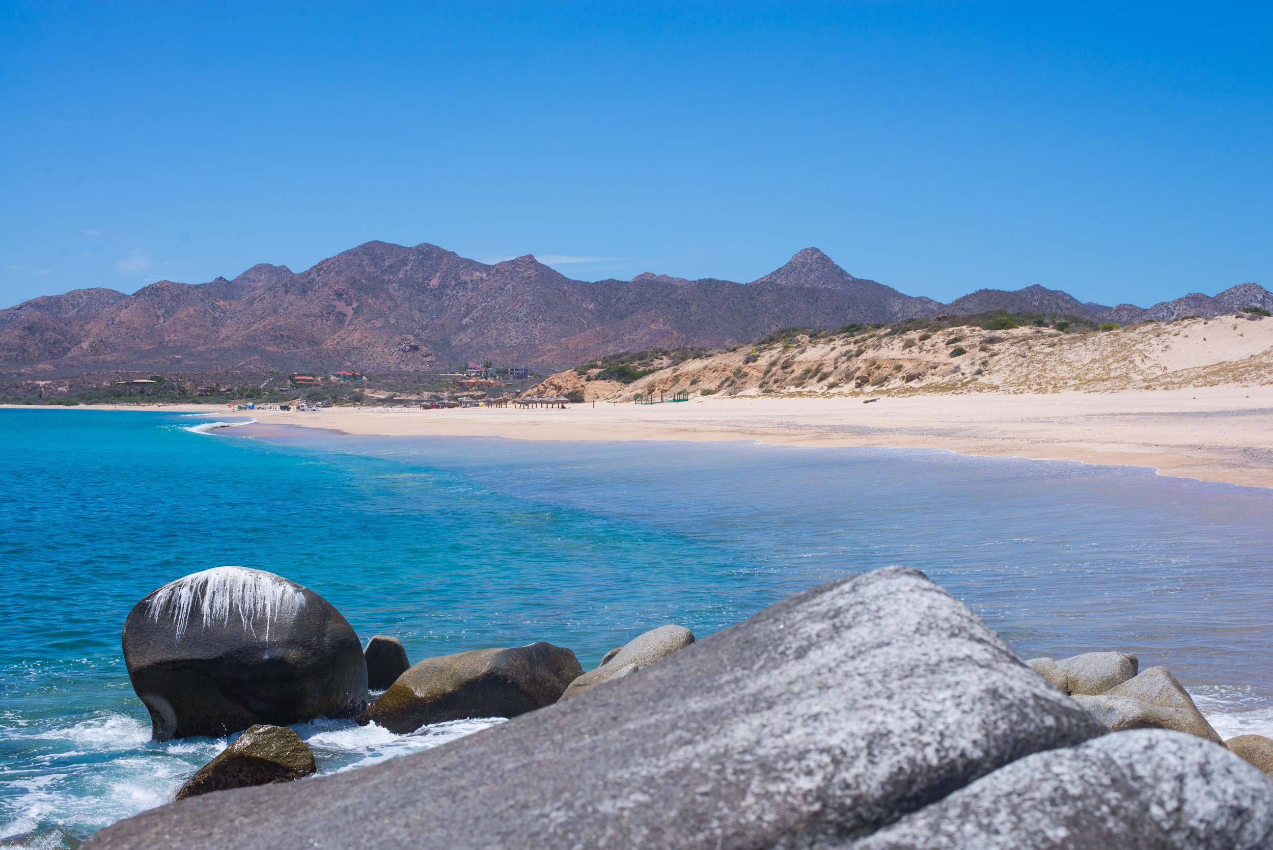
Sunrise was epic every day as it rose over PUNTA GORDA!!:
Exploring the East Cape of Cabo:
Cabo Pulmo Marine Park, Los Frailes Snorkeling, Dirt Roads, and Deserted Beaches. That pretty much sums up our amazing experience.
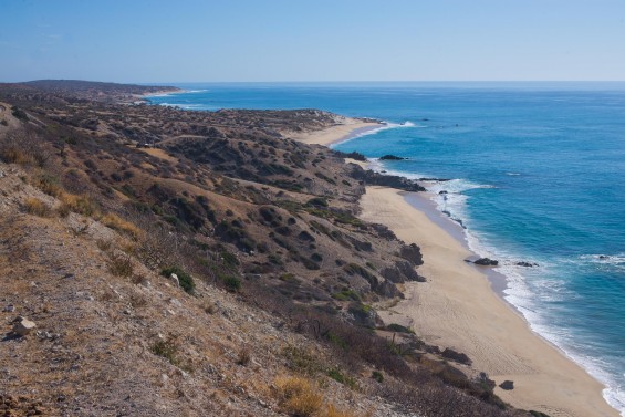
We took the coast road which was no problem in our little rental car. The road was full of beautiful overlooks and interesting sights along the way. While worried a little about this road it actually was in top-notch conditions and was easy to travel on for what it is.
Los Frailes (link to MAP) was the beach we stopped at in Cabo Pulmo Marine Park. Snorkeling Saw some cool fish; Parrotfish, Scorpionfish, Cornet Fish, and schools of lots of colorful fishes.
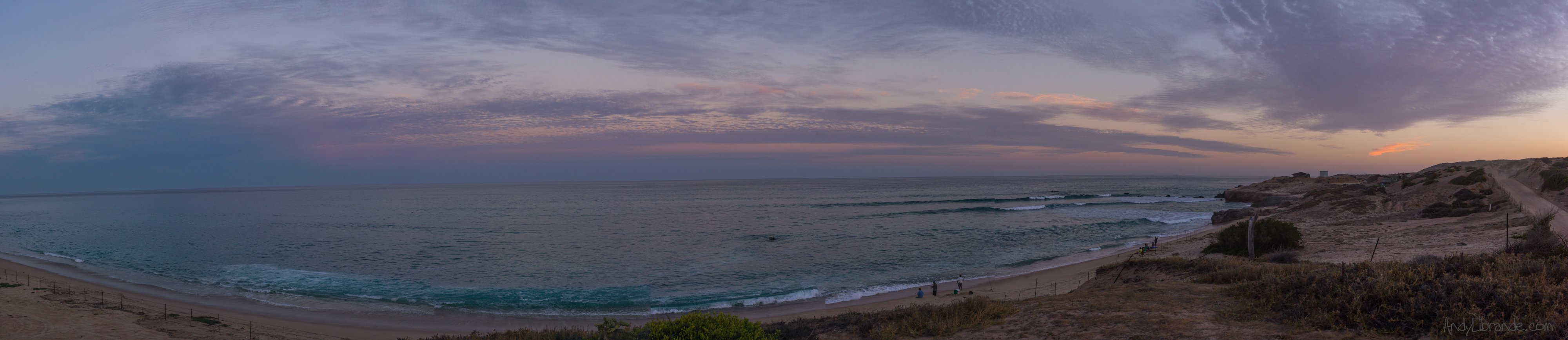
It was a Sunday and the beach was 100% deserted. A couple sailboats were moored offshore, and fisherman were 1 mile+ away. It was very enjoyable!! There was amazing covered shade PALAPAS on the beach for use making it really practical.

Looking back on the Beach from where we went snorkeling:
We spent all day at the beach enjoying the sun, snorkeling, and quite time. Lunch was snacks we brought along. For Dinner we decided to drive a little further up the coast to the city of CABO PULMO (maybe 15 buildings big) where we ate at the La Palapa and had amazing scallops, lobster, and shrimp!
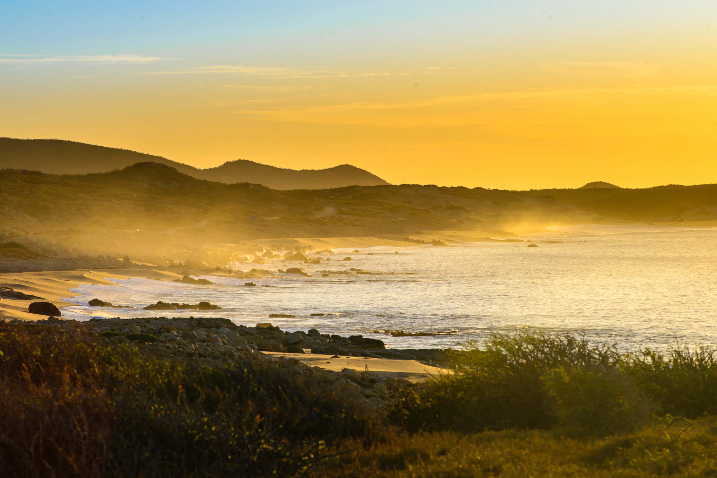
We arrived home in the dark after the drive home, enjoying a few stops for the sunset:
San Jose Del Cabo:
We spent a lot of time eating at the many unique restaurants in the area. Flora Farms stuck out as being such an unique spot with incredible food.
We had one run-in with the law which ended with no problems. Apparently bumping down the pot-hole strewn road as fast as you can is not generally looked highly upon. After some exchanges in our poor spanish discussing why we were here, that we were from Colorado, that they acknowledged there are a lot of Mexicans in Colorado, that we had a rental car, and that we were going to a local farm for lunch (less then 1/4 mile away at that point), was enough to let us away with a caution to drive slower.
YUM Fried Snapper:

TIPS for Cabo San Lucas or San Jose Del Cabo or East Cape:
- MEGA Supermarket: As you come from the airport and hit HWY 1 the MEGA store is awesome. Bottles of top notch tequila for ~$13USD, pasteries, food, dried meats, beach stuff, fruit, booze mixers, etc. Load up here once and be happy!
Accommodations:
We found a beautiful casita to rent from Kim on VRBO. Amazing views. Such a great deal in a very private neighborhood with 24/7 security:
https://www.vrbo.com/642197
One of the most beautiful places to watch sunrises as we enjoyed them from the house and also on the beach. The guard looked at us funny each morning as we strolled past him down to the beach before sunrise, enjoying the calm only a deserted beach can deliver.
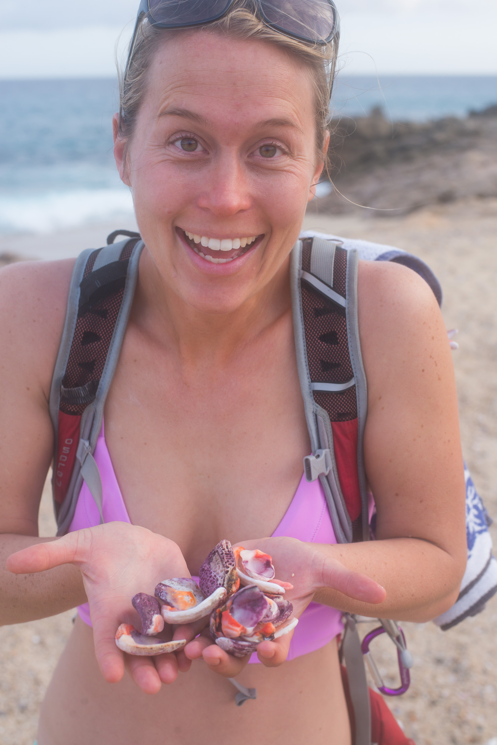
Sea Shell Hunting:
Until Next Time MEXICO!!!
Bishop California Bouldering, Hot Springs, and Camping Adventure
- Posted: December 18, 2015
- By: andylibrande
- In: Activity Categories, California, Camping, Location Categories, Rock
- 0
When: November 11th, 2014 thru November 17th (barely enough time)
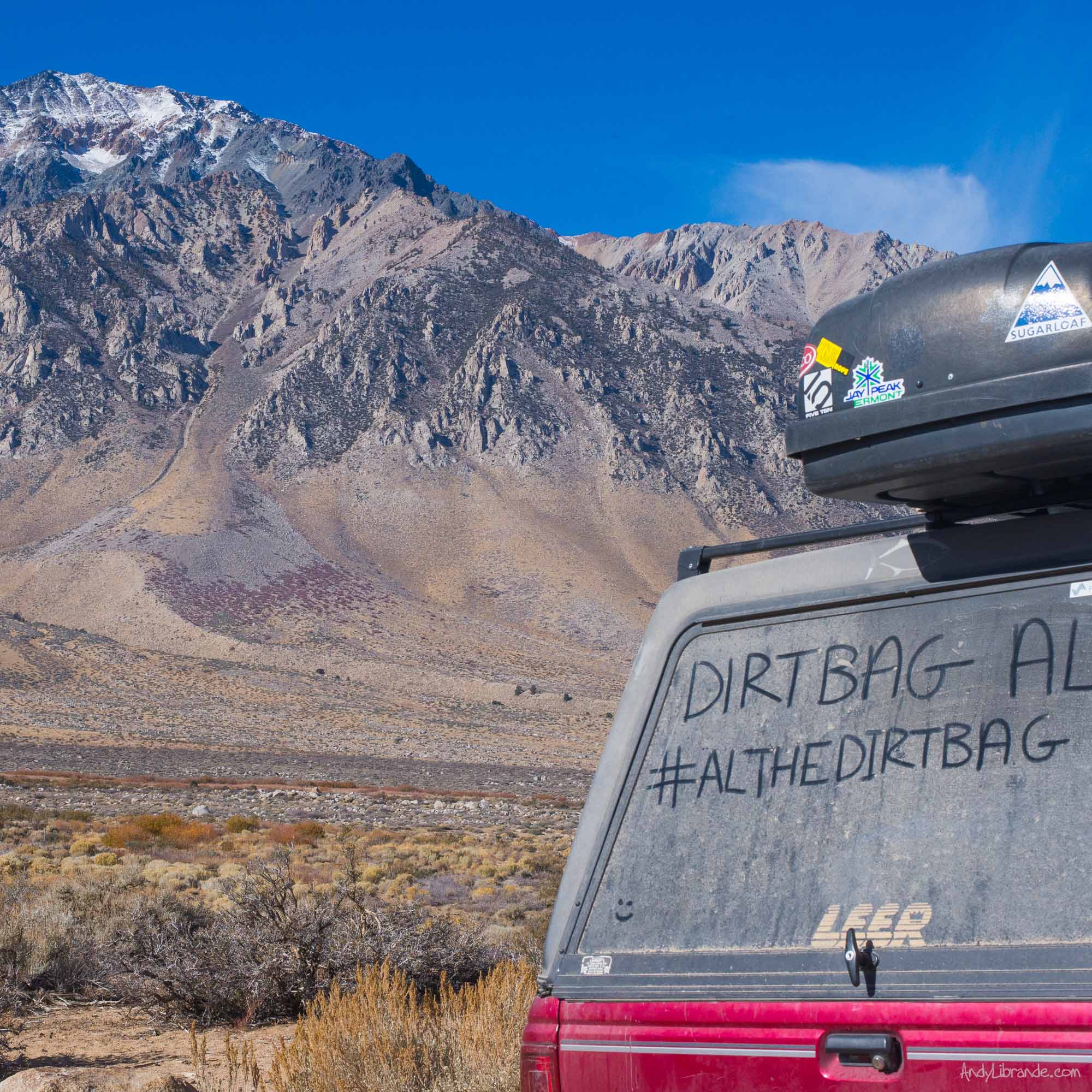
Who: Drove to meet-up with a crew: Mr Chris Storms + Sasquatch driving in from Oregon, Dirtbag AL: new friend roadtripping all over US and friend of Chris, Teresa: dirtbagging it with AL, and of course Caitlin + Andy driving in from Colorado!
Bouldering Areas Visited:
- Catacombs on the Sherwin Plateau
- Happy Boulders
- Buttermilks
- One lone boulder in Mammoth Lakes on a cold, windy day
Camping Locations:
- Side of I-70 at 2am just past Moab turnoff (Where caitlin and I slept due to late departure from Denver)
- Catacombs Bouldering Area = amazing free camping location with beautiful views. Large area to camp in with numerous options.
- Hotsprings Parking Lot
- Forest Service Land just past the Owen River Gorge Sport Climbing Area. Drive as going to 3rd parking lot but continue on dirt roads until you find a suitable dispersed camping spot.
- On way home stopped at Bryce Canyon for a night of camping and a surprise sunrise engagement PROPOSAL!
- Our three vehicle crew all had vehicles we could sleep-in making it easy to set-up camp anywhere, protect us from the constant wind, and be mobile as we explored the numerous unique stops in the area.
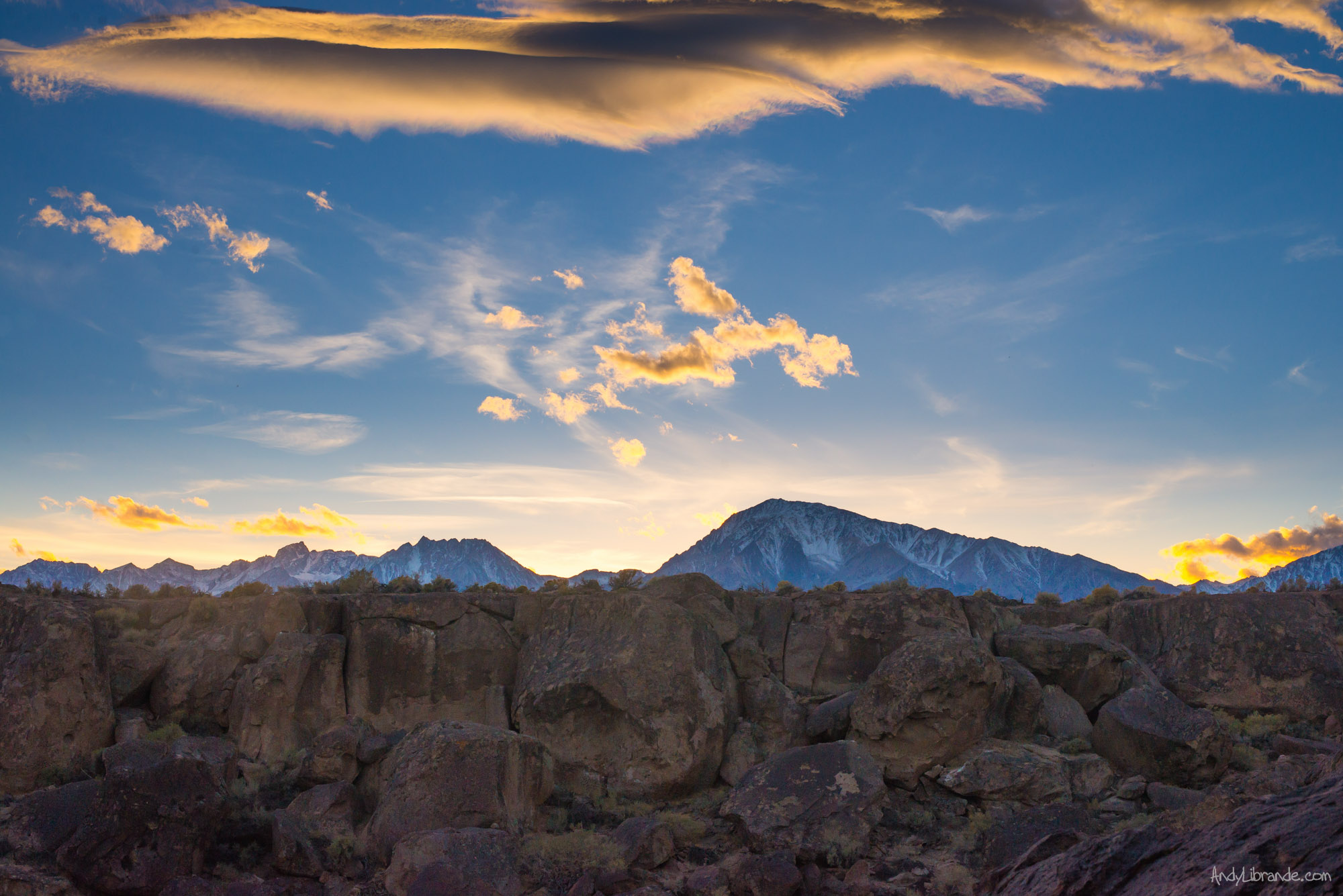
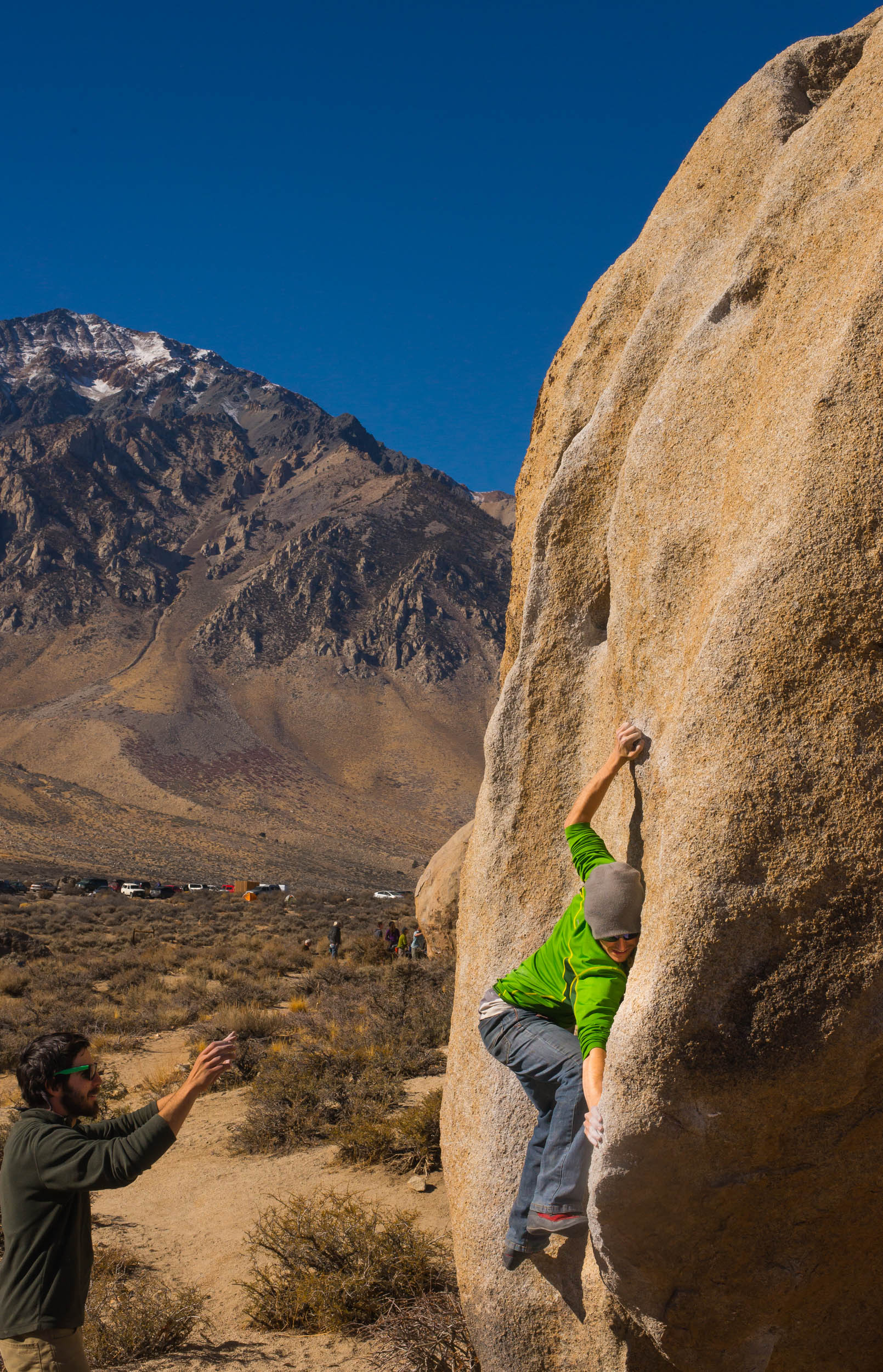
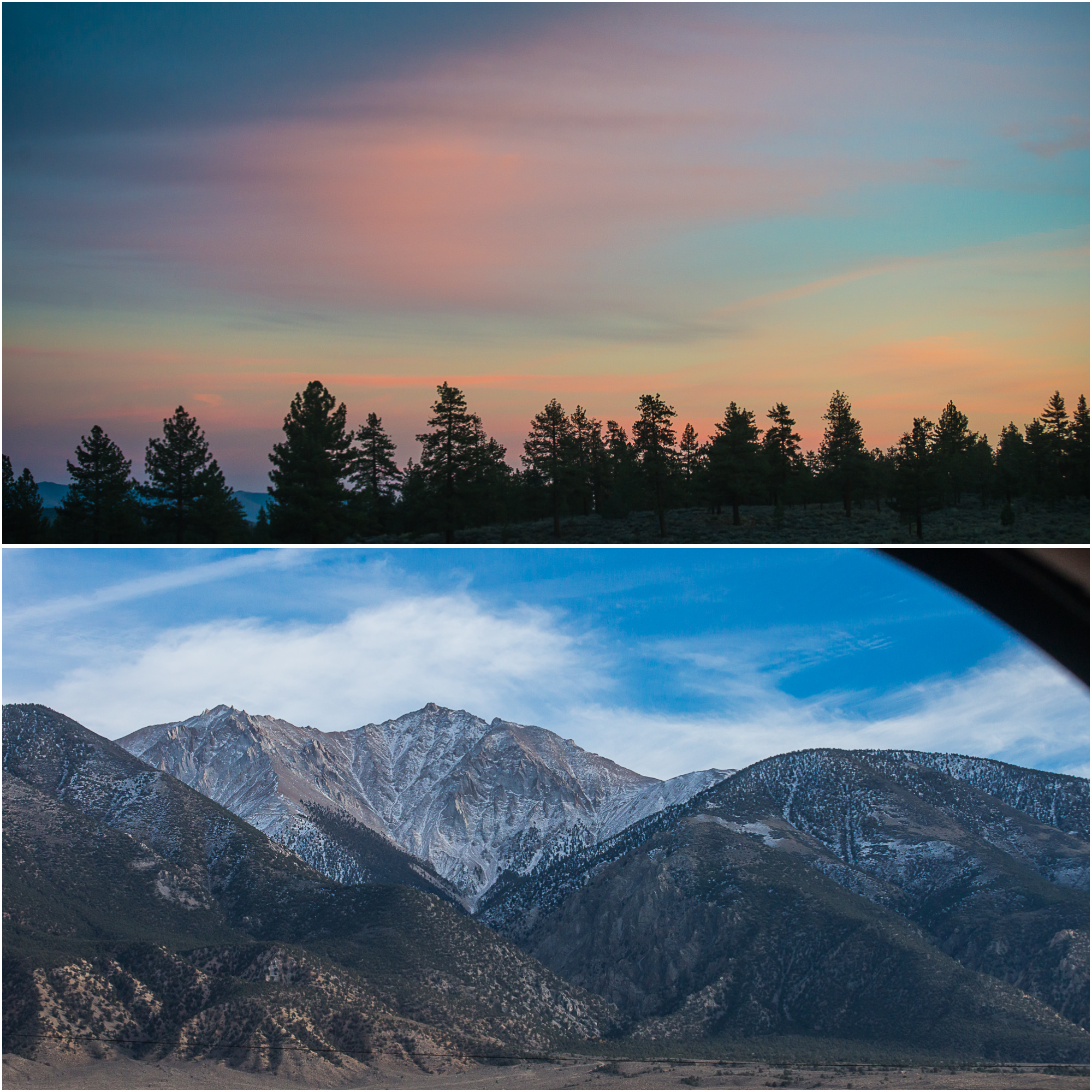
View of Mt. Whitney and the Eastside of the Sierra Mountain Range (from Catacomb Boulders):
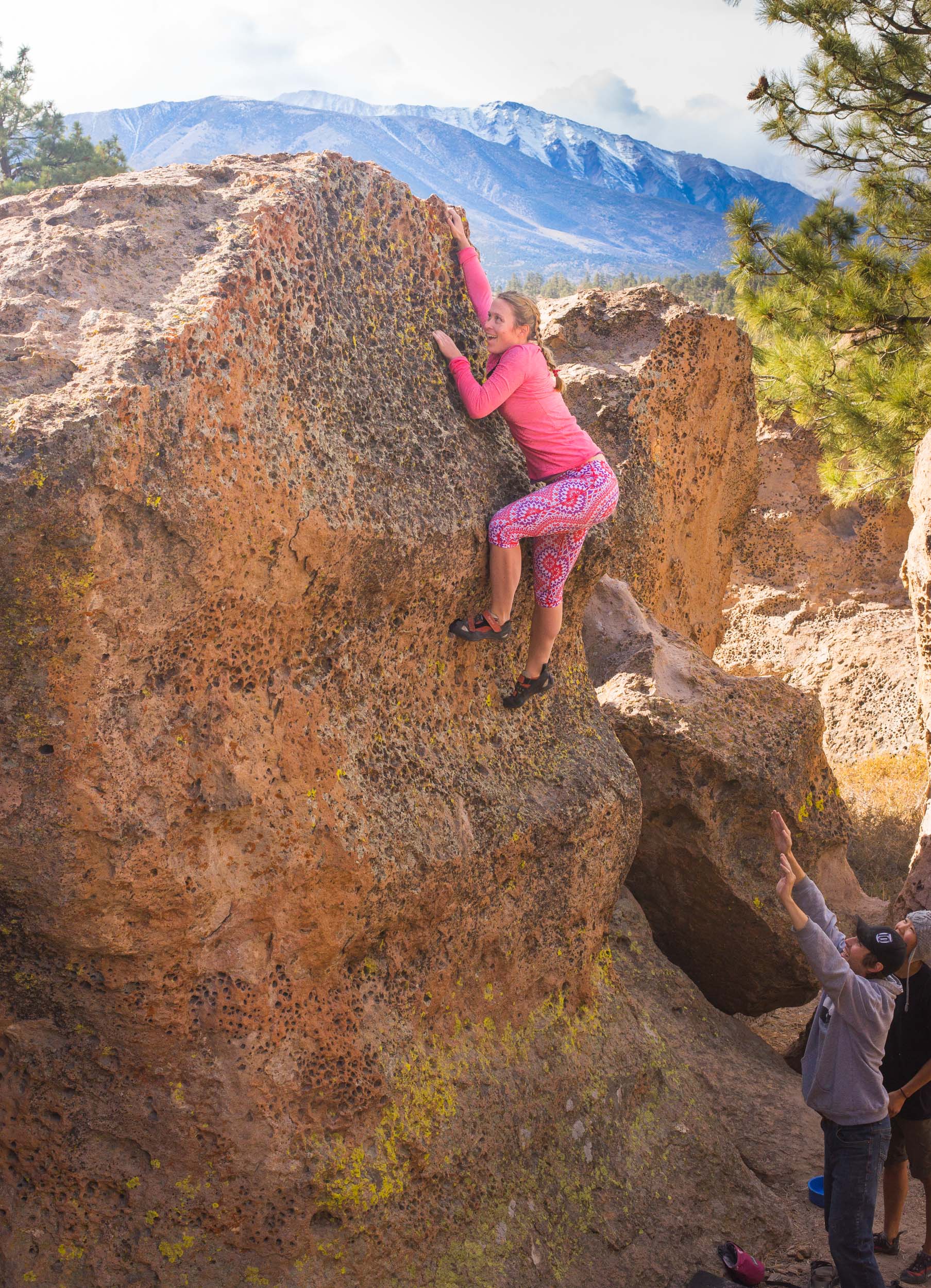
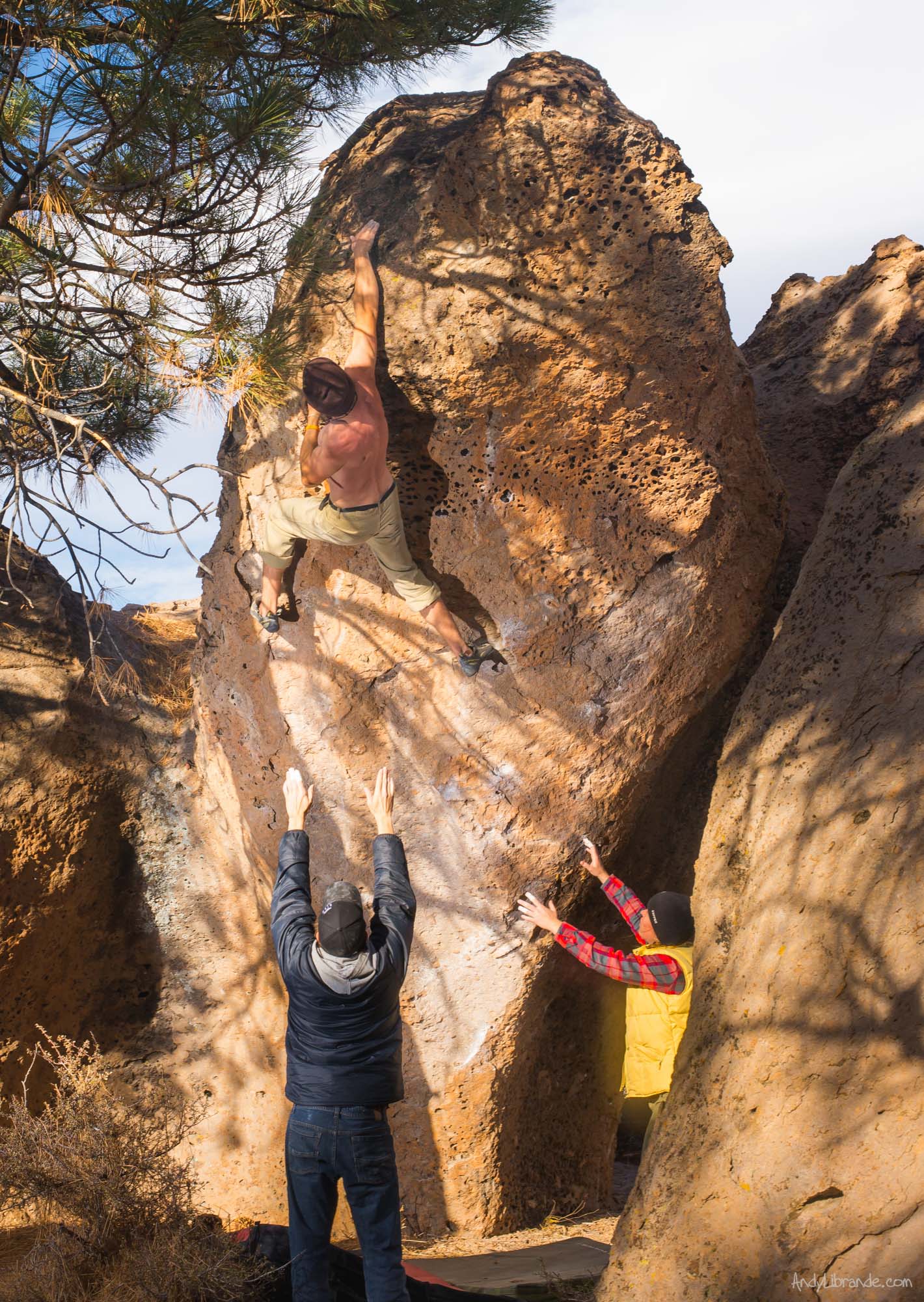
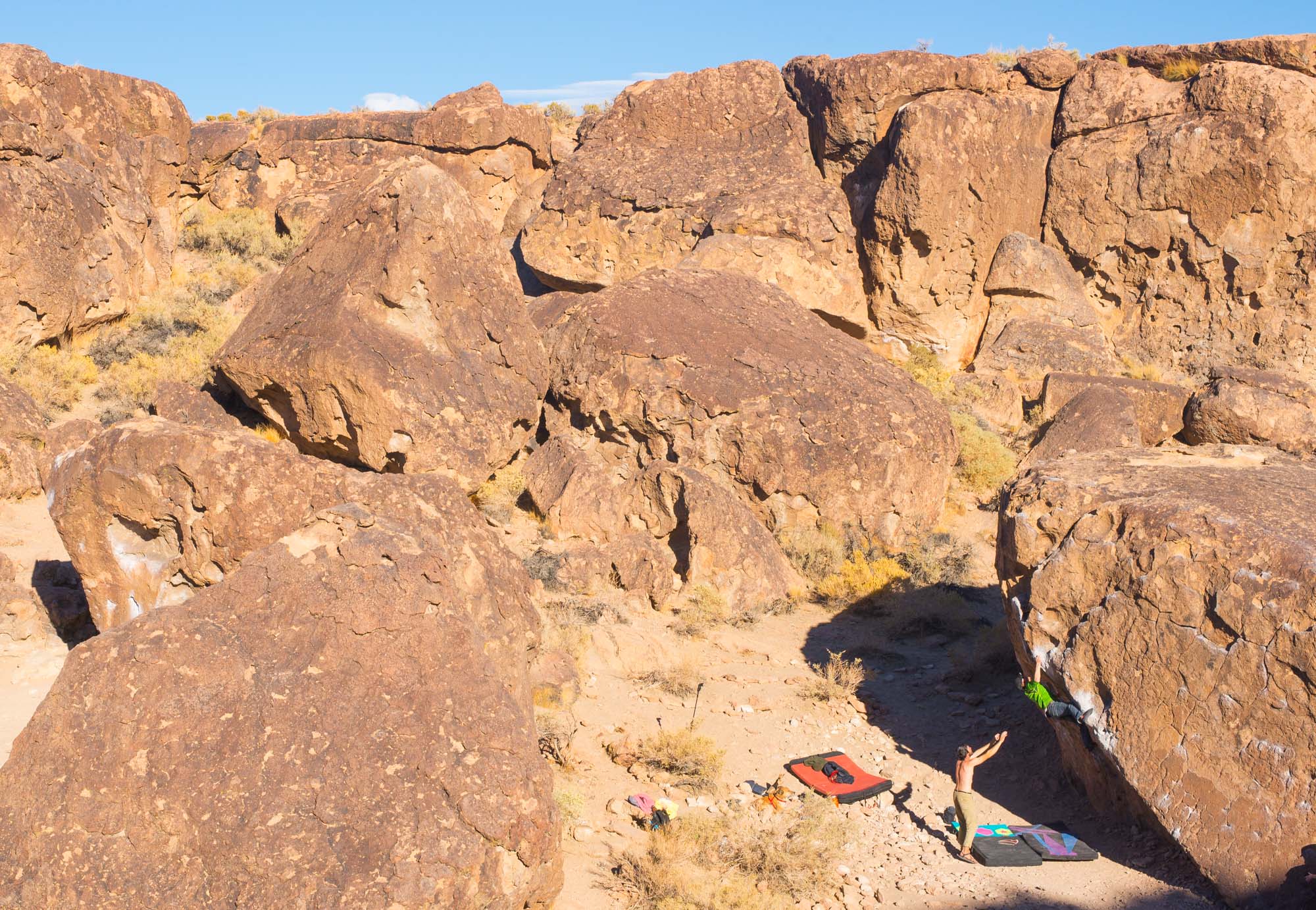
Bouldering at the Catacombs in Bishop California:
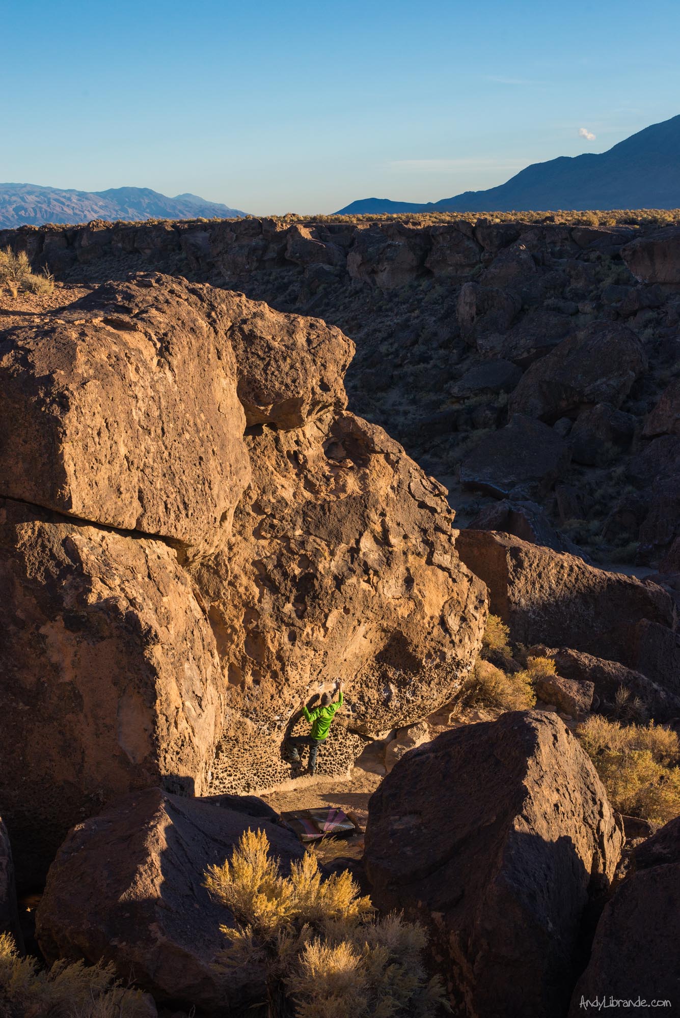
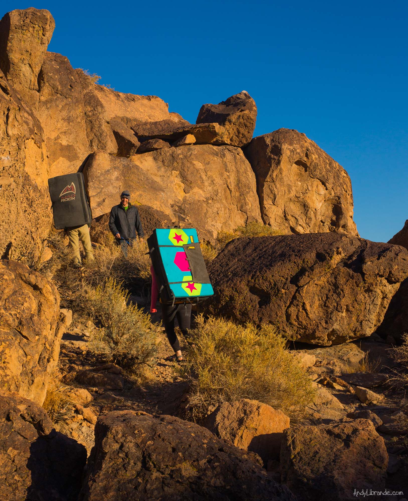
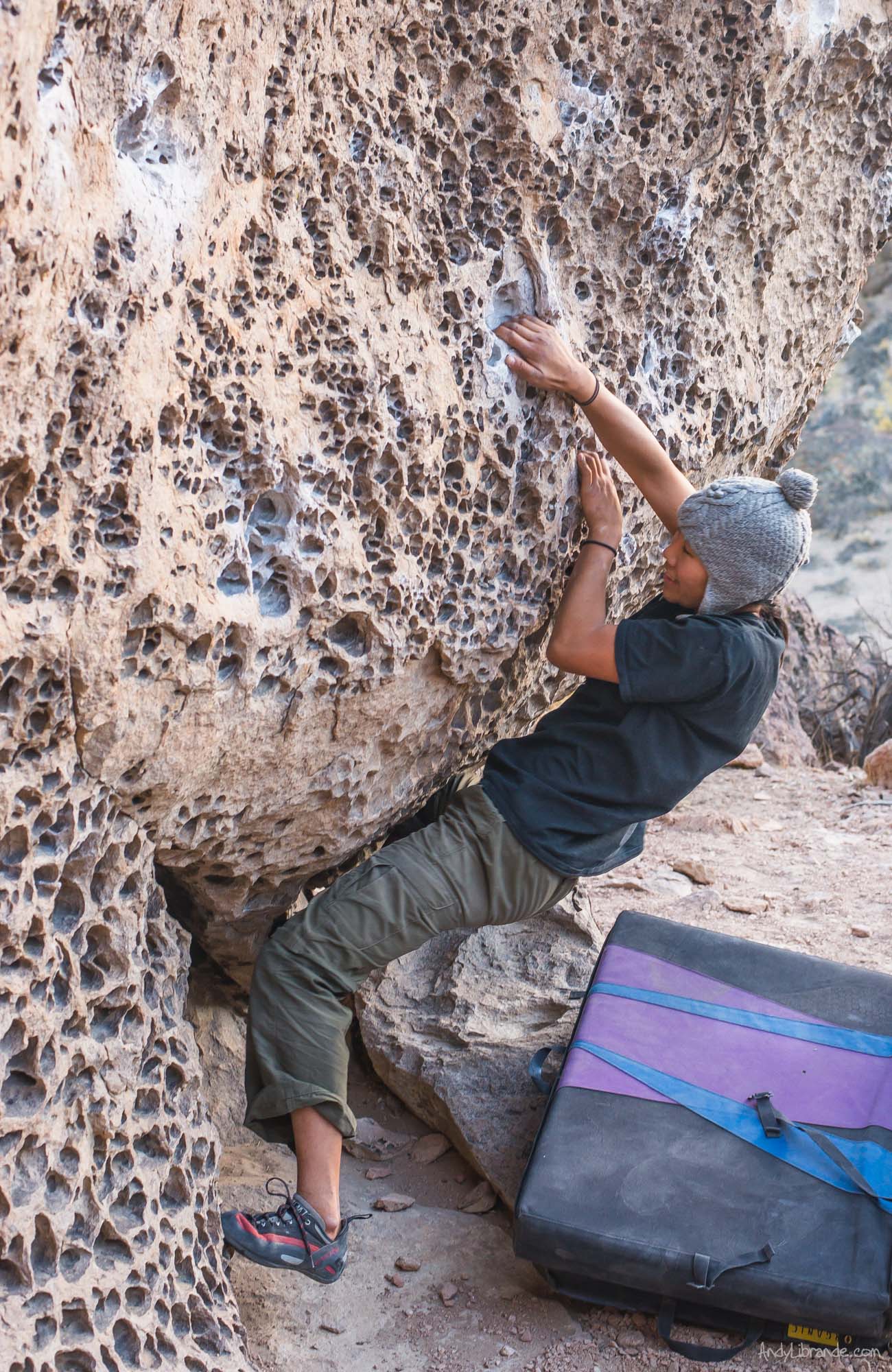
Bishop’s least known climbing area was easily one of our favorites for our crew. Hiding in the shadows of the heavily publicized Buttermilks and Happy/Sad Boulders, this bouldering area would be the crème de la crème in other locations. A short walk from the parking lot (and camping zone) and you encounter dozen of heavily pocketed walls, 15 ft tall, with perfect flat landings. Beautiful lichen covers the walls with an incredible backdrop. This was a great place to get into the mindset of the highball bouldering that was coming and stretch out after 20+ hours of travel.
Caitlin all smiles after hitting the top jug:
Chris working on the moves “I am a Beautiful Man”:
Located a short-drive outside of the town of Bishop, CA it sits high above the Owen River gorge with impressive views of the Sierra Eastside. There was no one else out there but us!! Below is the view from where we were camping:
A few more shots from this great full day of bouldering. We spent 6-hours on the rocks (it helps when the cars/campsite/lunch are no more than a 5 min walk away):

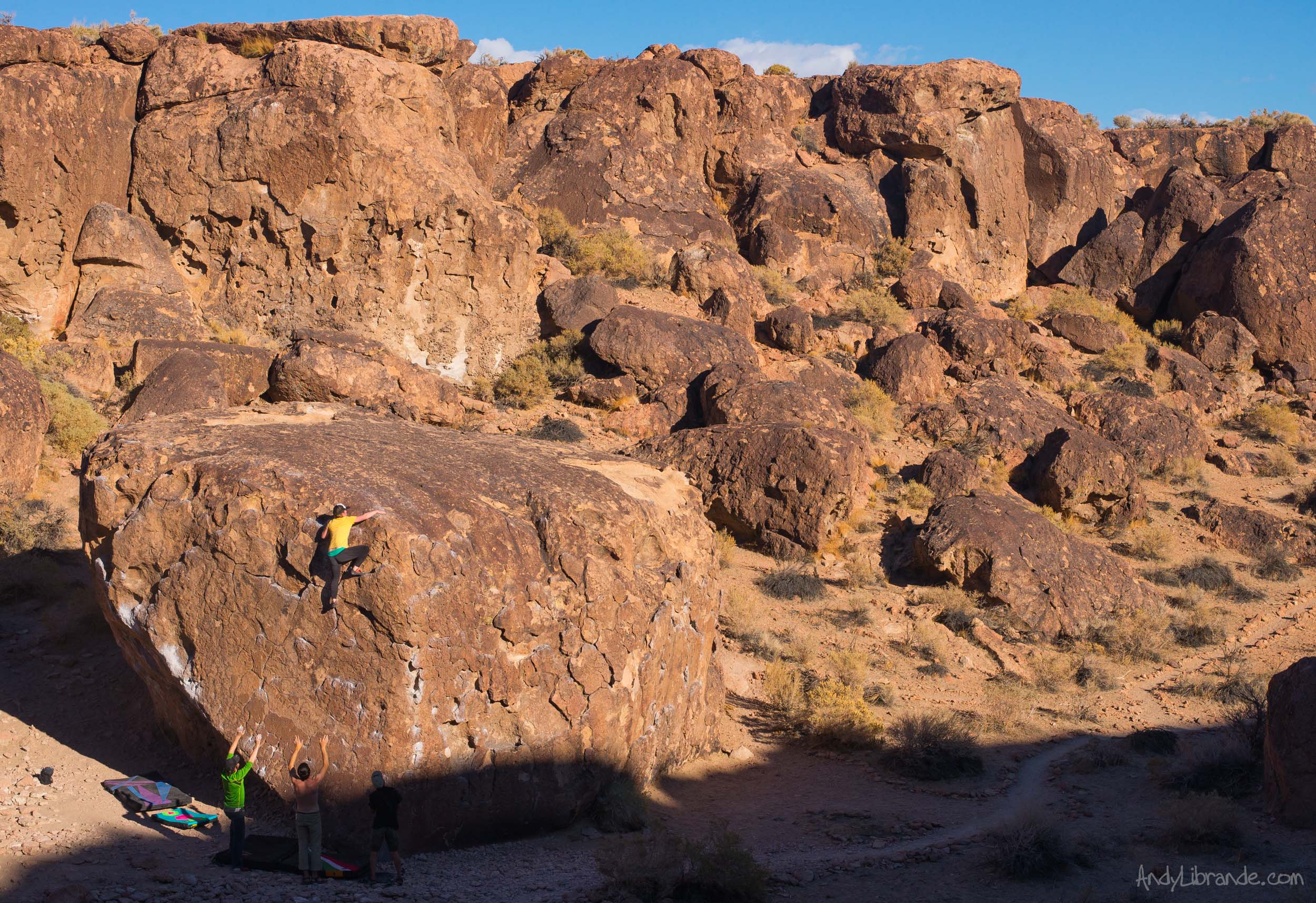
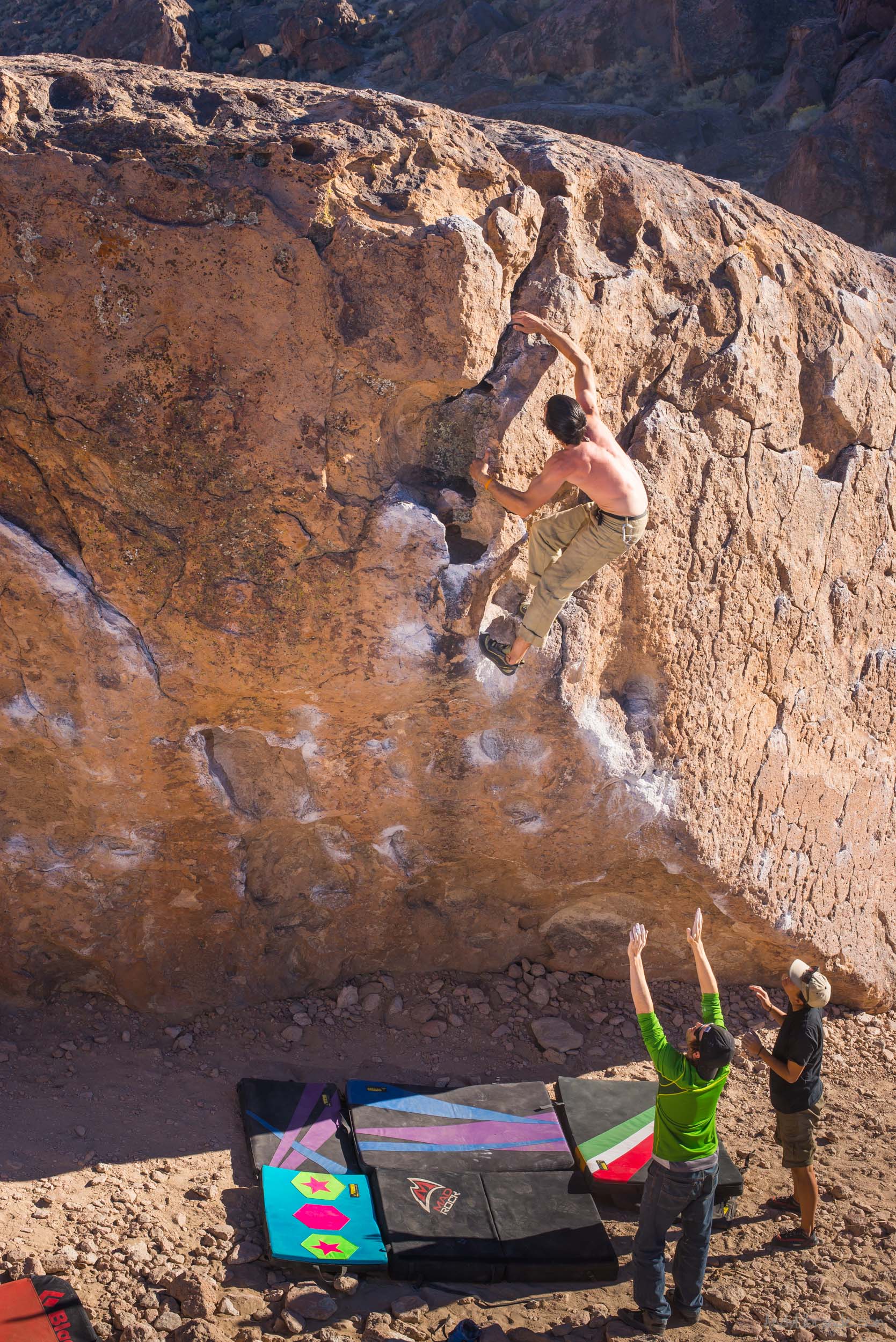
A Day Exploring the Happy Boulders:
After breakfast at the Catacombs and 2nd breakfast at the world famous Schat’s Bakery, we made it to the trailhead of the Happy Boulders. A quick but stout hike in the already warm temps landed-us in a paradise full of mammoth boulders. Walking down the trail and passing hundreds of climbs that are recognized from countless videos, magazines, and website posts, I was very excited to be in the Mecca.
Dirtbag Al and Theresa quickly took off and were ticking every highball moderate they could find.
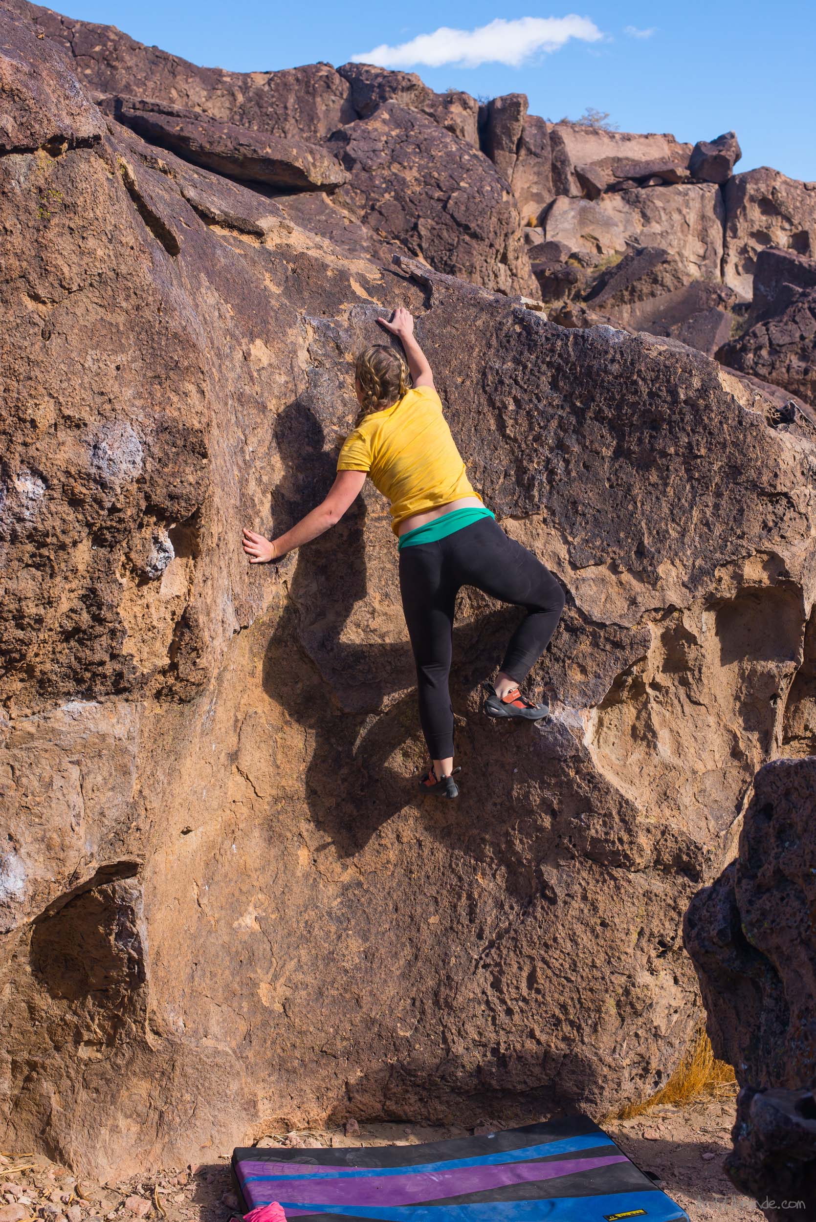
Caitlin stepping outside of her comfort zone with the highball Duck Soup on the Savannah boulder:
Dirtbag Al with a long reach to stick the crux on Ketron Classic v4:
The last light fades over the Sierra’s as we watch from the rim of the Happy Boulder’s:
A few more photos from the day (hover over for descriptions):
Teresa on the crazy pockets of Sixty Foot Woman:
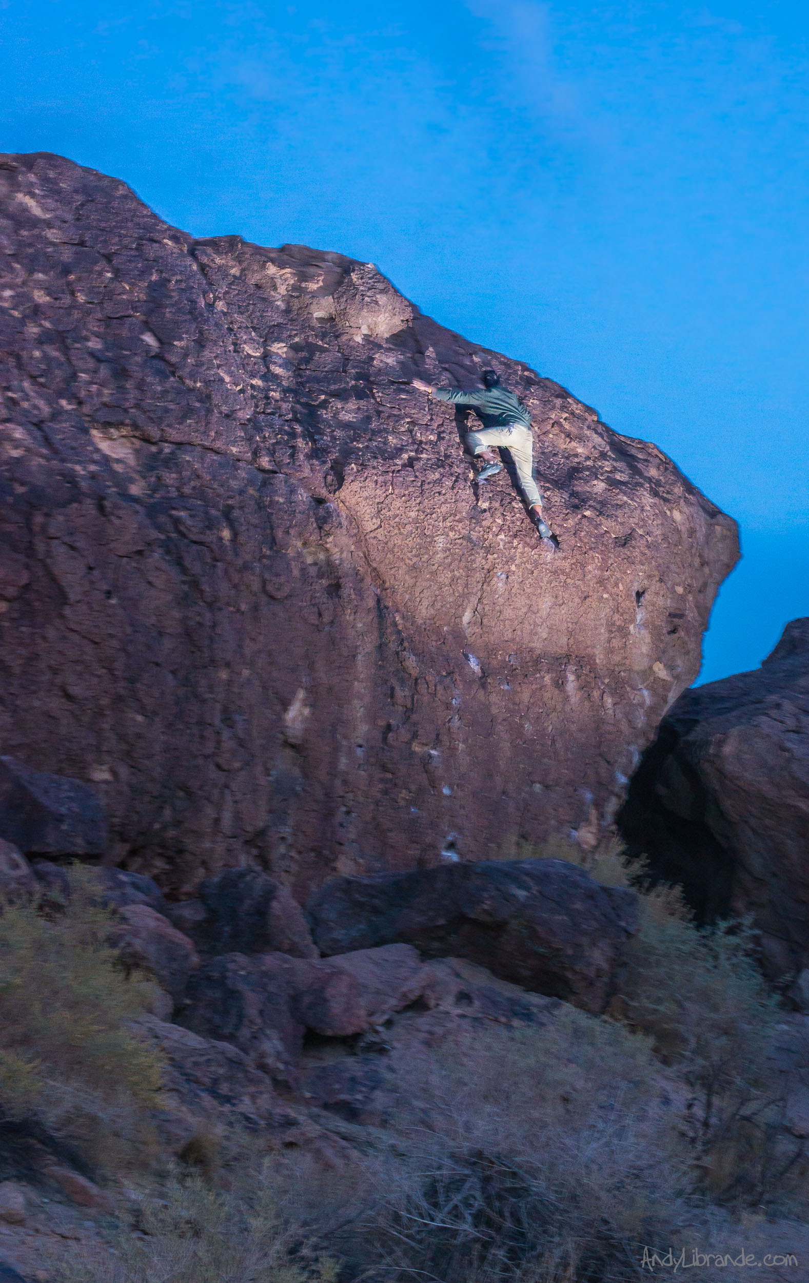
Hiking out and Dirtbag Al spots one more highball he couldn’t resist and sent it in the dark:
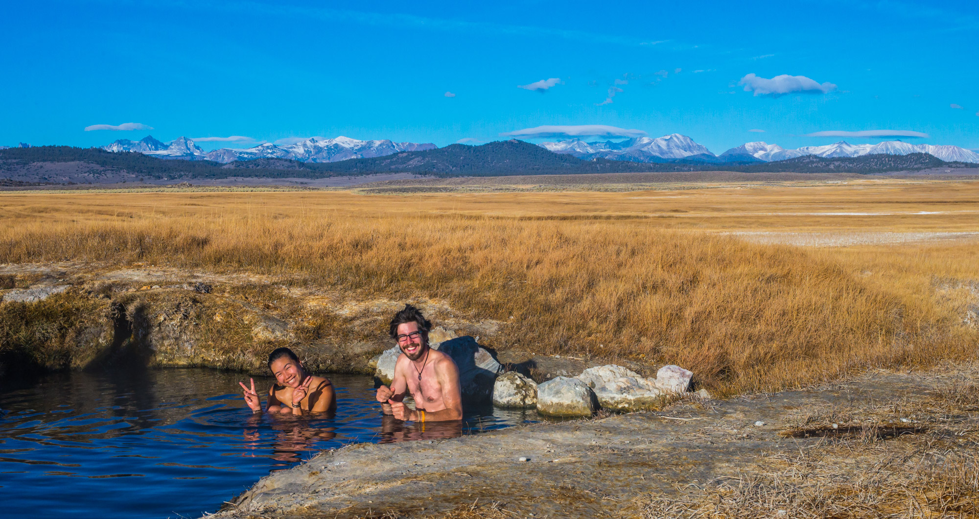
Wild Willy’s Hot Springs:
Dirtbag Al was given some directions to these hot springs and after a hard day of climbing in the Happy Boulder’s, we followed his seemingly random turns in the middle of the valley until we arrived at a sizable parking lot with numerous cars in it. A quick hike down the boardwalk and our crew found ourselves bathing in our own hidden pool while all of the other visitors were in the main, larger pool. The stars were unbelievable that night as we sat for as long as our bodies could stand it, basking in the moonless night.
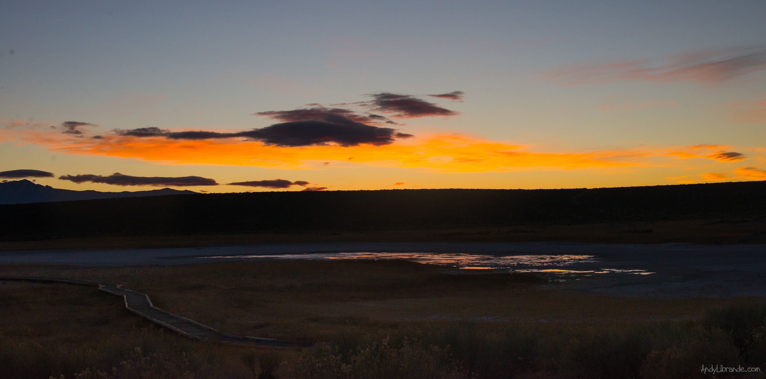
6:30am Sunrise at Wild Willy’s Hot Springs: while not well publicized the BLM does an great job with the boardwalks and conservation. Also it was getting pretty cold overnight.
Dirtbag Al and Tersea enjoying the 8AM morning dip before heading out for the day:
Of course the local custom is to bath au naturale…which is a great reason to get naked in the wild!! We were pretty beat from the last two crazy days of climbing and the long drives to get there, so we headed-up to the city of Mammoth Falls, relaxed, saw a lot of ducks, found a boulder, and did a little outdoor hiking. That evening we drove down to just outside the Owen River Gorge sport climbing area and camped for the night.
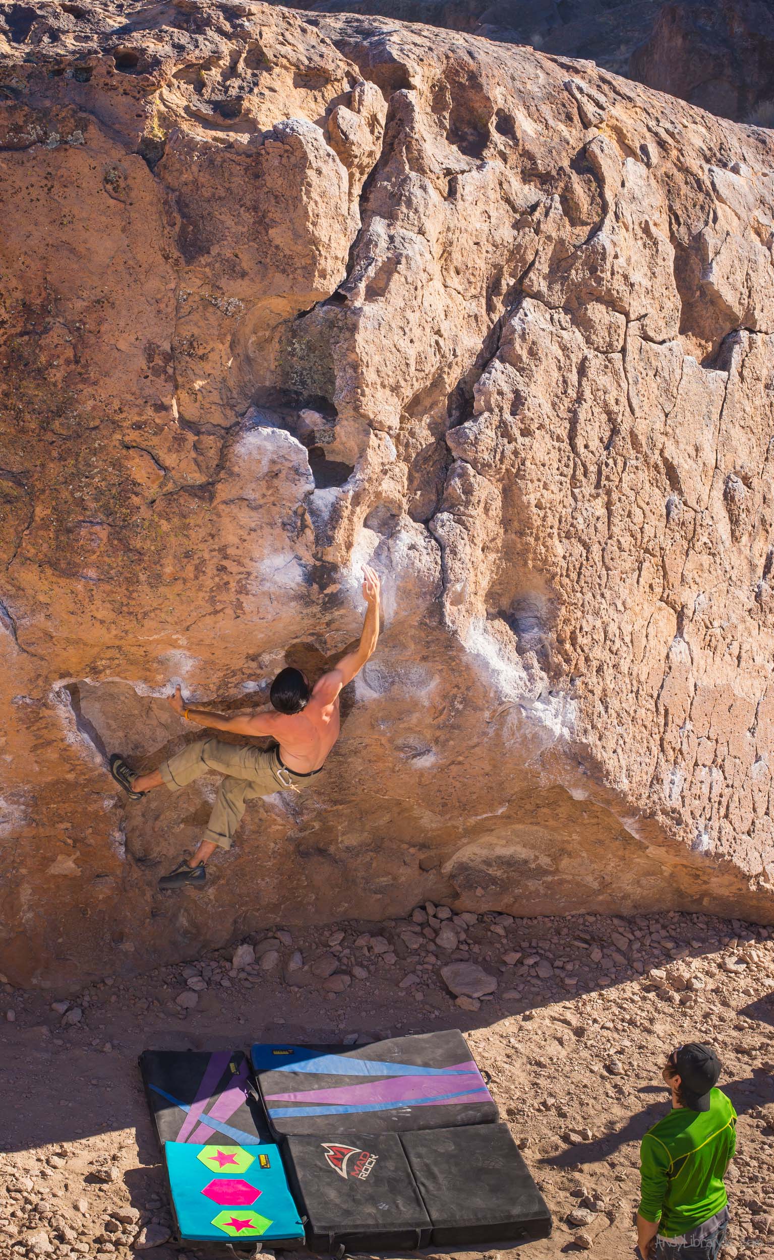
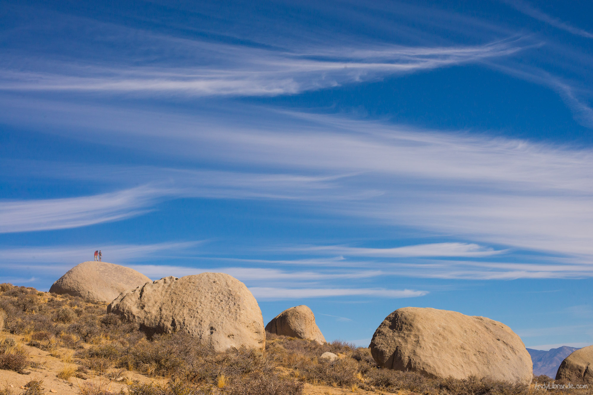
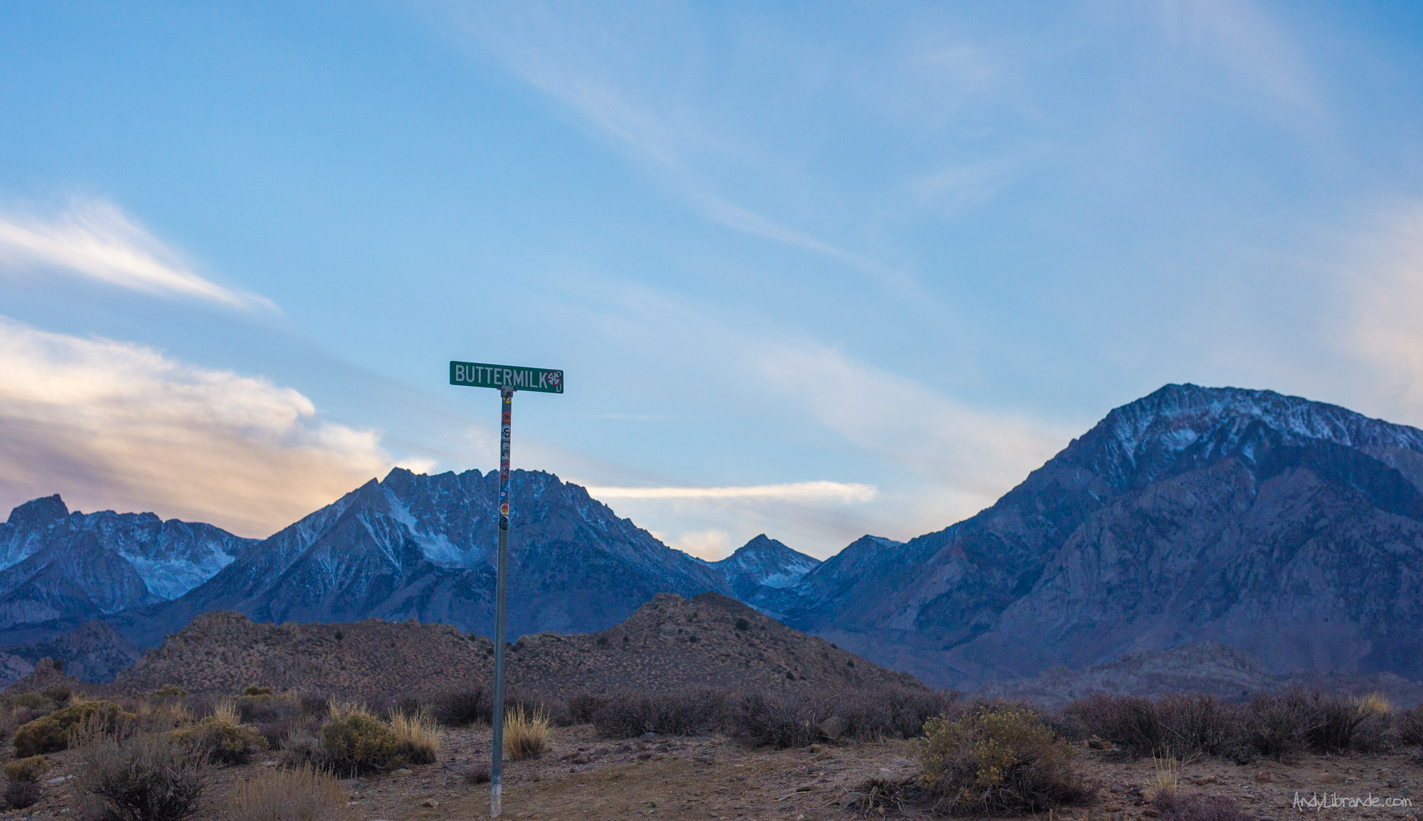
Buttermilk Country:
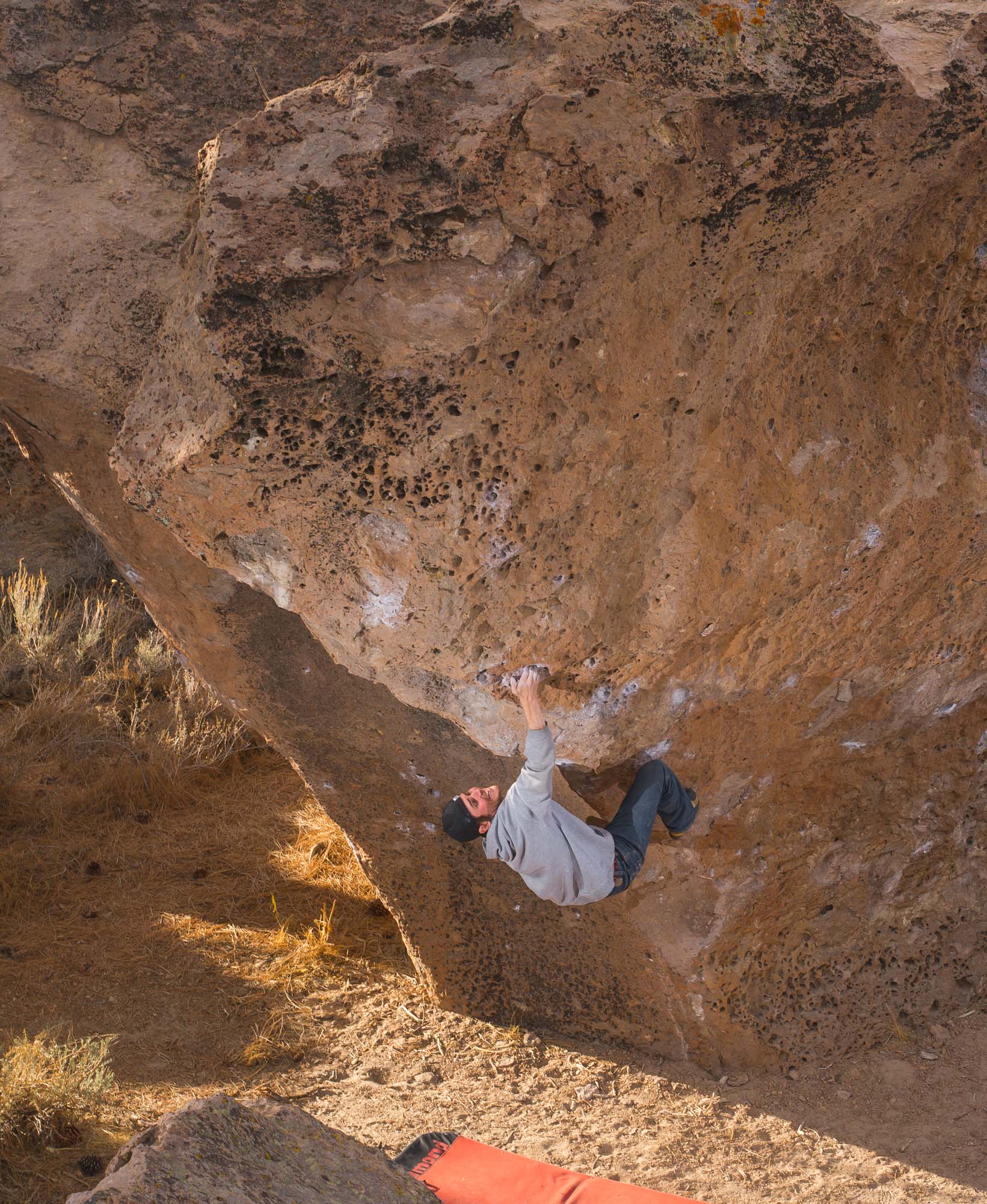
Our last day in the area and we headed to the world-renown Buttermilks for some serious ass-kicking. The sendage was extremely low that day on these stout boulders, however the stoke was high being in the presence of monster boulders.
This problem called the Buttermilk Stem being sent by Chris below (and Al Photo #1, #2, #3, #4) is an example of the crazy types of climbing in Bishop. What feels like a impossible start and moves can quickly be sent with the right technique and beta and shows that something rated only a V1 can be a classic for anyone:
The Buttermilks were crowded as it was a beautiful fall Sunday and attracts climbing tourists from around the world. Once early afternoon happened it quickly cleared-out as it seemed most people were driving back to LA. As it calmed down and after we had our fill of attempted sendage, we had an enjoyable stroll through all of the boulder field sightseeing the famous lines (that literally had 20+ people standing around earlier) and watching the hardmen/hardwomen work these massive, beautiful boulders strewn across the hillside. Also standing underneath the famous PeaBody boulders made your sphincter tighten-up with just the thought of climbing something that big.
Sunset happens quick this time of the year when you are this close to the mountain range. By 4:30 the sun had already been gone for nearly an hour as we took one last look at this amazing place:
At the end of the day we all said our goodbyes with Chris heading north towards Oregon with Al and Teresa following and Caitlin and I made a long journey to Bryce Canyon to spend the night. Hint: arriving at 1am in the morning on a freezing cold Sunday night means free entry and front-row parking for the morning spectacle.
Bryce Canyon Surprise on the way home:
Read More Here: http://andylibrande.com/wedding/about/engagement/
Sights on the Drive from Denver to California: Pictures from: 7am, 8am, 10:30am, 11:30am, 3pm, 6pm, Star Trails that night.
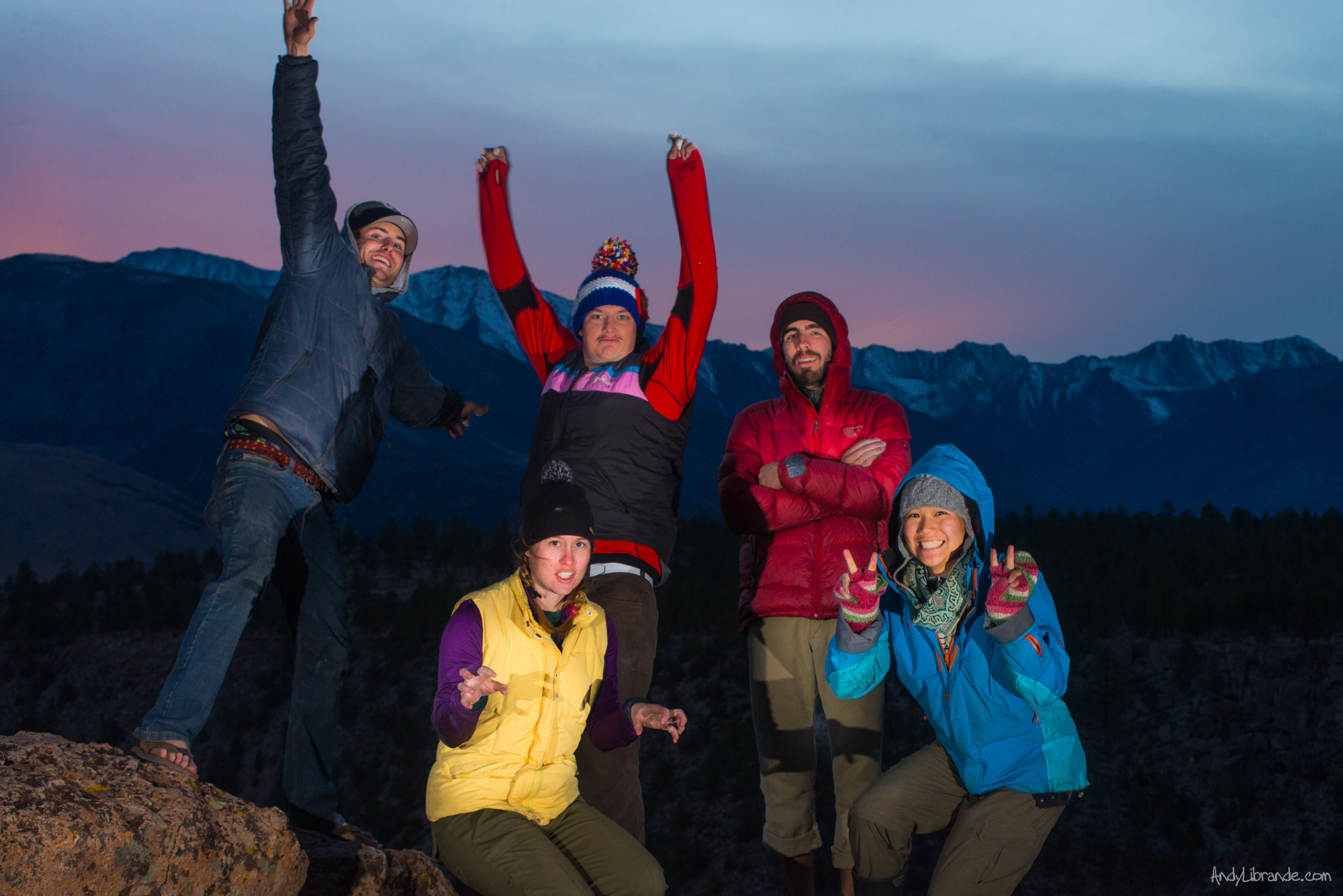
Group Photo at the Catacombs:
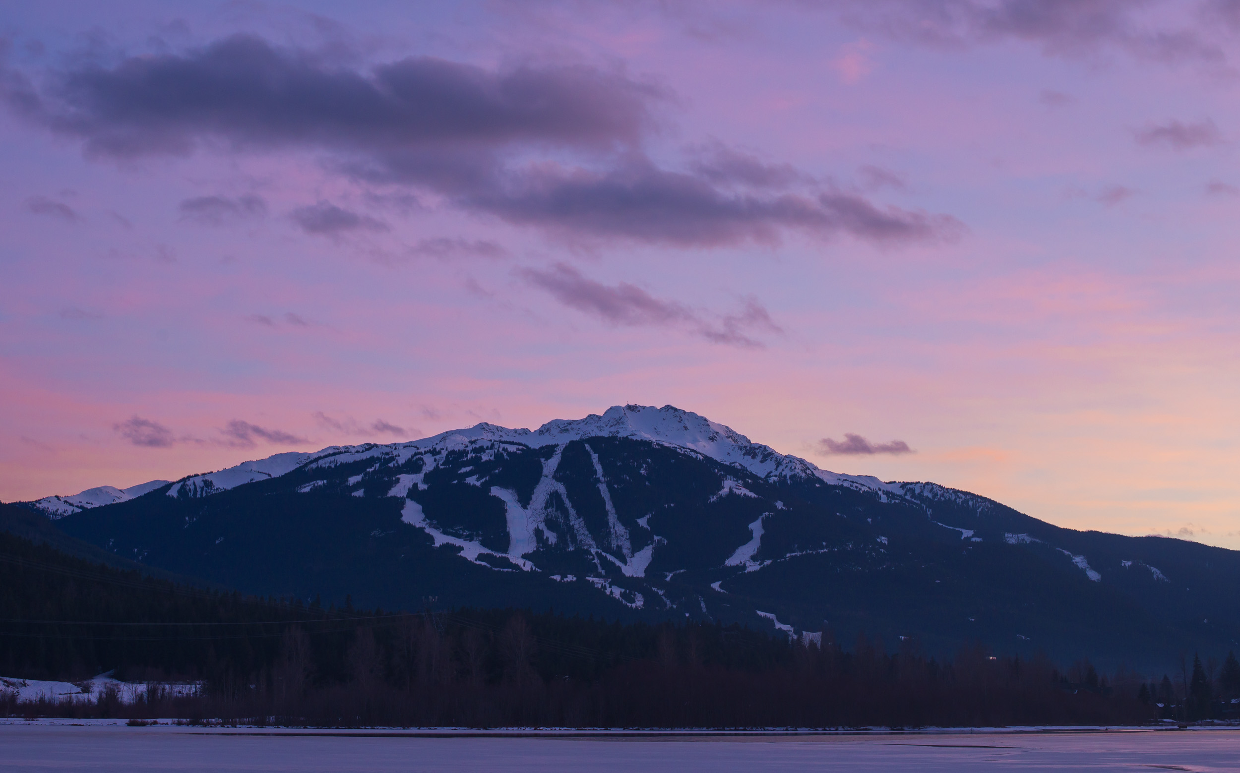
Whistler – What to Do When the Snow Sucks
- Posted: December 18, 2015
- By: andylibrande
- In: Activity Categories, Canada, Location Categories, Snow, Travel
- 0
When: Jan 28th, 2015 thru Feb 2nd, 2015
Who: Andy+Caitlin (we celebrated Caitlin’s B-day on this trip!!)
Trip Details:
- Fly from Seattle to Denver
- Rent Car and Drive the Amazing Pacific Highway
- 3 Days of Skiing at Whistler/Blackcomb
- Hiking to several waterfalls in the area:
- Afternoon, Evening and quick morning in Vancouver
The skiing was nothing exciting as Whistler area/Pacific Northwest had been under quite the unusual snow-drought. The best snow was usually around 3pm every afternoon as at that time it had warmed-up just enough to soften, unfortunately the resort closes shortly after that. Skiing outside of groomed runs was not possible due to the hard-pack snow-ice (something I have not really experienced before!), but luckily we were greeted with beautiful skies that allowed us to soak in the landscape views of this amazing place.

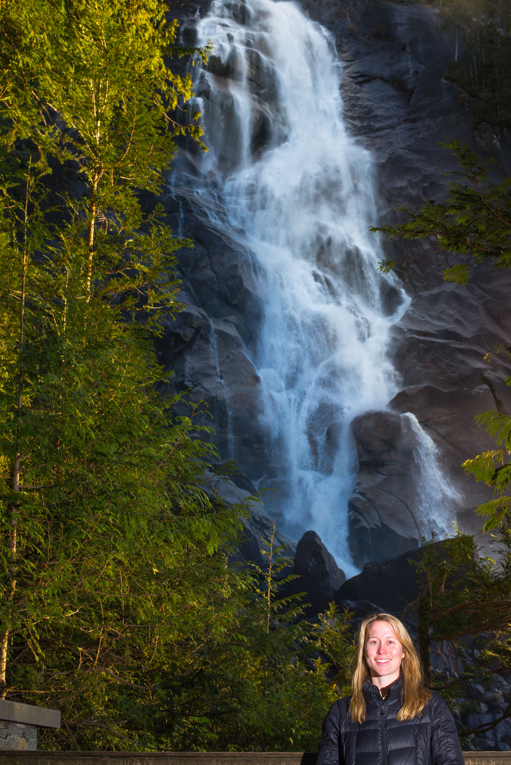
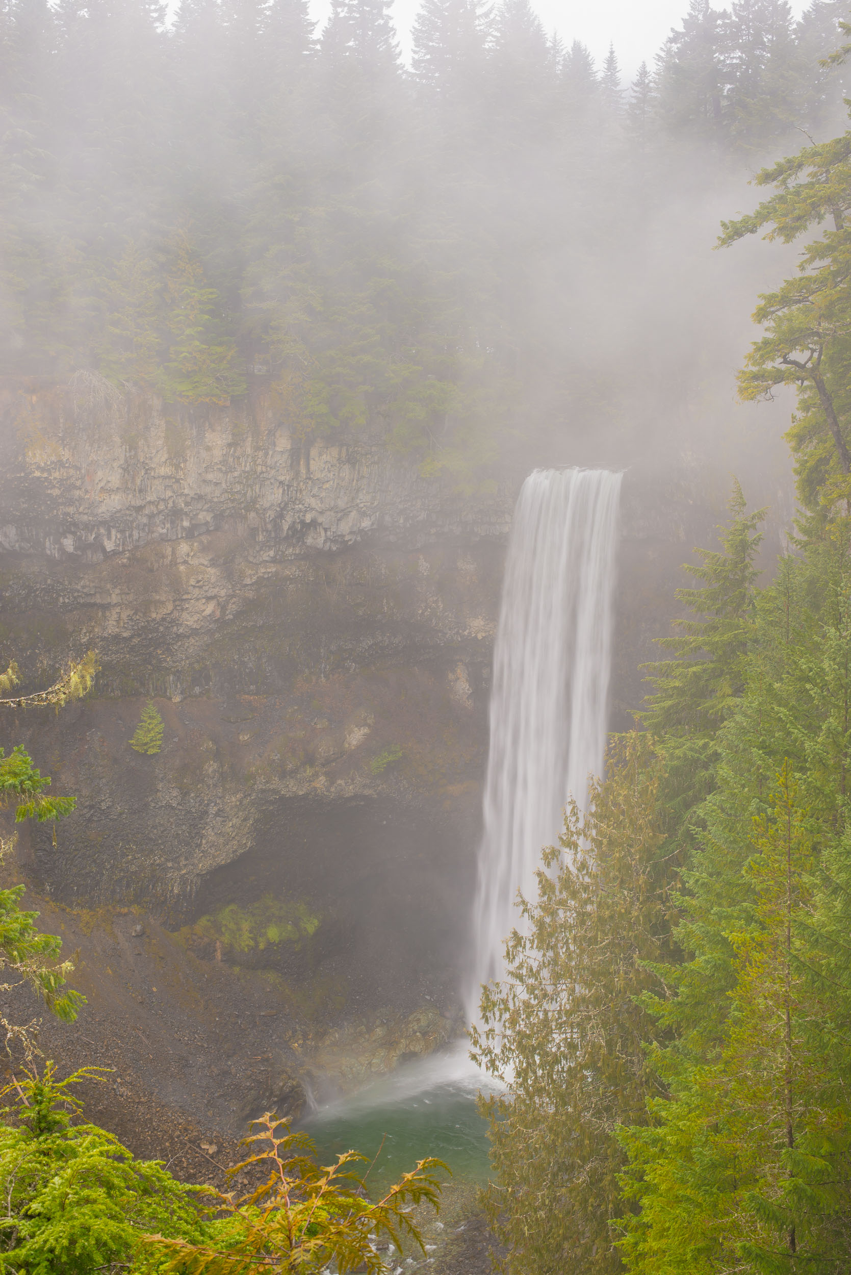
Shannon Falls at Squamish, BC was a perfect pit-stop along the Sea to Sky Highway:
Whistler was a lot of fun and we ate a lot of great food such as Sushi, Australian Meat pies (with kangroo!), brown-sugar glazed smoked salmon bits from the grocery store, and numerous other delicacies. At the time the Canadian Dollar was about 20% less than USD and allowed us to continue to indulge in nice restaurants since everything about 20% off!!
It was the Whistler PRIDE festival while we were there and really the best part of that was meeting an very eclectic group of people every night at the hot-tub. Otherwise it was not really crowded.
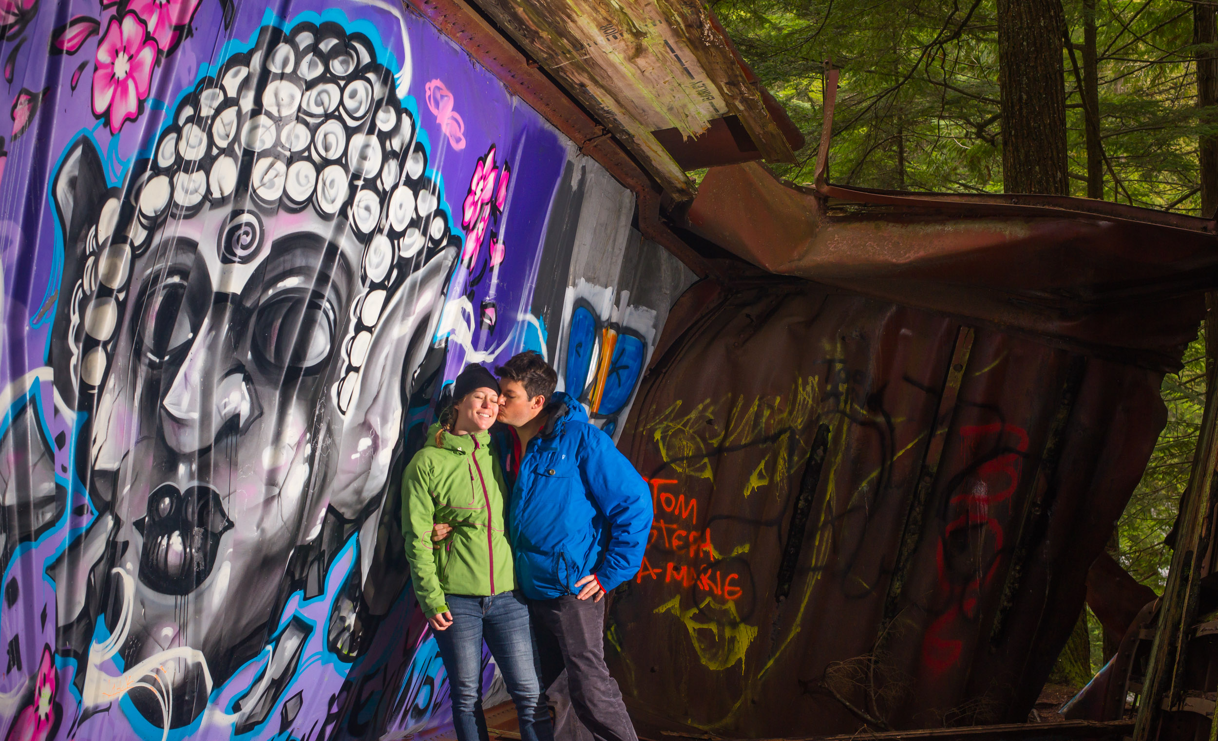
Morning Hike on the Trainwreck Trail in Whistler:
After realizing we couldn’t really ski before 11am due to the hard-icy conditions we started looking for other activities. We were looking online for other outdoor activities and found a unique looking trail that seemed to be low enough in the valley to be relatively snow free. Granted these trails are supposed to be buried under snow this time of year we instead encountered mostly dry paths that you would expect in early fall or late spring.
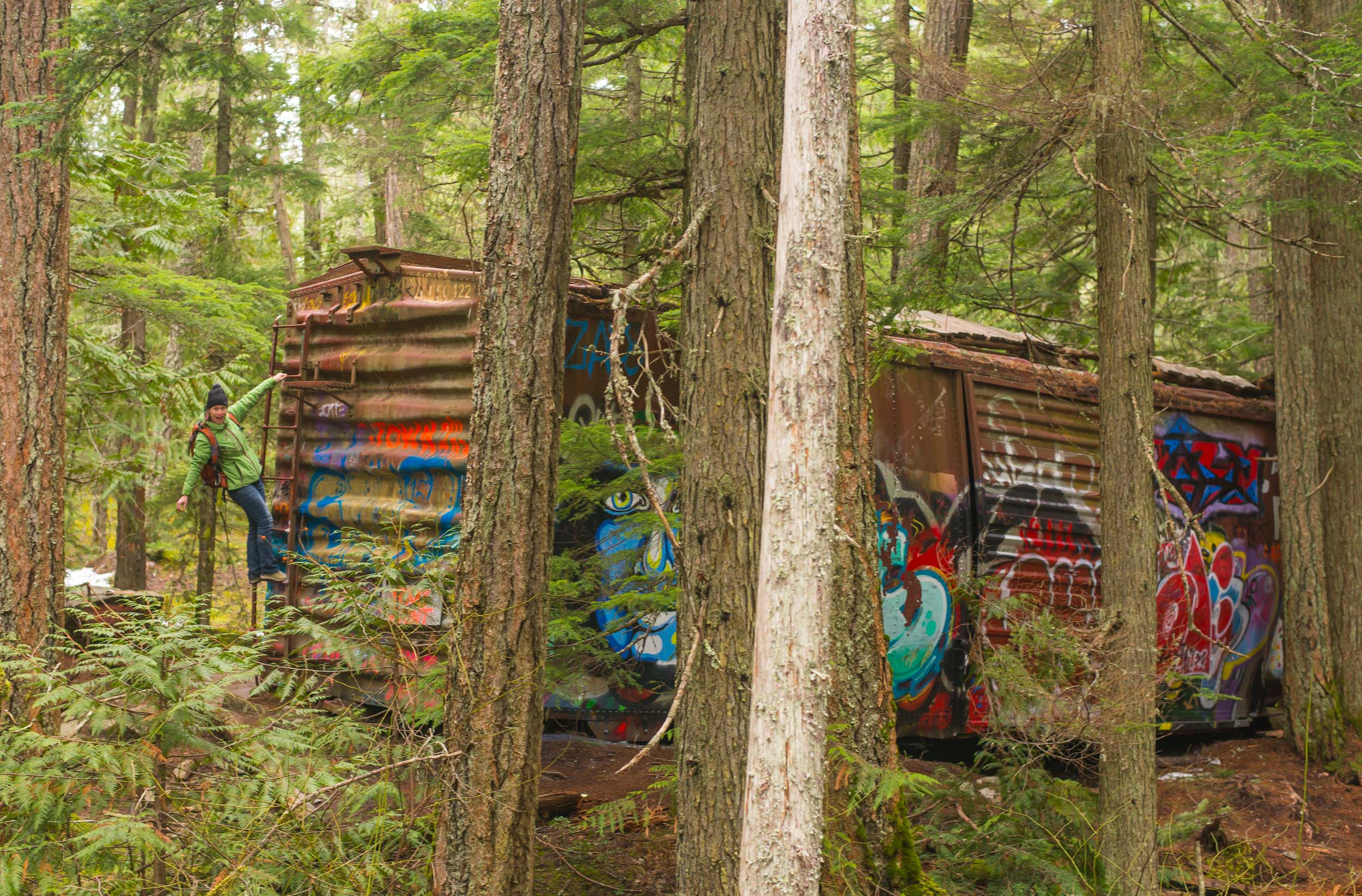
Hiking into the Trainwreck area on dirt (eerily missing any snow):
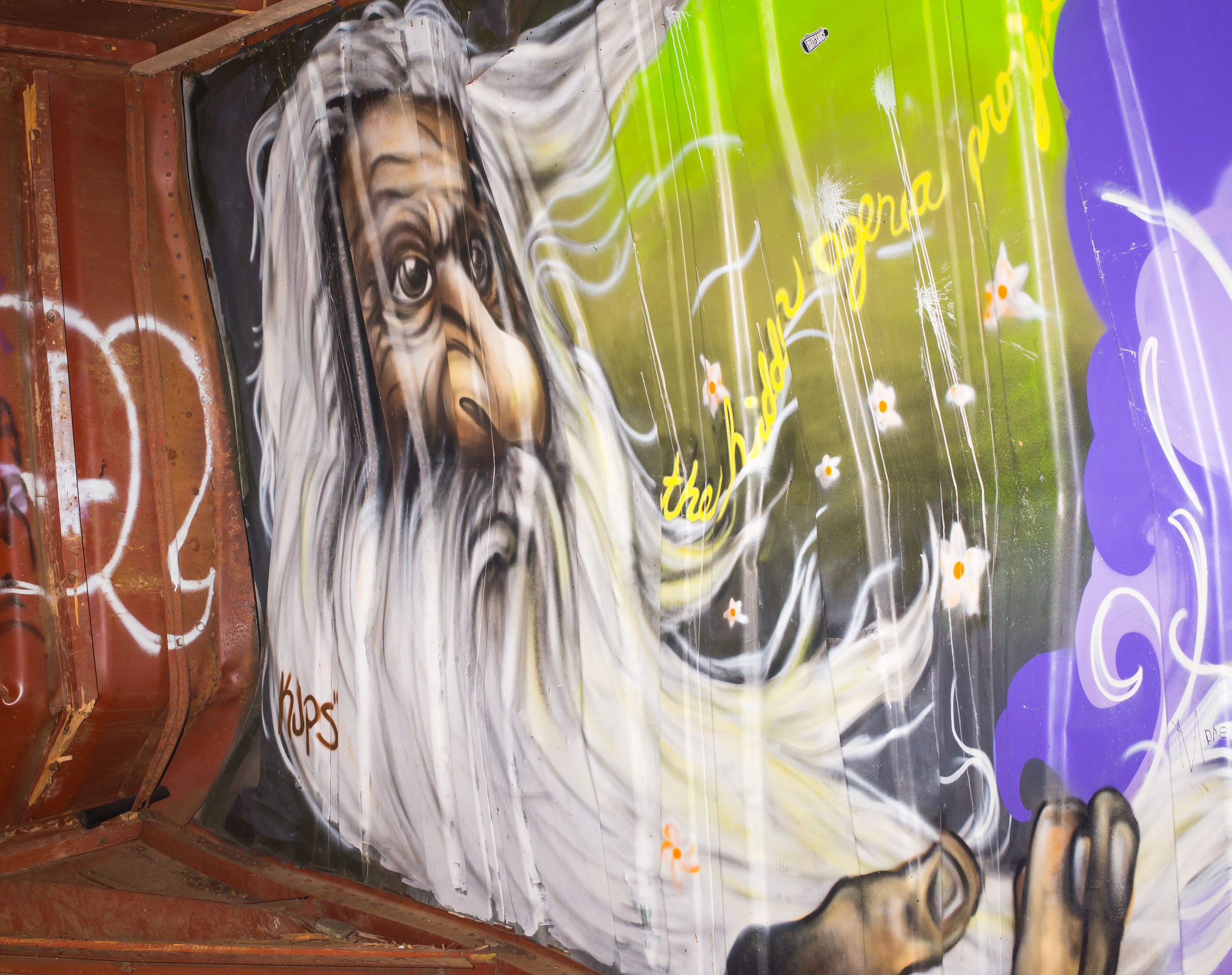
After a short hike we made it to the Train Wreck which is literally just a bunch of trains that had derailed a long time ago, fell down the hill, and now are overgrown with trees, lichen, and graffiti.
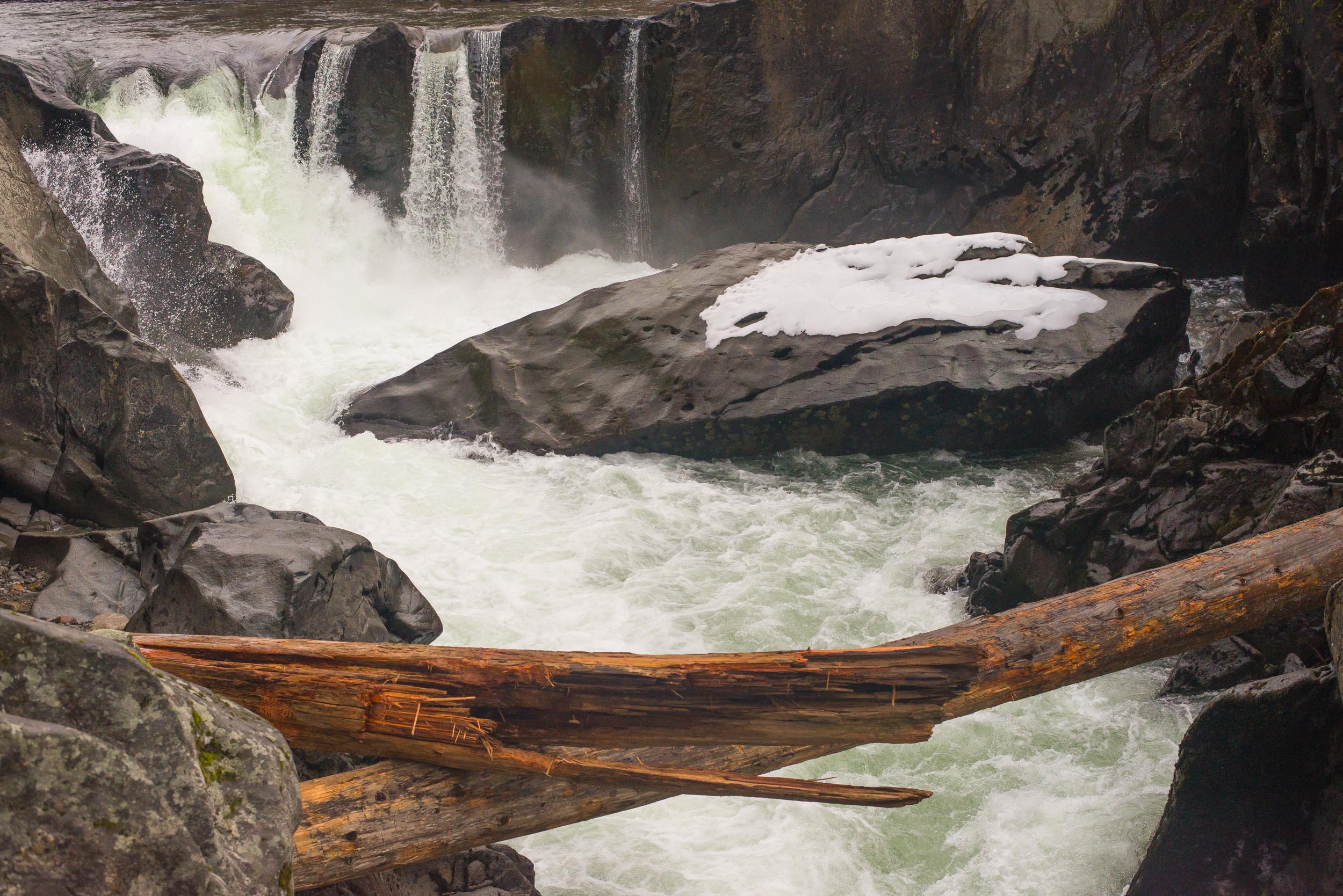
A waterfall was also along the hike making a quick pitstop on the way back. We had started early in the day and on the way back ran into a number of groups also making this hike. Luckily for us we had the place to ourselves.
After skiing one day we noticed the sunset was looking pretty and headed-out to a better vantage point to soak in the colors:
Brandywine Falls Hike in the Winter:
We had looked at the internet to see if this was possible due to the low snow, people had pictures of years past with 15-20 ft snowdrifts covering the entrance to the park. Instead we found pavement and dirt trails. Short hike to a really cool formed waterfall which is tough to photograph.
The drive back down the Sea to Sky highway reminds you of the quickly changing weather. This sign was in front of a beautiful mountain range on the way into Whistler and now you have no idea.
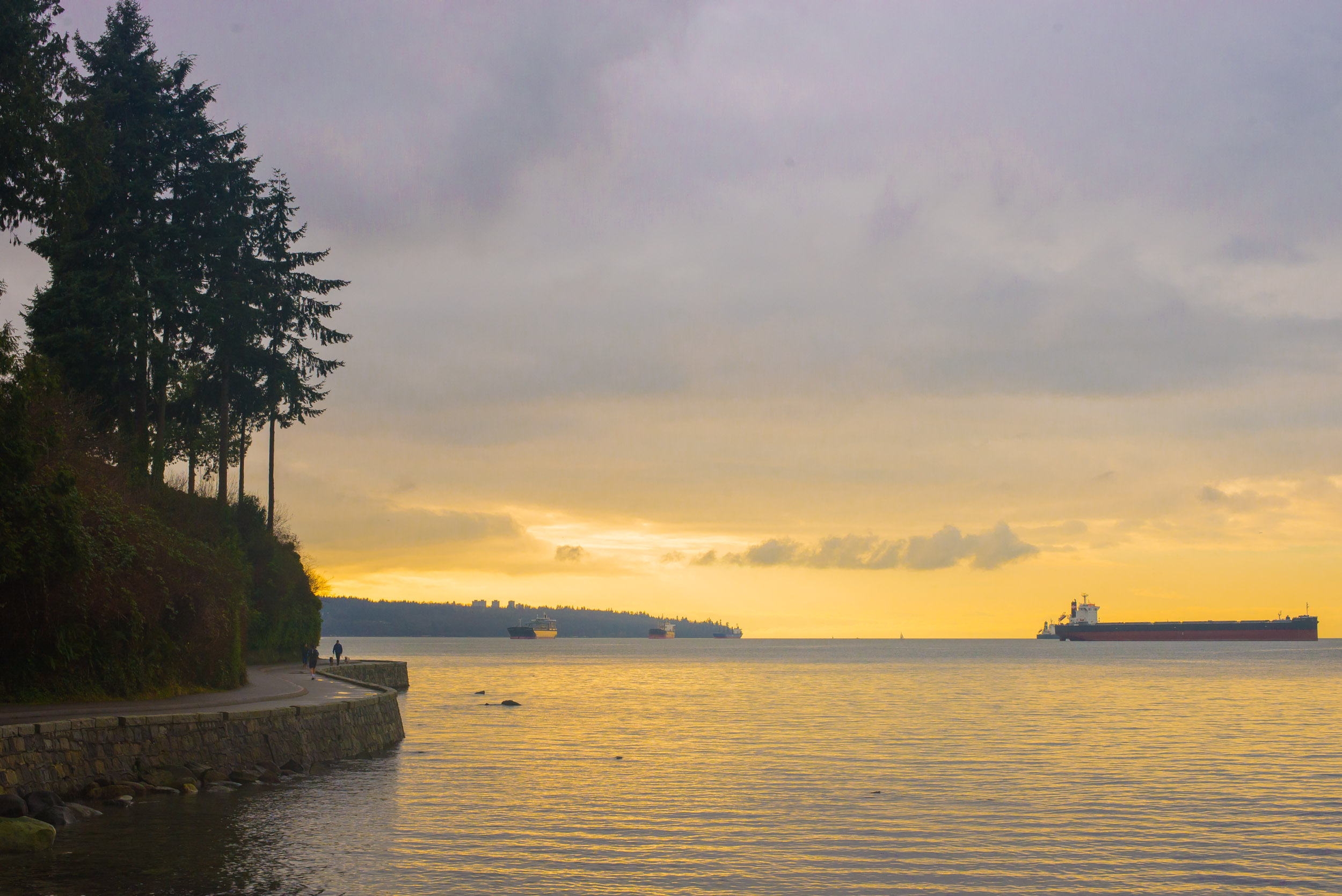
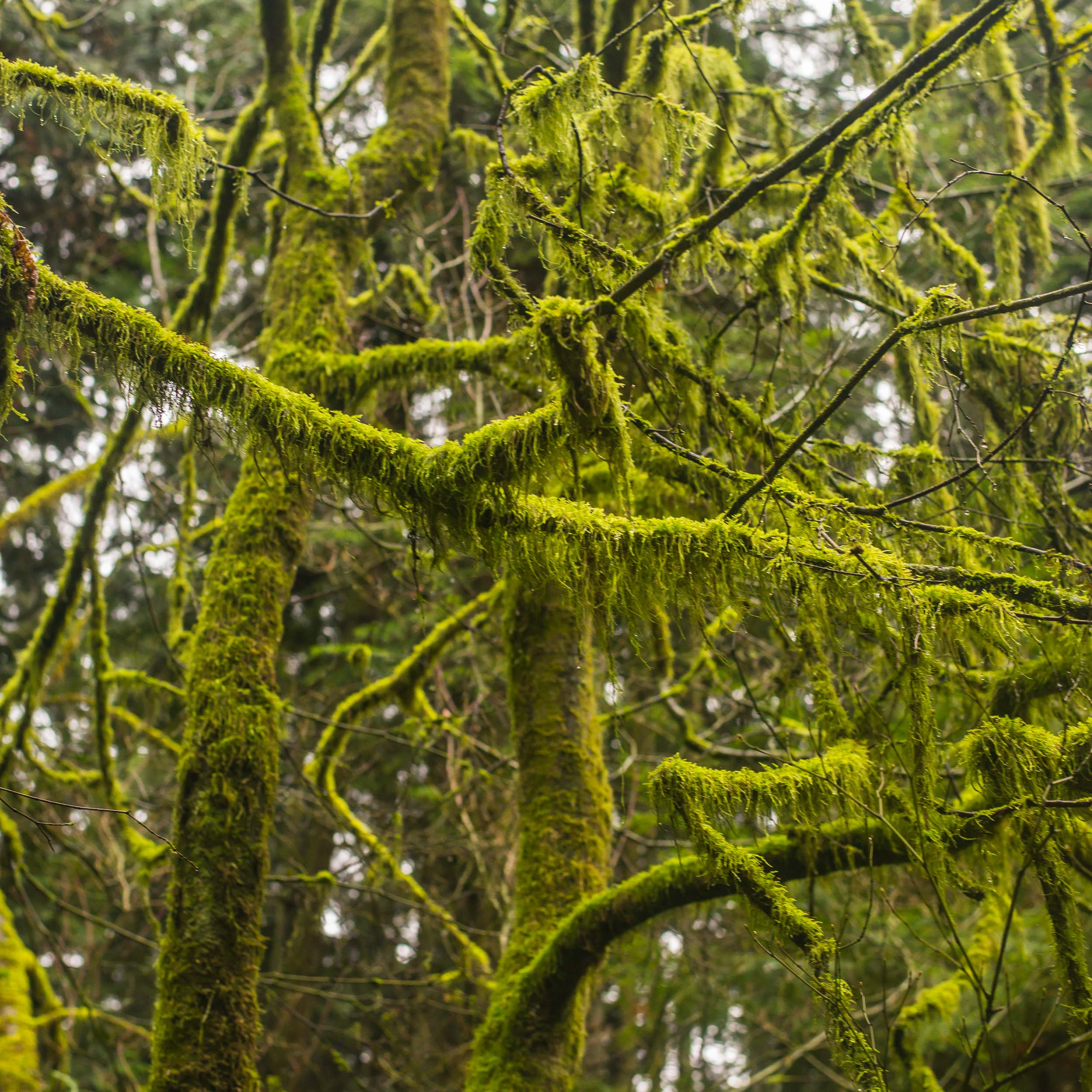
An Afternoon Stroll at Stanley Park, eating Sushi for Dinner, drinks in Gastown and eating breakfast in Chinatown:
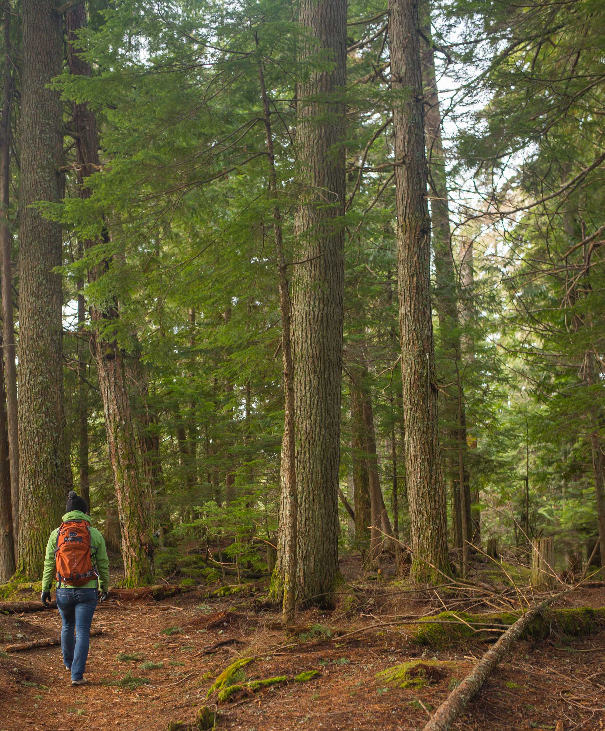
In less than 24 hours we had a taste of Vancouver. Our first stop was the majestic Stanley Park with it’s beautiful seaboard trail and incredible trail through the thick forest.
The Seaboard Walking Trail is peaceful and Beautiful:
It is hard to walk by this tree’s like this and not hug give it a giant hug:
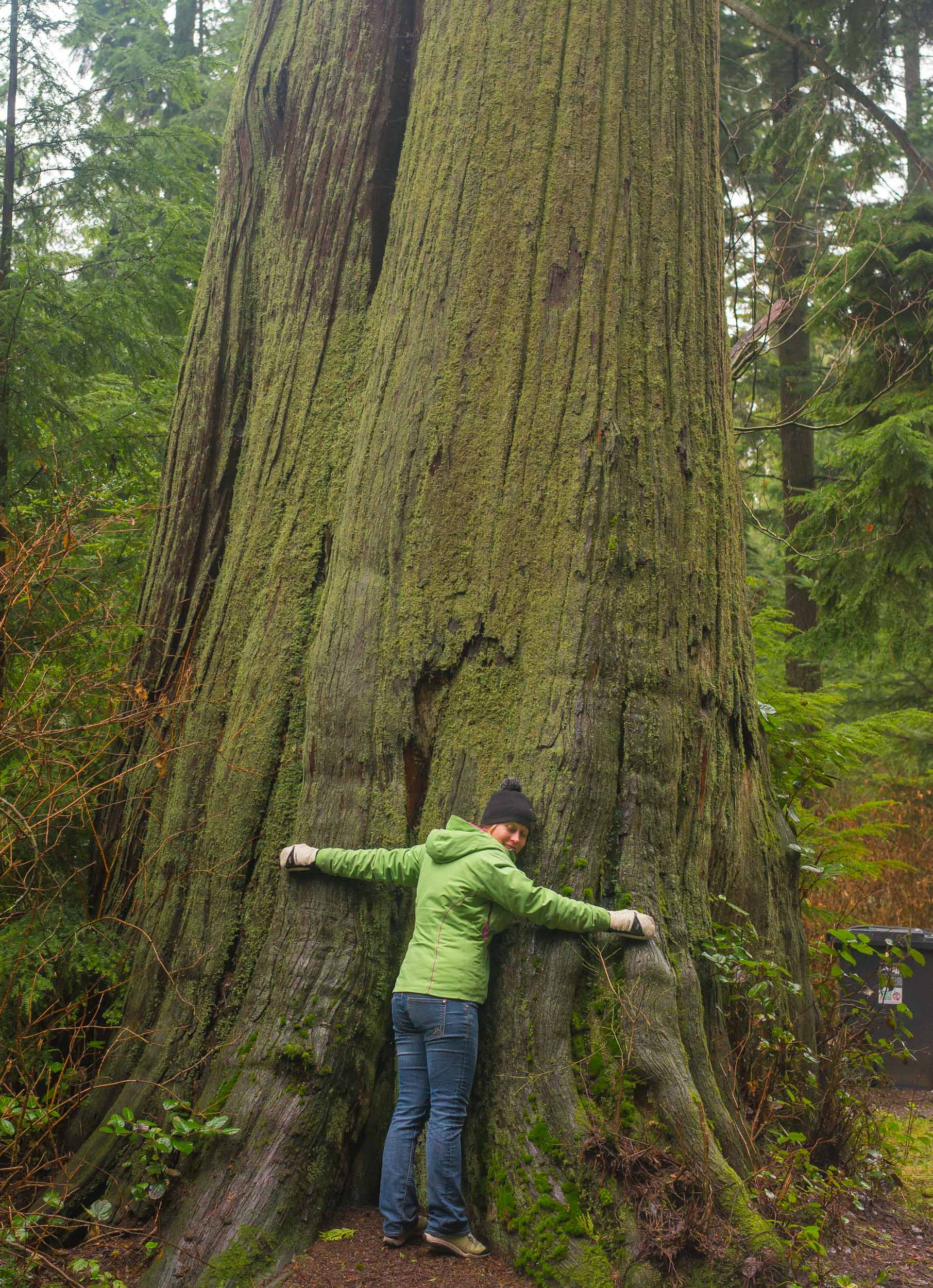
Moss Covered Trees:
We had meet-up with a friend of Caitlin’s who was living in the city and she took us to one of her favorite neighborhood sushi places. It was amazing. We followed that up by a walk to the Gas Lamp district where we cozied up for some well crafted cocktails at the Pour House. The morning was brief but allowed us a few mins to grab delicious buns from China Town and enough time to quickly walk through the area seeing several cool shops and a traditional chinese garden. Great way to end the trip!!
Andrew and Whitney’s Wedding in Wisconsin
- Posted: March 08, 2015
- By: andylibrande
- In: Activity Categories, Events & Parties, Location Categories, Wisconsin
- 0
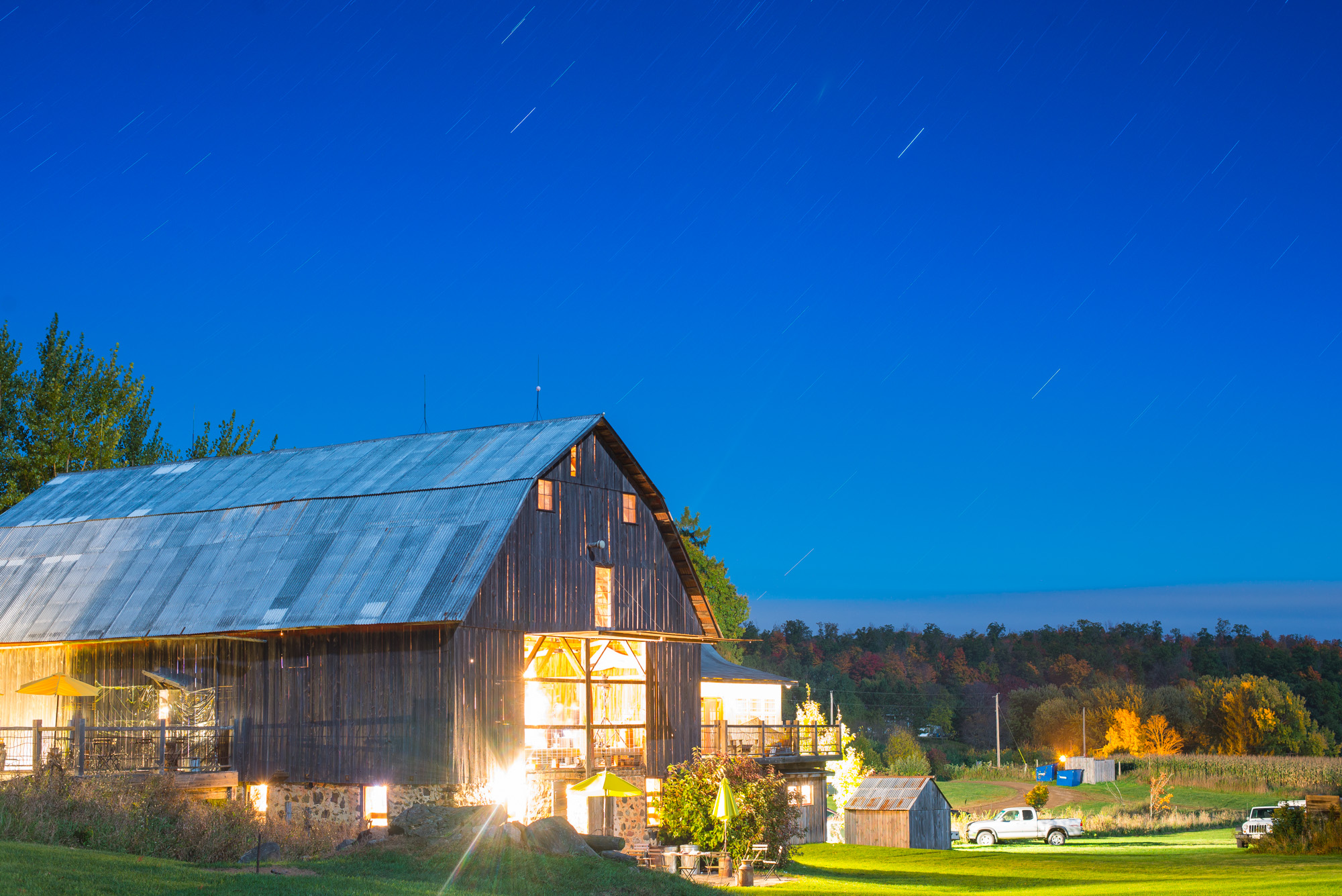
Where: Chetek, Wisconsin at the Enchanted Barn
When: Oct 4th, 2014
Andrew and Whitney had an awesome wedding in a perfect country barn made more even more rustic as it was in the middle of nowhere Wisconsin. The location was beautiful, the weather cleared for their wedding day, and luckily they brought the party with them! In preparation for this day I took the engagement photos earlier in the year and then we also held a waterski bachelor party at Lake Granby.
Larger Album of Photos can be Found Here!
Keeping it short and simple but below are a few of my favorite pictures that I took from the evening. The Enchanted Barn looking pretty under the late-fall cold, clear sky:
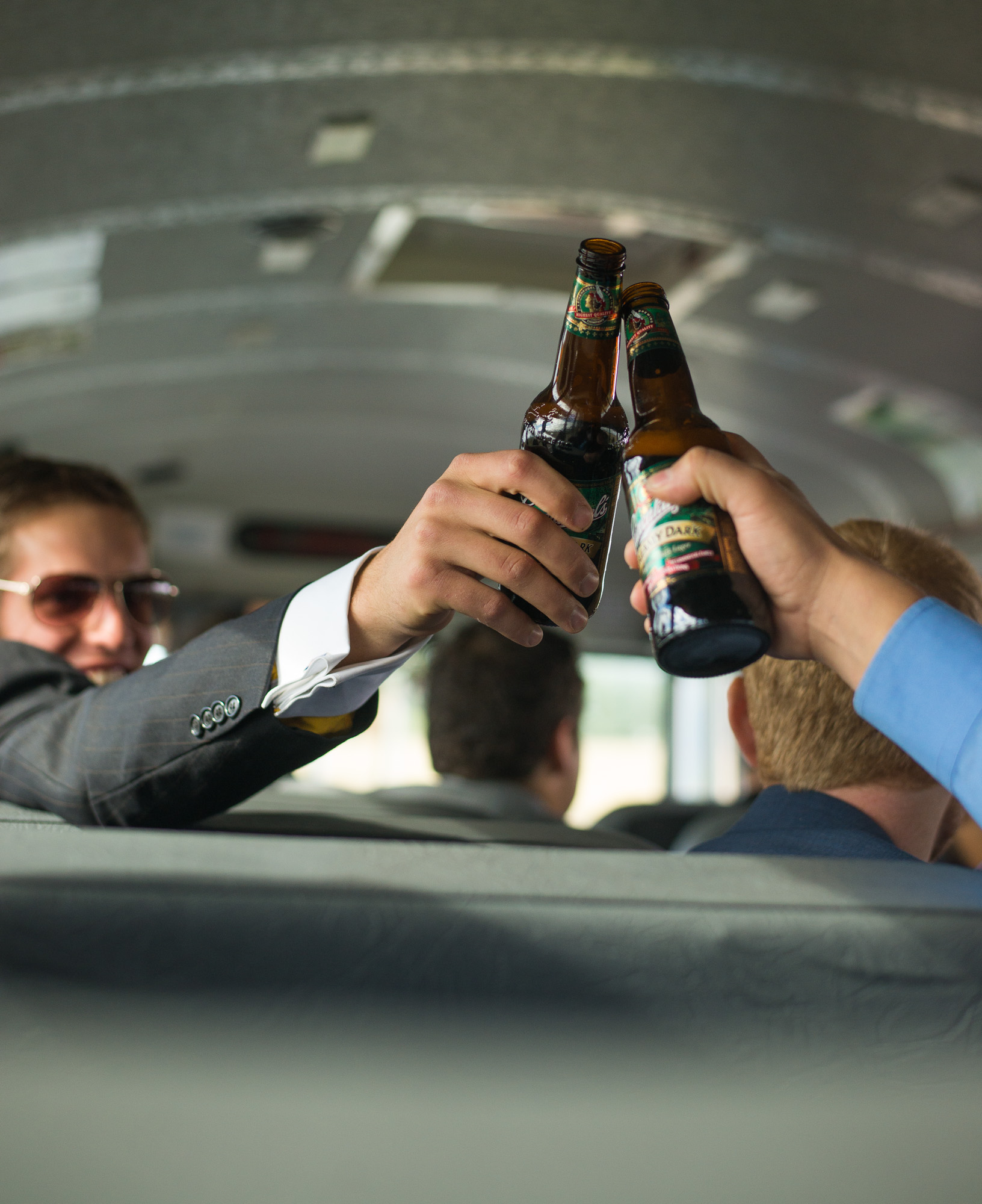
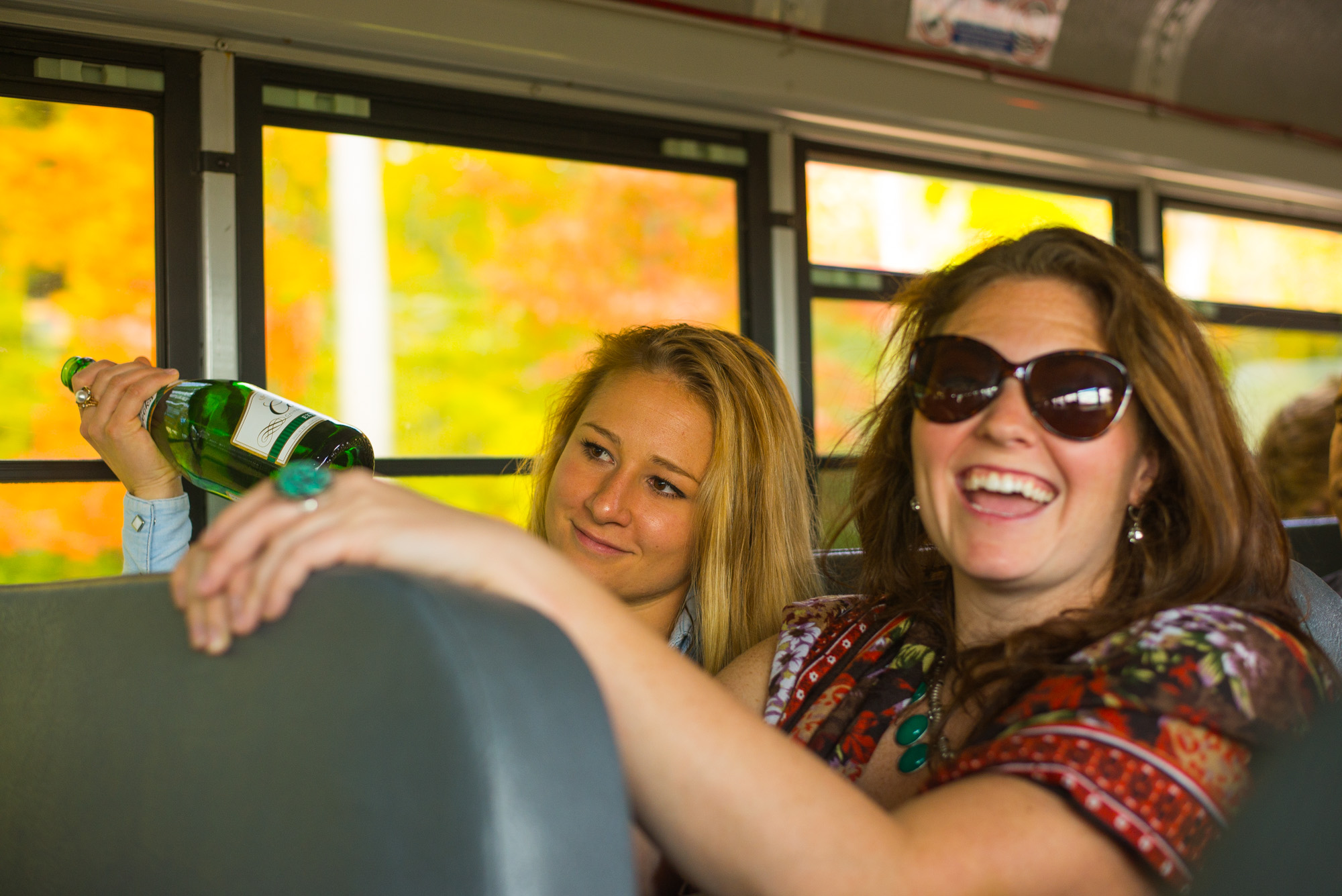
The Bus Ride from our cabins in Chetek, WI to the Enchanted Barn was a good distance, luckily we all came prepared:
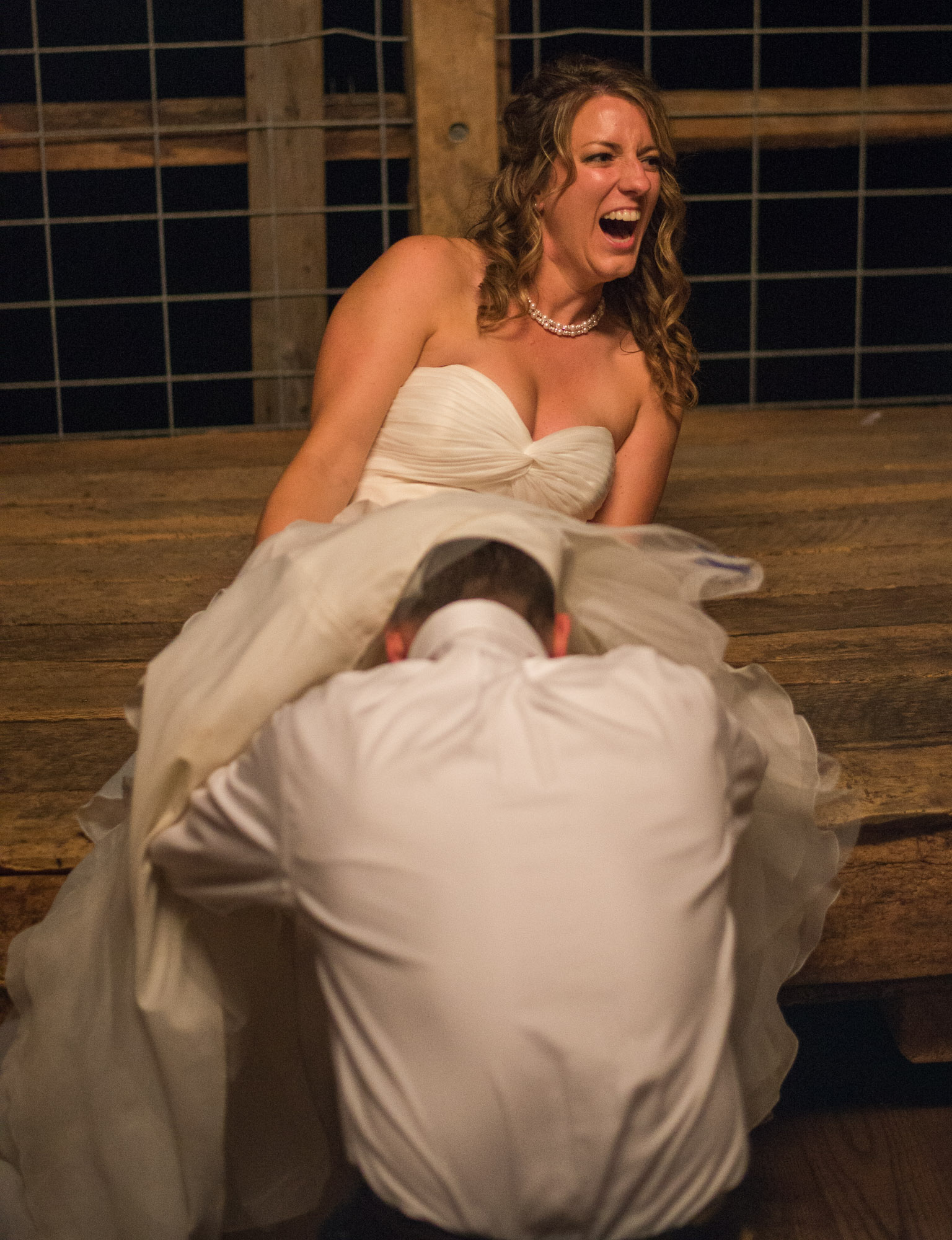
Andrew and Whitney getting married in the barn!!
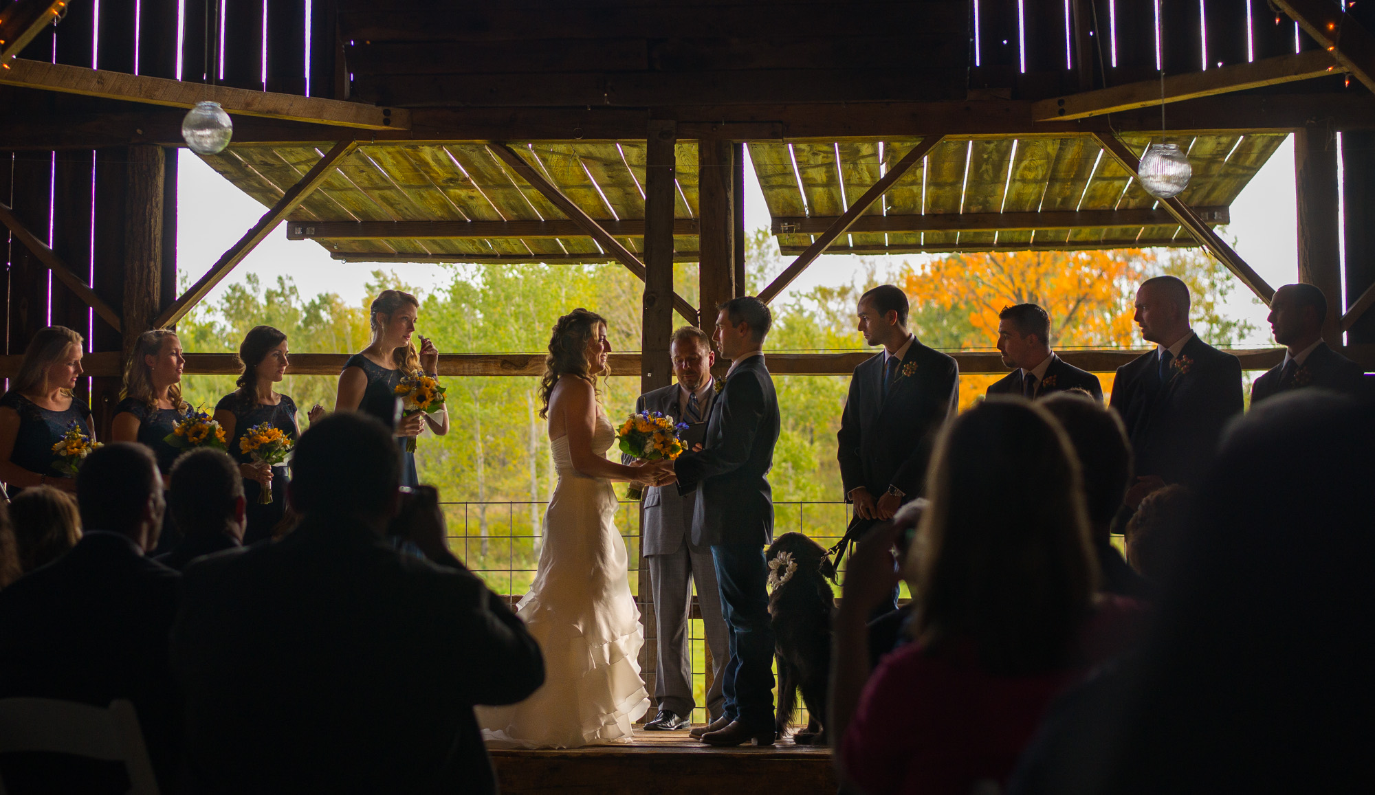
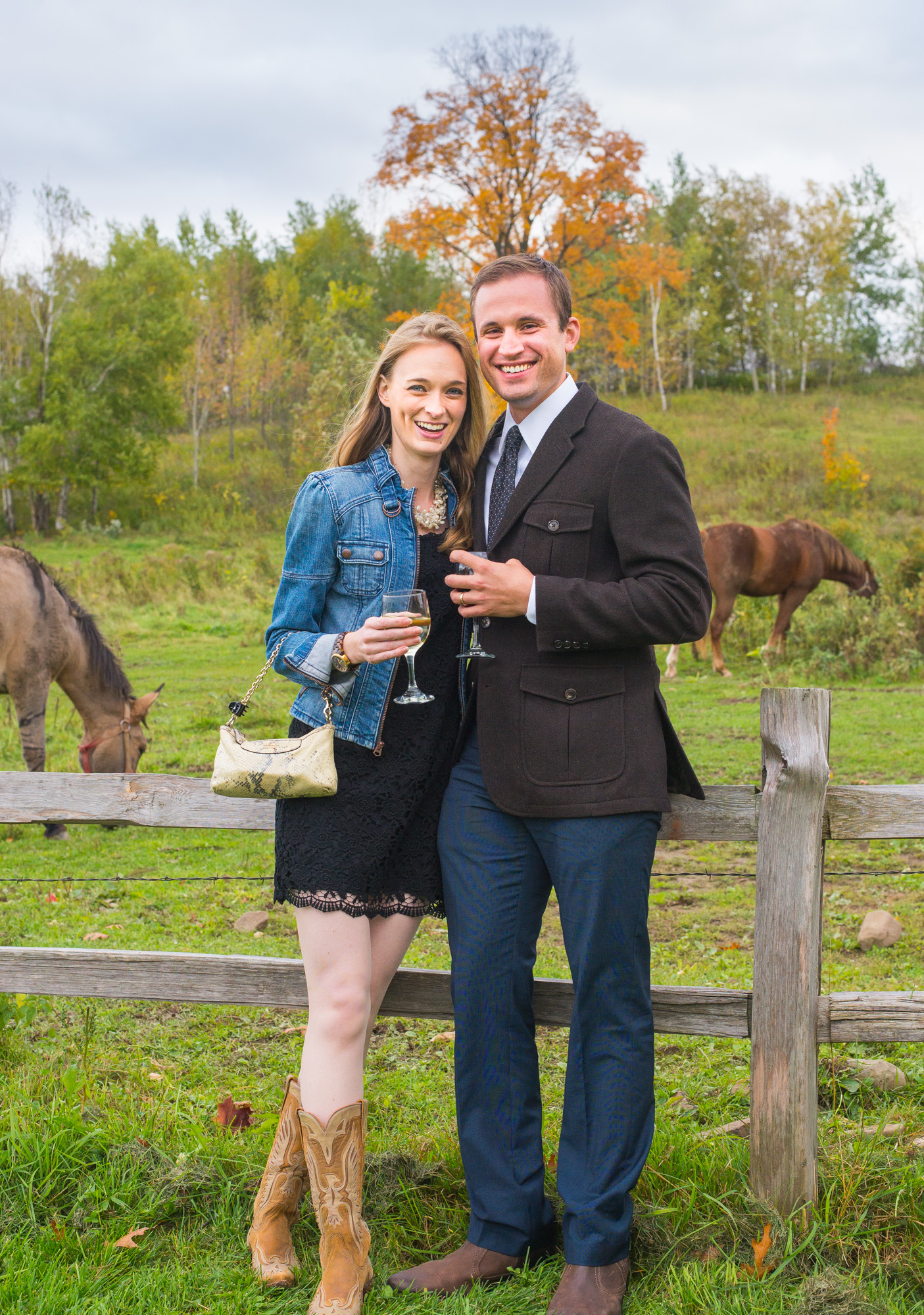
A beautiful country-farm backdrop provided some perfect photos of friends.
Paige and Bobby:
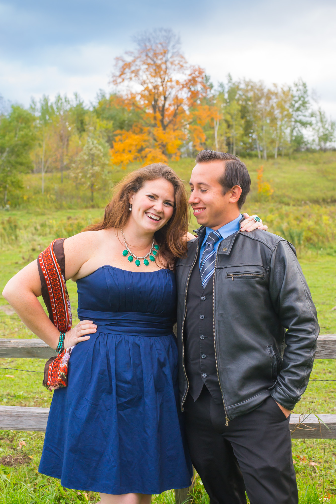
Tyler and Alisha:
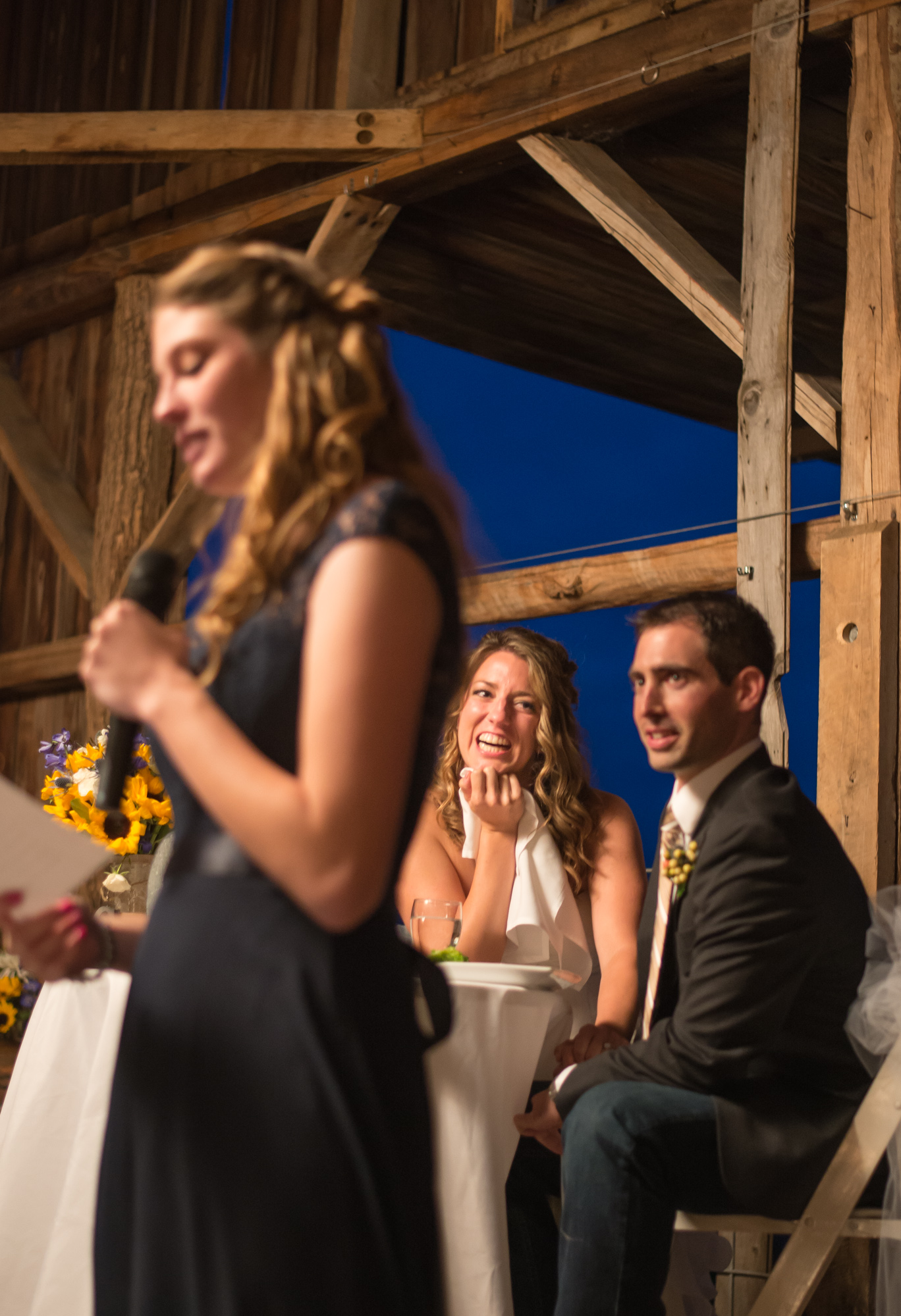
The Maid of Honor (Whitney’s sister), delivering a perfect speech:
Andrew digging for something down there:
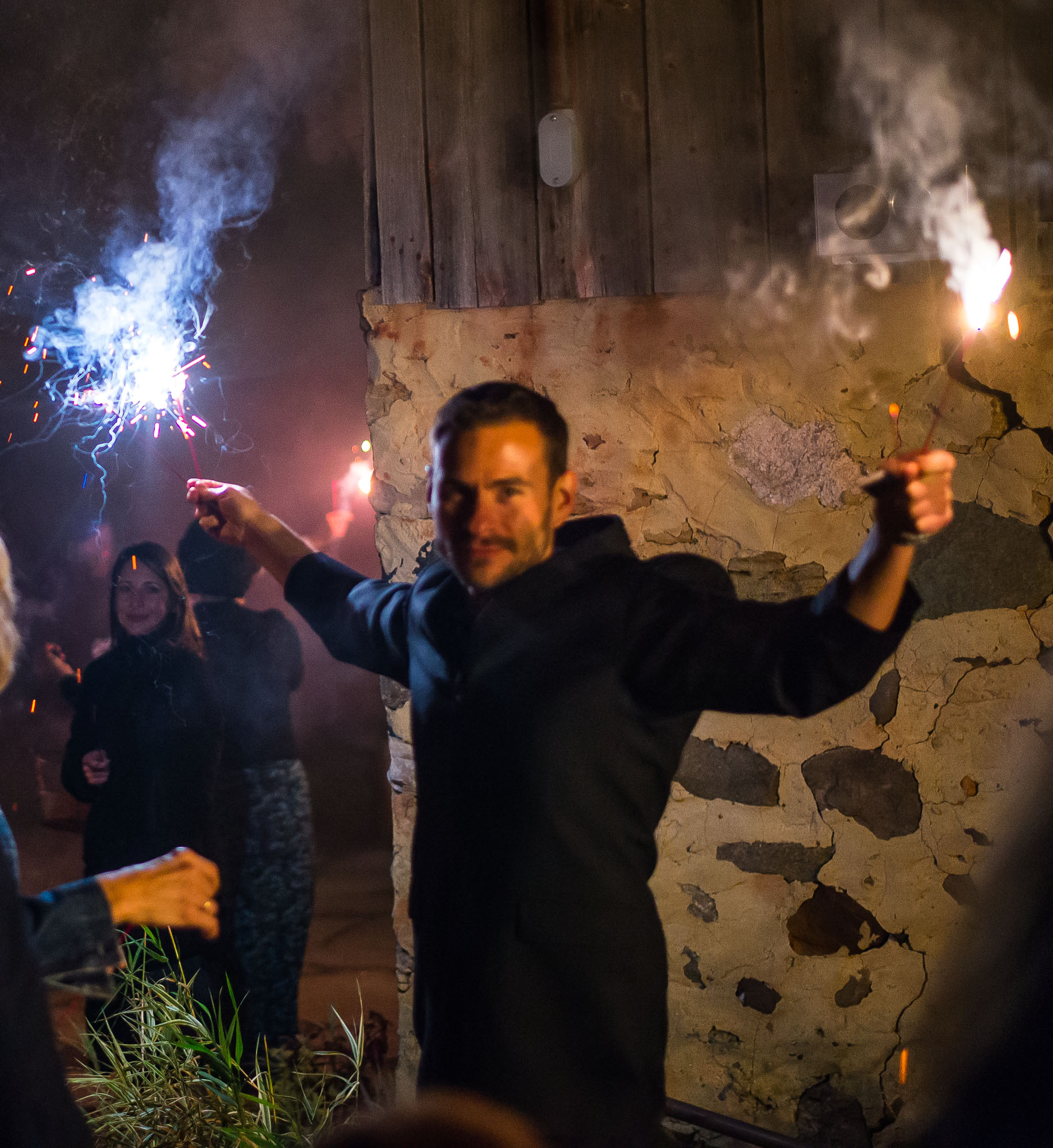
Kid-friendly fireworks:
Awesome wedding in a perfect barn setting. Check out the full-album for more photos!
Congrats Andrew and Whitney!!!!!
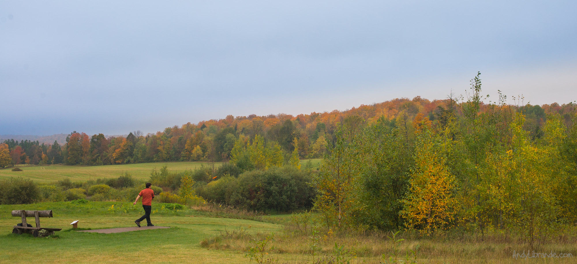
A Quick Trip to Highbridge Hills Disc Golf Course in Wisconsin
- Posted: November 25, 2014
- By: andylibrande
- In: Activity Categories, Camping, Disc Golf, Location Categories, Travel, Wisconsin
- 0
When: October 1st-2nd, 2014
Who: Andy and Caitlin
Highbridge Hills is home to one of the great disc golf destinations in the United States. Situated on over 500 acres this isolated complex houses 6 full courses and several additional alternate courses that use various teepads of the main courses (something like 120+ holes!). The area of Disc Golf is huge and the location is in one of the most beautiful spots in Wisconsin.
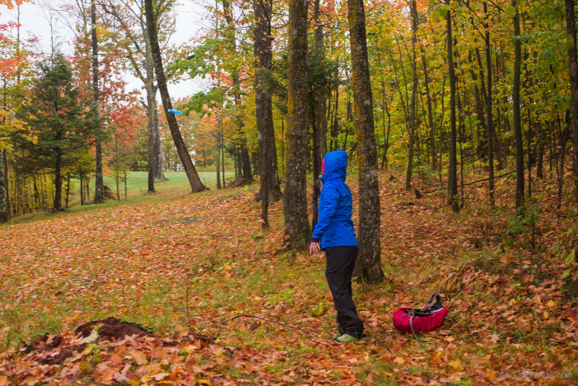
Caitlin and I were lucky to play two of the main courses there, Blueberry Hill and Granite Ridge, and get just a taste of this mecca of disc golf. We were in the area due to a wedding some of our best friends and since we were going to make the trek to Wisconsin anyways, we knew we had to visit. We spent one afternoon playing one course and one morning playing another course while camping out overnight at the complex.
Here are a few pictures from an awesome adventure. I have also included some more details to help any other people that may be planning a trek here as the details on this place are surprisingly lacking (considering it is a destination place).
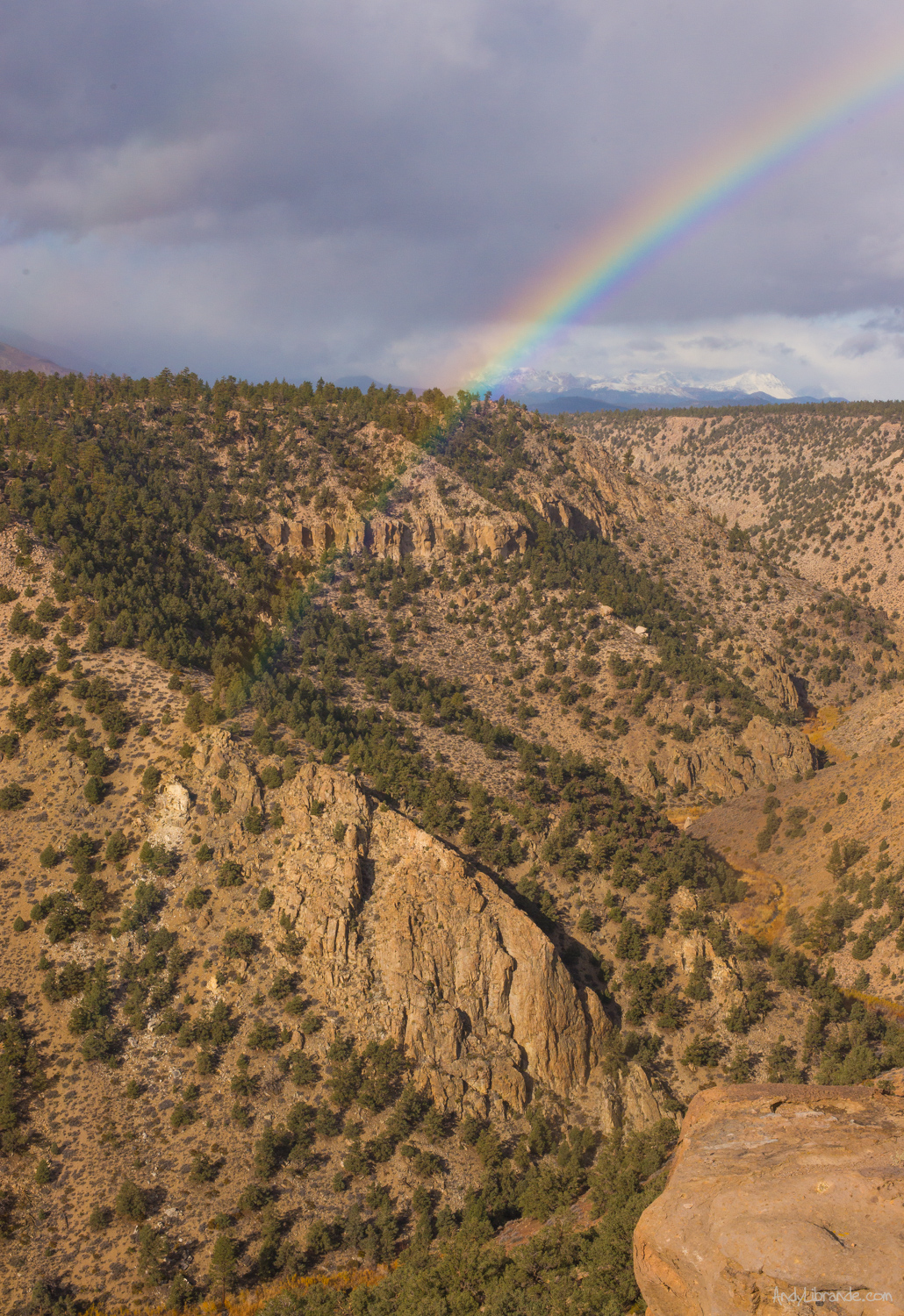
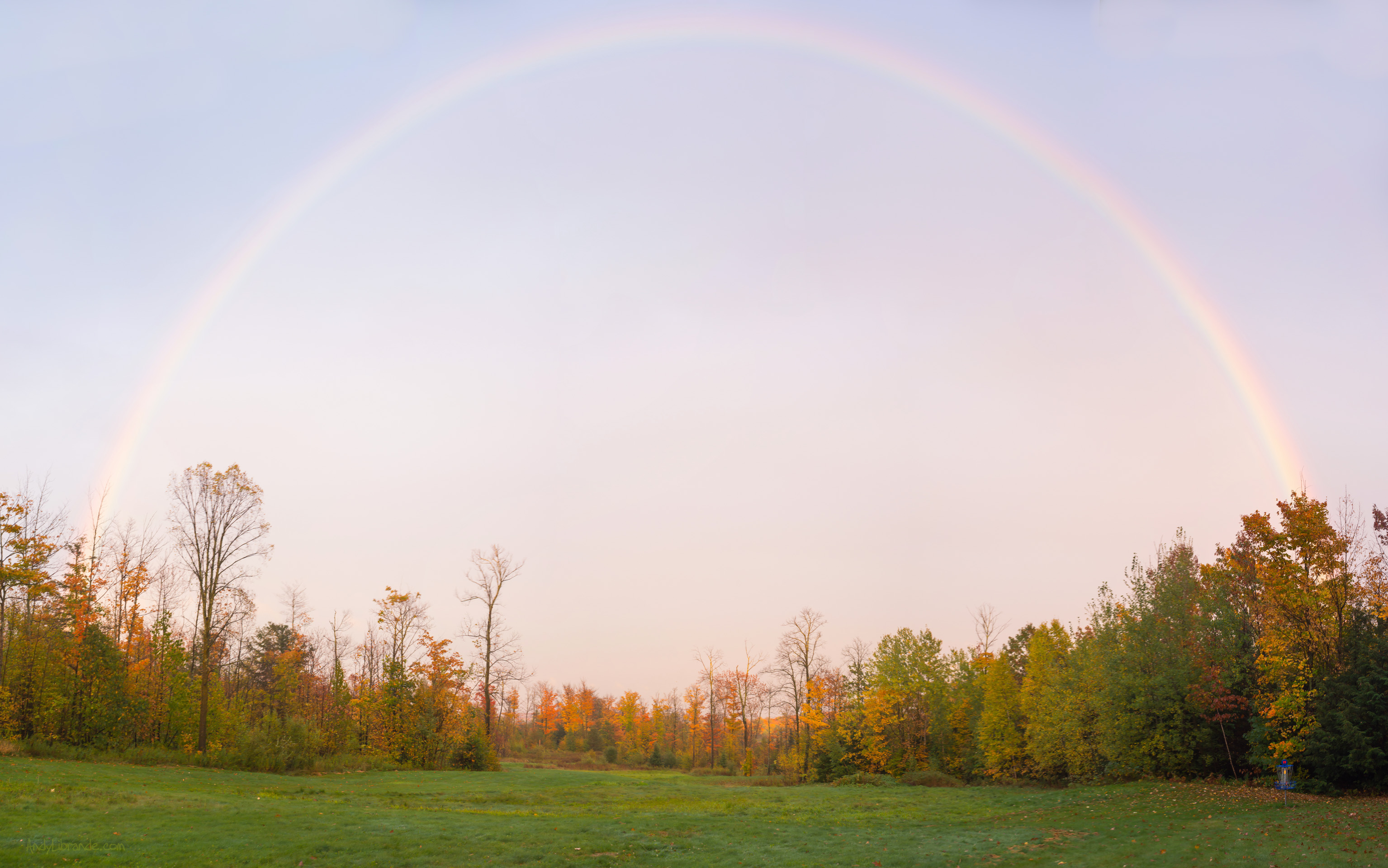
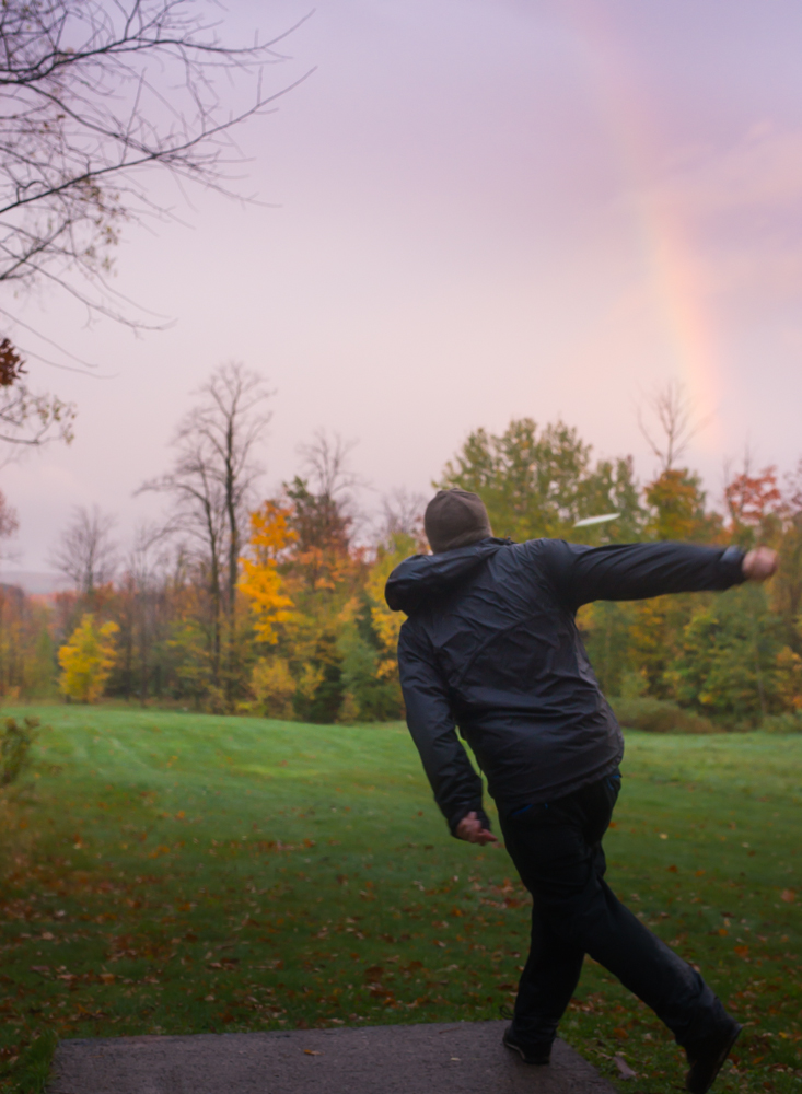
We were greeted with an amazing full-rainbow on Hole #11 of Blueberry Hill on our first night (click image for full-size, basket is in bottom RH corner):
Blueberry Hills Disc Course:
We arrived to the complex after 4 hours of driving mostly country roads. We left Minneapolis after picking up Caitlin’s sister’s car in downpouring rain and we drove almost the whole time in that same rain. Miraculously it was only lightly raining when we pulled up to the seemingly abandoned course.
It was the middle of the week and it was raining so the lack of people around was not surprising. After reading every map on the wall in their unique clubhouse and realizing that the camping was in a different place, and still being unsure of what to do since we were told people would be there, we just decided that light was fading quickly and we were going to get at least a few holes completed.
We started on Blueberry Hill and after a few holes the rain lightened-up and eventually came to a halt. The views were limited but everything we did see was incredibly beautiful.
Hole # 8 played through some really cool forest into an open field and then back into the forest. Lots of variety!
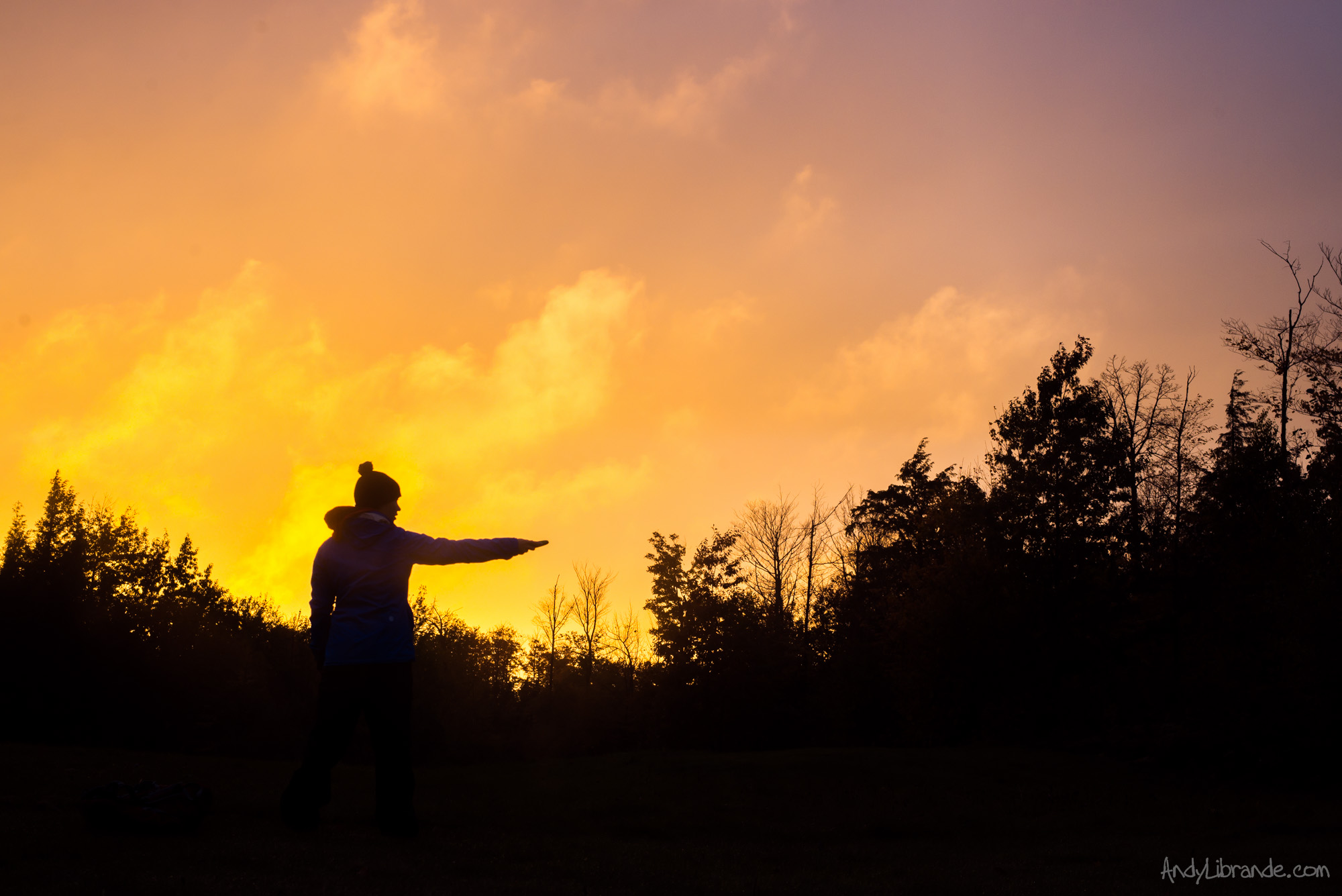
After losing a disc in some really thick grass, soaking ourselves while looking for it and generally wasting a lot of precious time, we were greeted with an amazing full-rainbow on Hole #11:
The sunset continued:
We finished the round in the dark after getting confused on the course and playing a few holes of one of the other courses there. Afterwards we headed to the campground area for the night.
Granite Ridge Disc Golf Course:
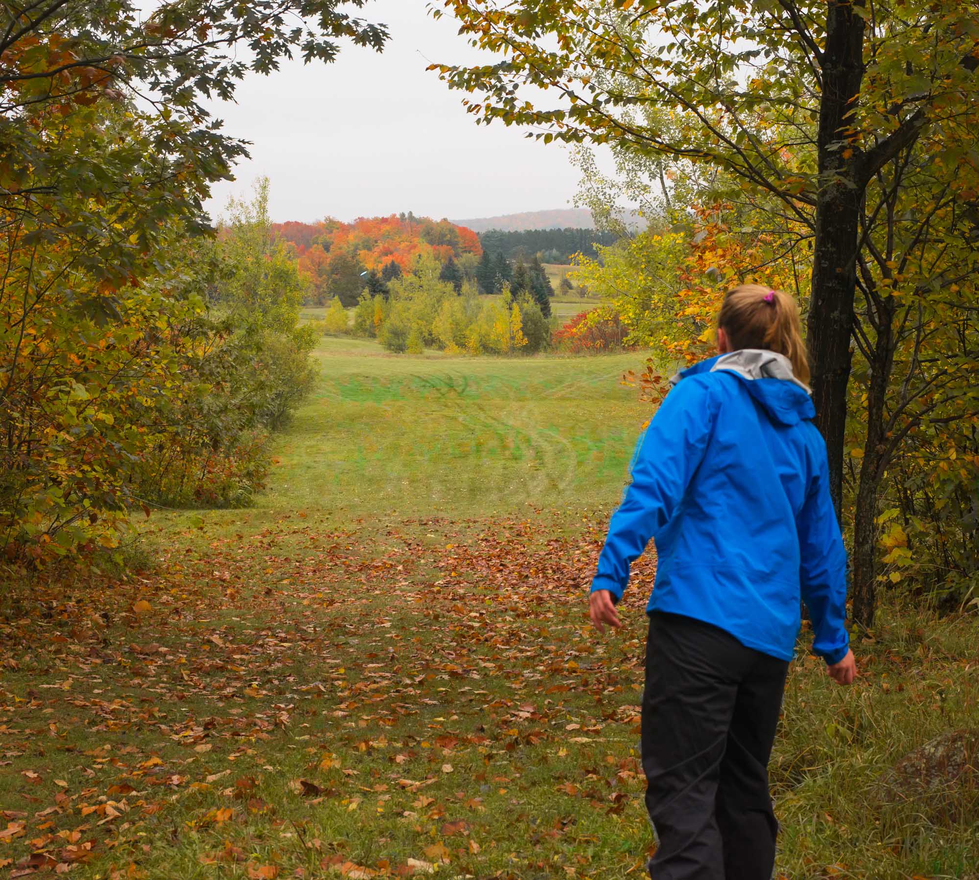
We awoke Thursday morning to clouds but no rain. After a early breakfast we were on the course at 9am. Granite Ridge was my favorite of the two courses as it had quite the variety of terrain (everything from tight trees, to open fields, to doglegs, water hazards, and swamps).
Hole #7 Granite Ridge is a tricky bastard. It calls for water on the lefthand side and you can’t see this large pond hidden behind a small amount of brush. Aim right. Her disc is visible and looked like it landed right on the edge of the green; however it was <5 ft from hitting the lake.
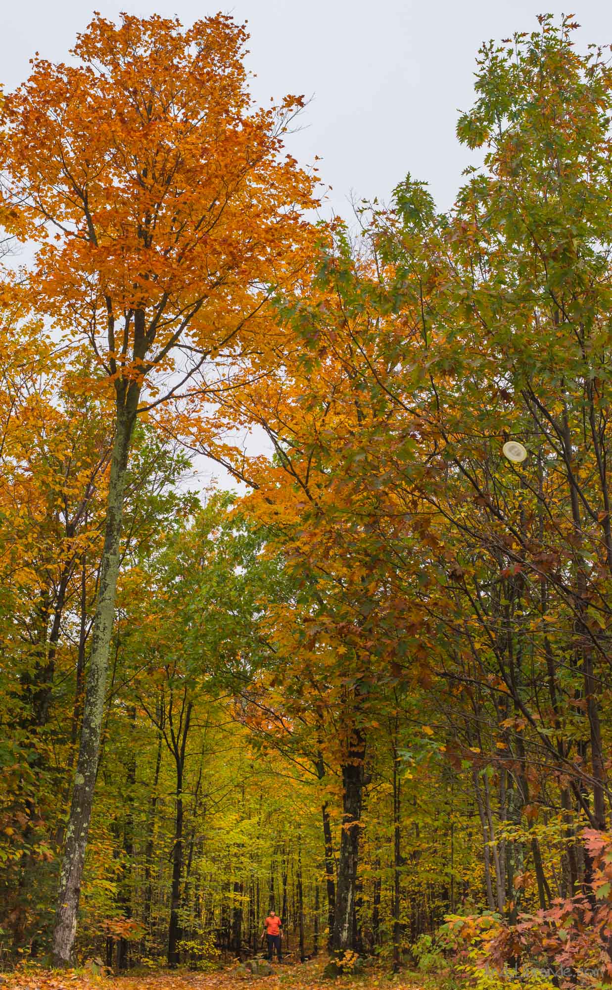
Myself teeing off and smacking a tree on Hole #6. To provide a little context on the height of some of these amazing trees on the course:
We had pretty bad weather and luckily it cleared up enough for beautiful views of the surrounding Chequamegon National Forest. Hole #11 on Granite Ridge:
After about 3 hours of somewhat slow playing (at least 4 times looking for discs but found all of them!) we ended our round, ran into Mike and Jonathan at the clubhouse and headed on the rest of our adventure to the Lake Superior area.
We just had a taste of the courses on the property and while unlikley we will be in the area anytime soon I hope that I can come back and experience the rest of the course.
Read more on camping at Highbridge Hills, other logistics and a few more photos:
Read More»Bachelor Party at Lake Granby
- Posted: October 24, 2014
- By: andylibrande
- In: Activity Categories, Camping, Colorado, Location Categories, Northern Mountains, Water Sports
- 0
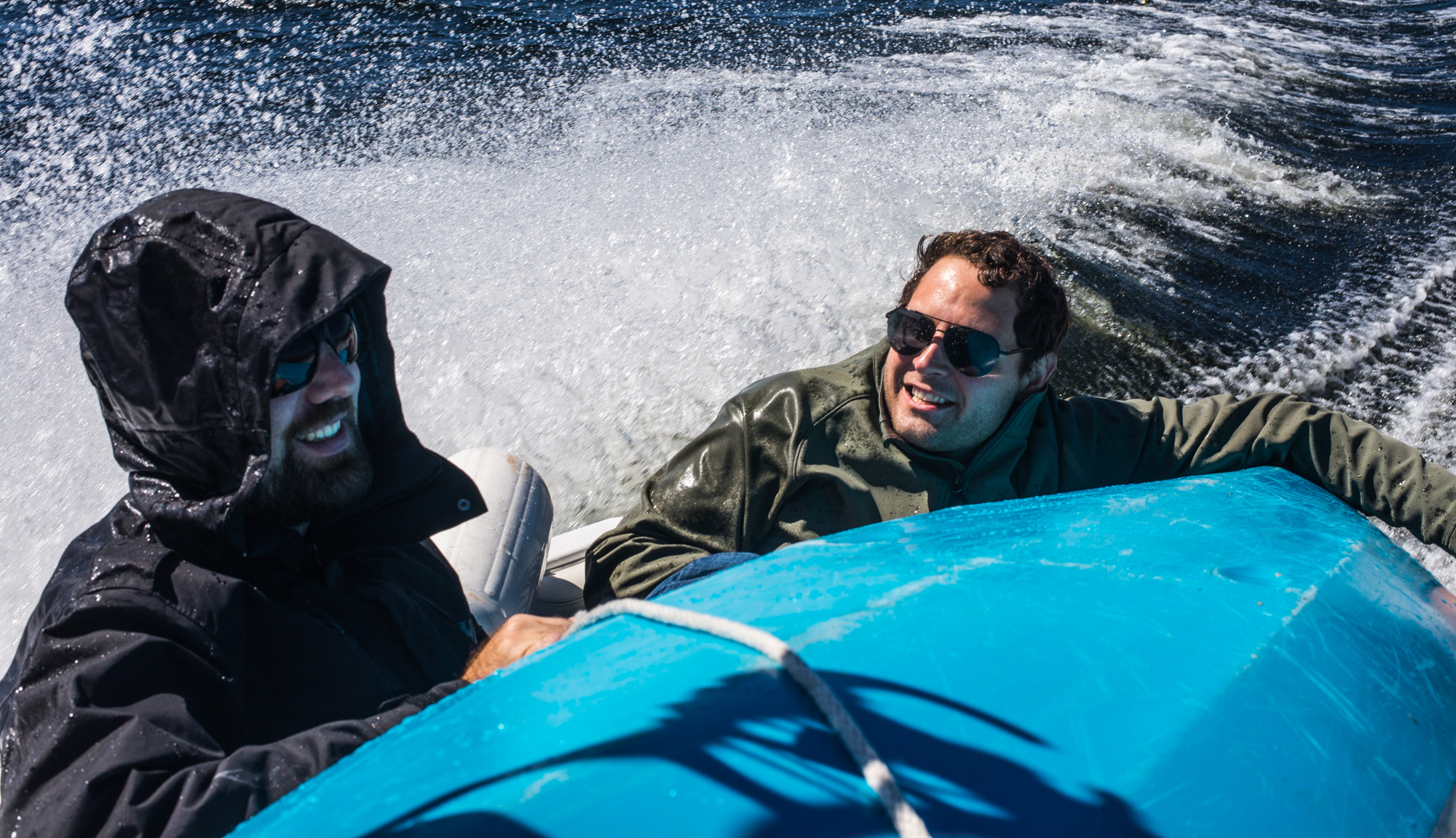
What: Our good friend Andrew was getting hitched in 3 weeks…so we threw him a good-ole bachelor party
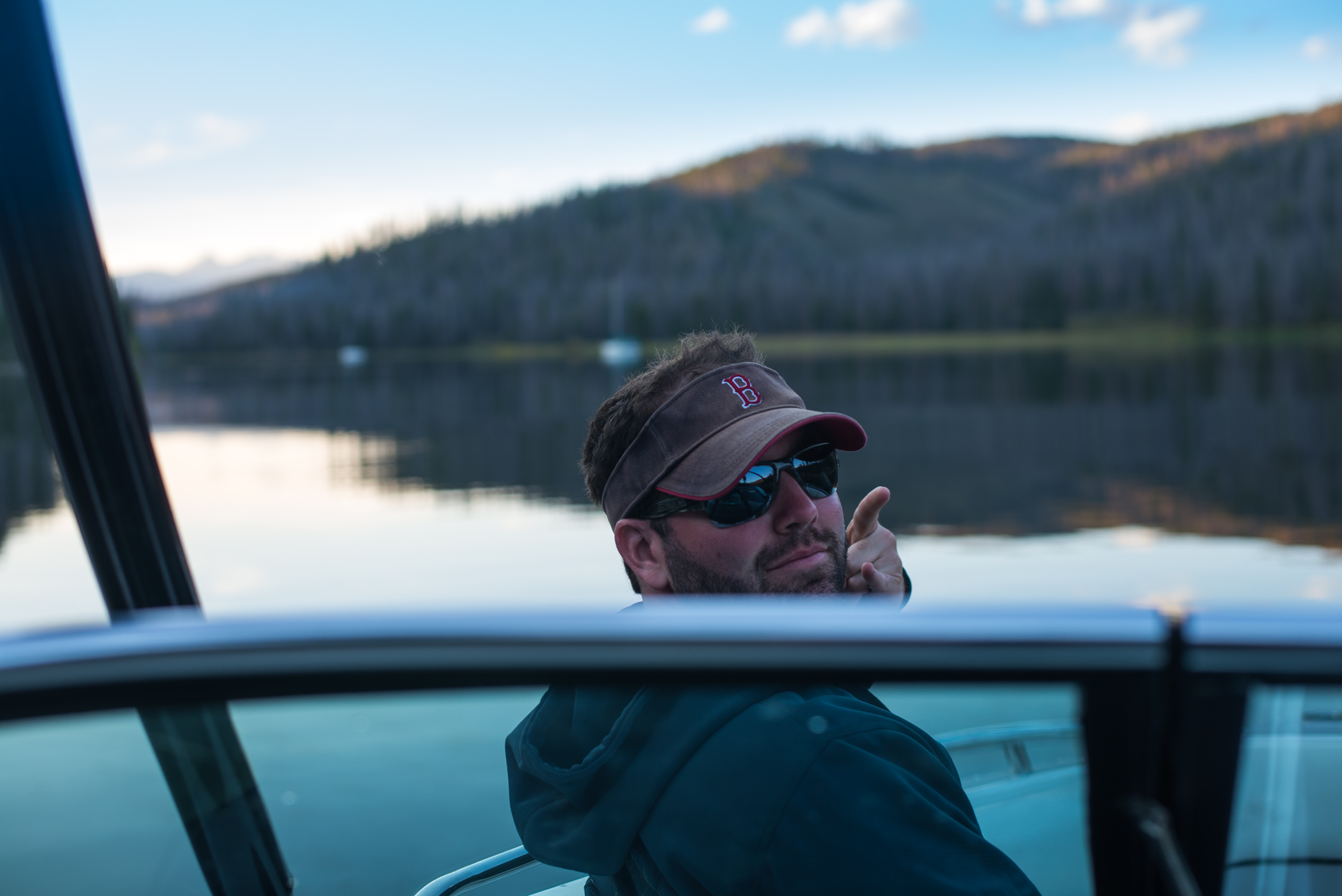
Where: Lake Granby, Colorado ; 8,300 ft elevation
When: September 13th-14th, 2014
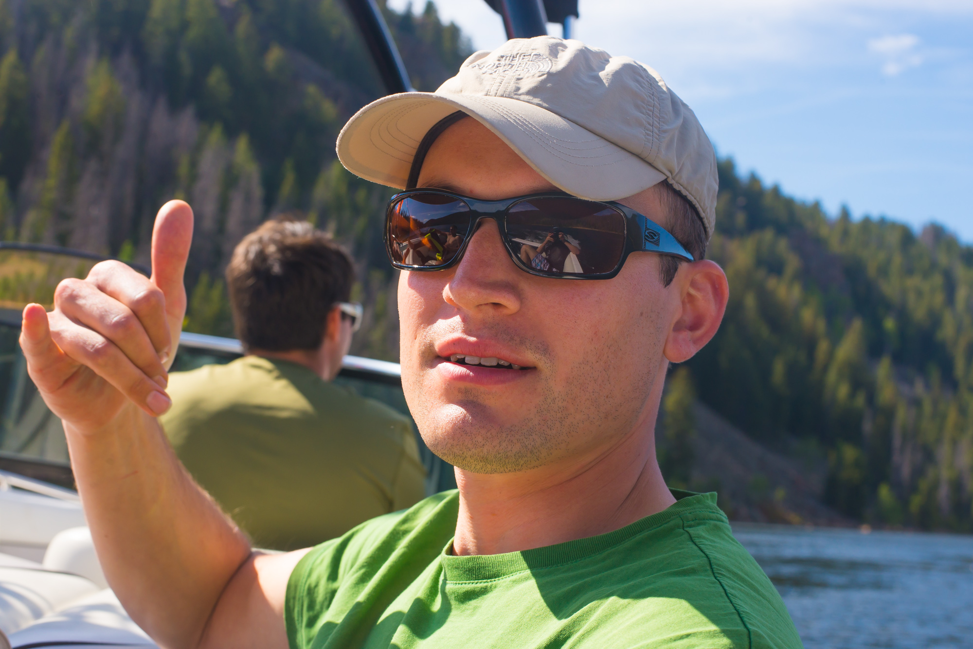
Who: Andrew, Ben, Brian, Paul, Dan G.#1, Dan G.#2, Billy, Rob, Nick, Vinny, Tyler, Andy
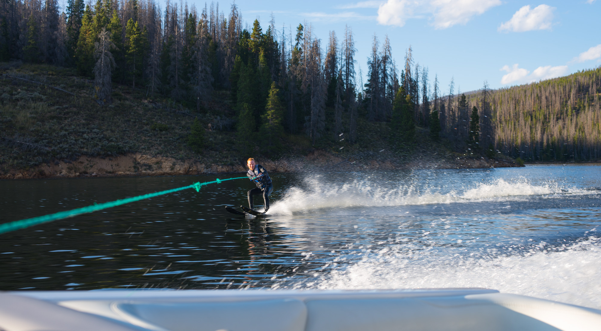
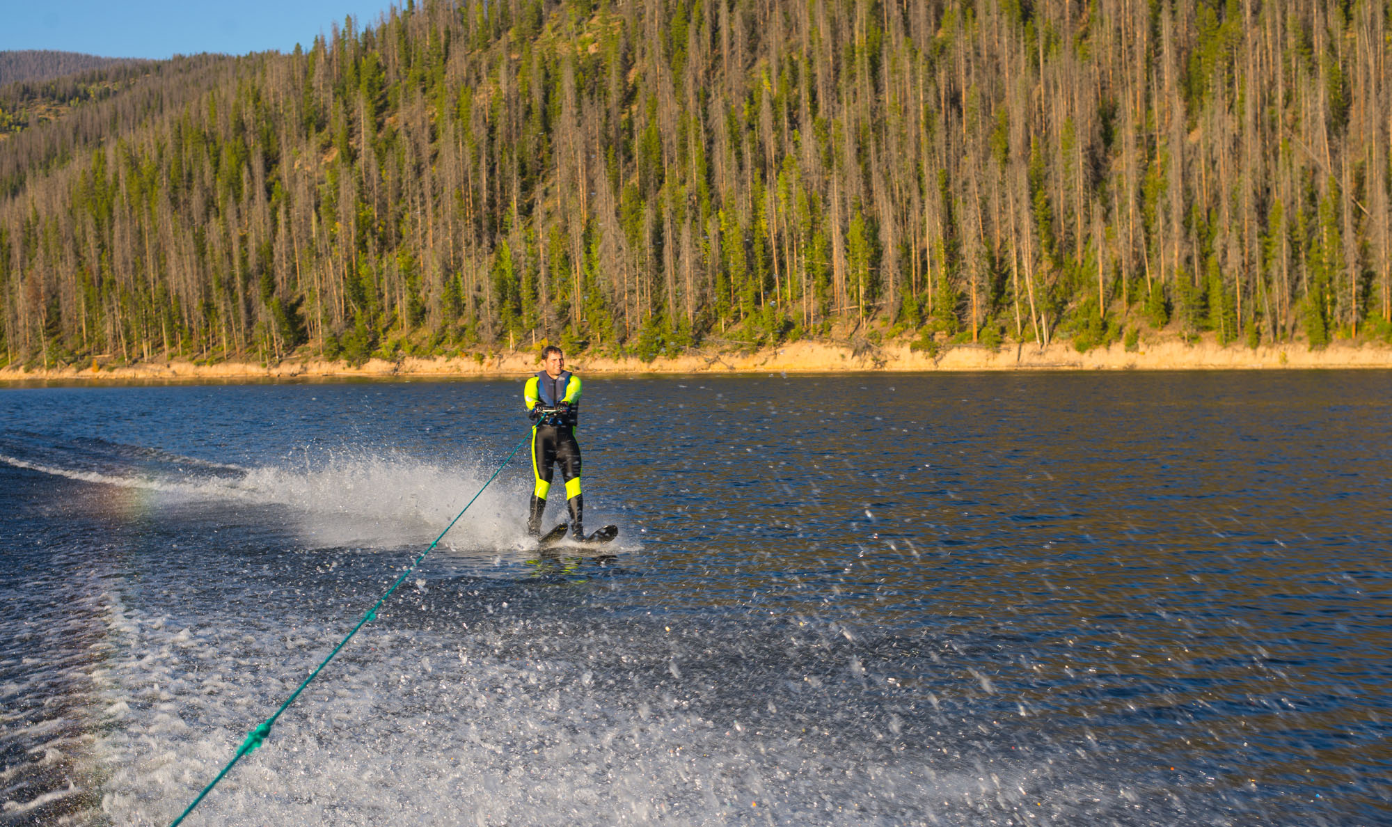
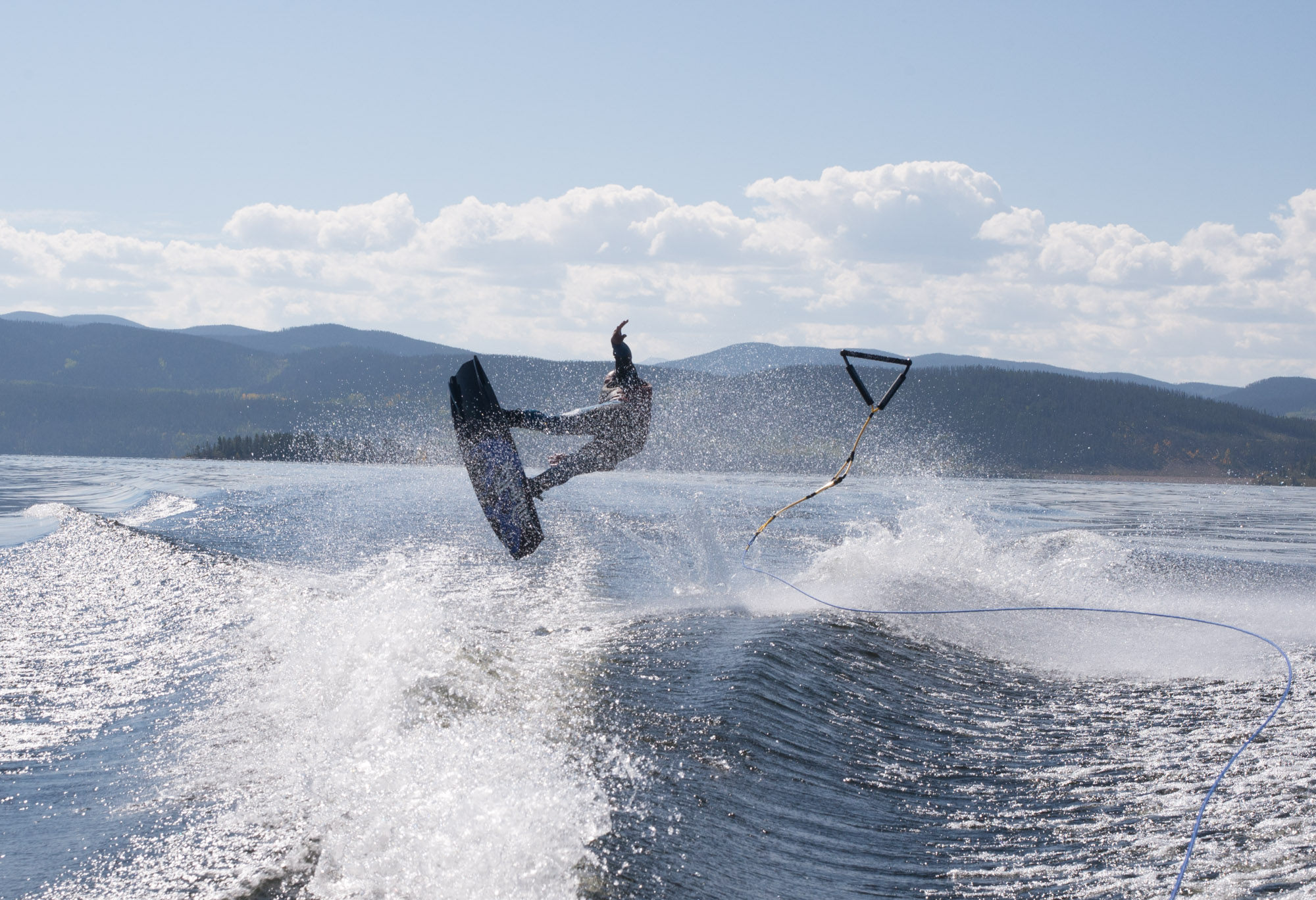
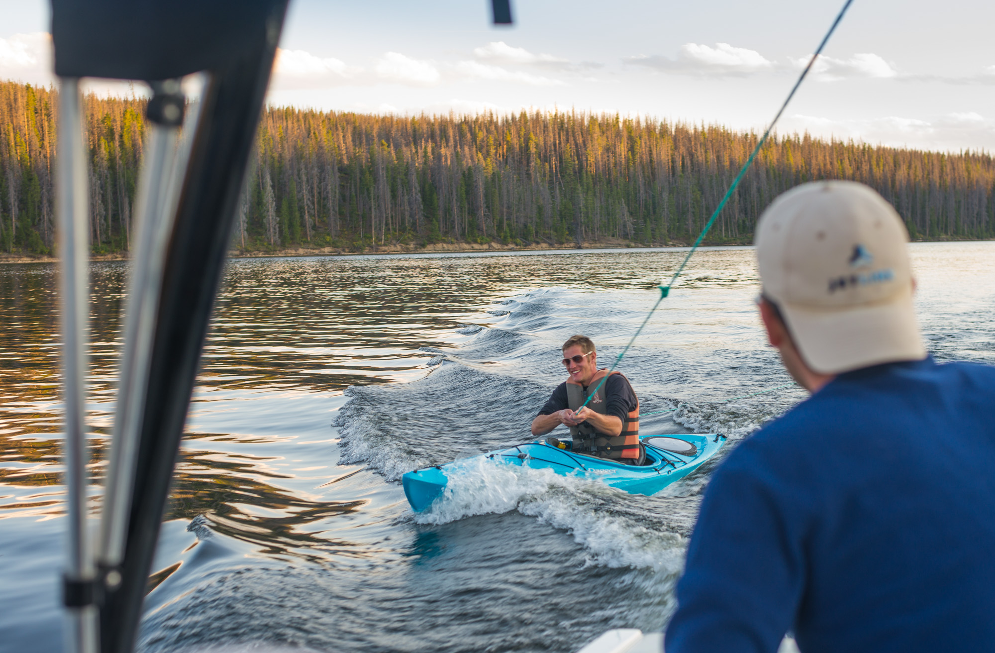
An early morning we left Denver after it literally snowed 24 hours earlier. As we drove-up and over Berthoud Pass the weather was incredible and we were stoked to be on our way. A quick 2.5 hour drive from denver and we were at the lake! Due to the size of the crew we had to take two trips to everyone to the campsite. The 2nd trip was a bit rough as the wind was strong and we were crammed into the boat:
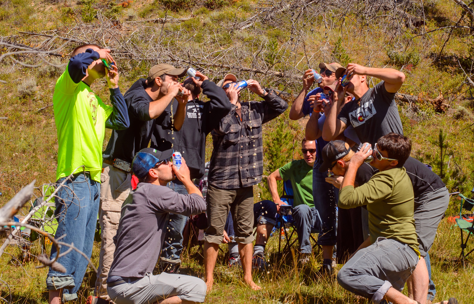
1st order of business at the campsite: Beer-Drinking group shot:
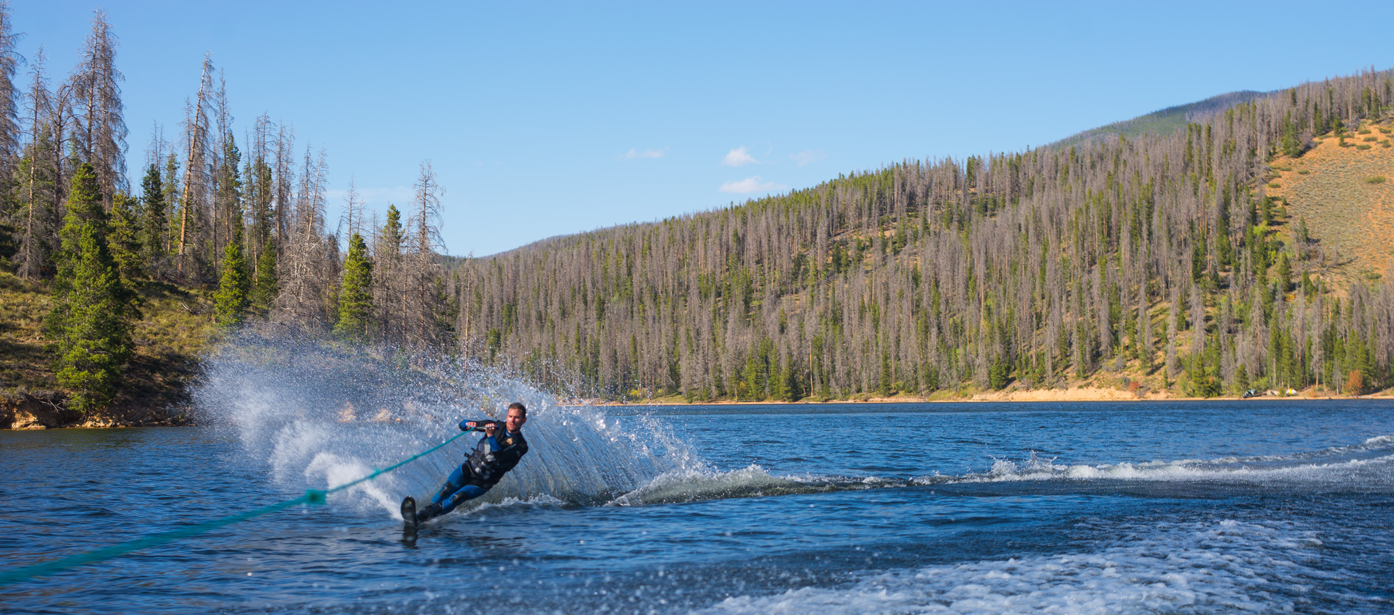
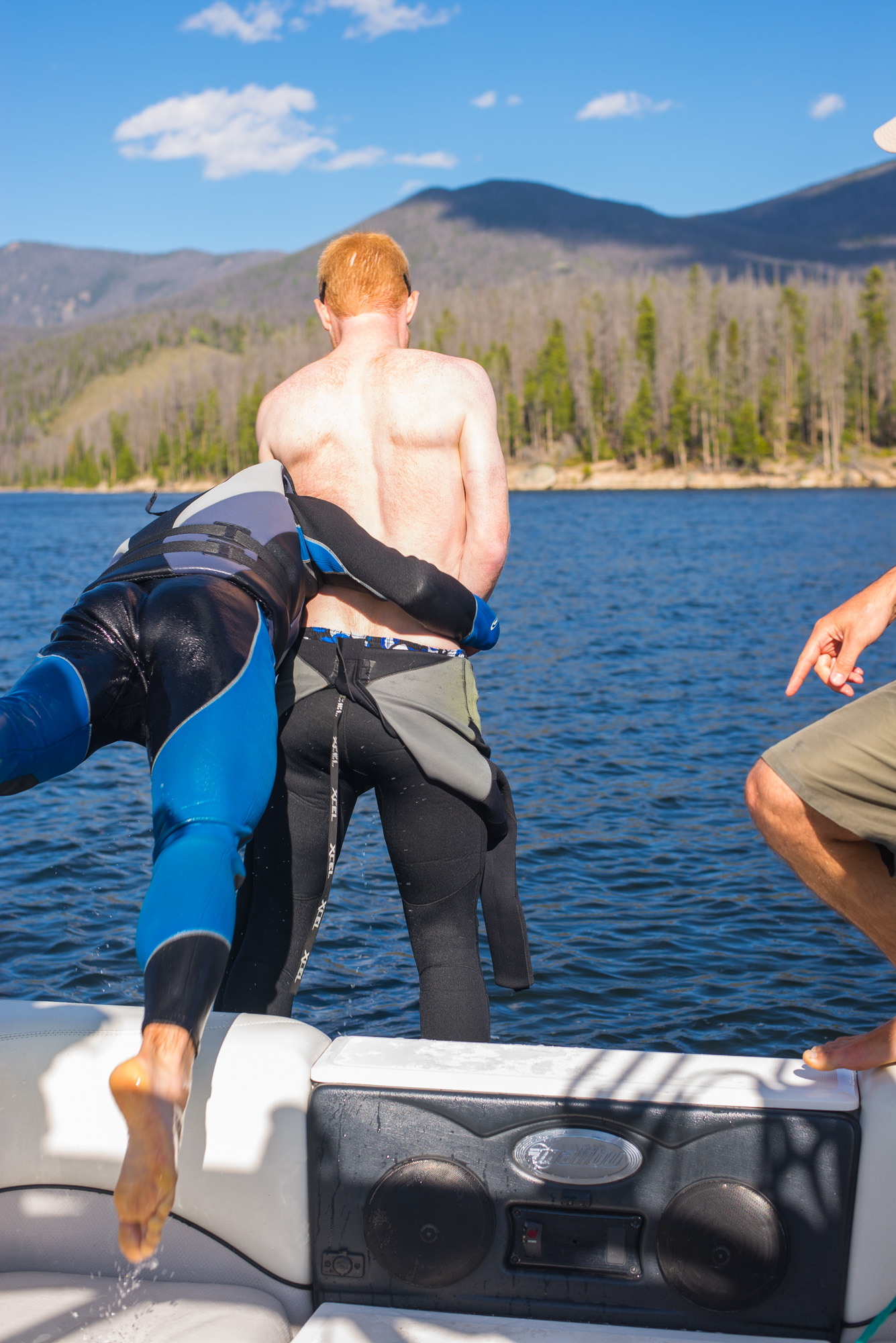
The wind calmed down and we spent the whole afternoon waterskiing some excellent water. The water temp was the same as the air temp so the transition was freezing cold (in or out) but once you were in there with a wet-suit it was worth it:
We cooked ribeyes on the campfire like men, watched a beautiful evening happen around us, and had some campfire fun:
——–>>>>—————>>>>
Read More»Vedauwoo Night Bouldering and Trad Climbing
- Posted: October 08, 2014
- By: andylibrande
- In: Activity Categories, Camping, Location Categories, Rock, Wyoming
- 0
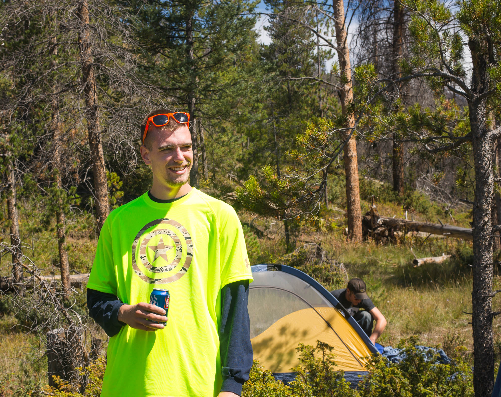
Who: Andy, Caitlin, Jake, Rambo, and Tweak
When: Saturday Night July 12th thru July 13th, 2014
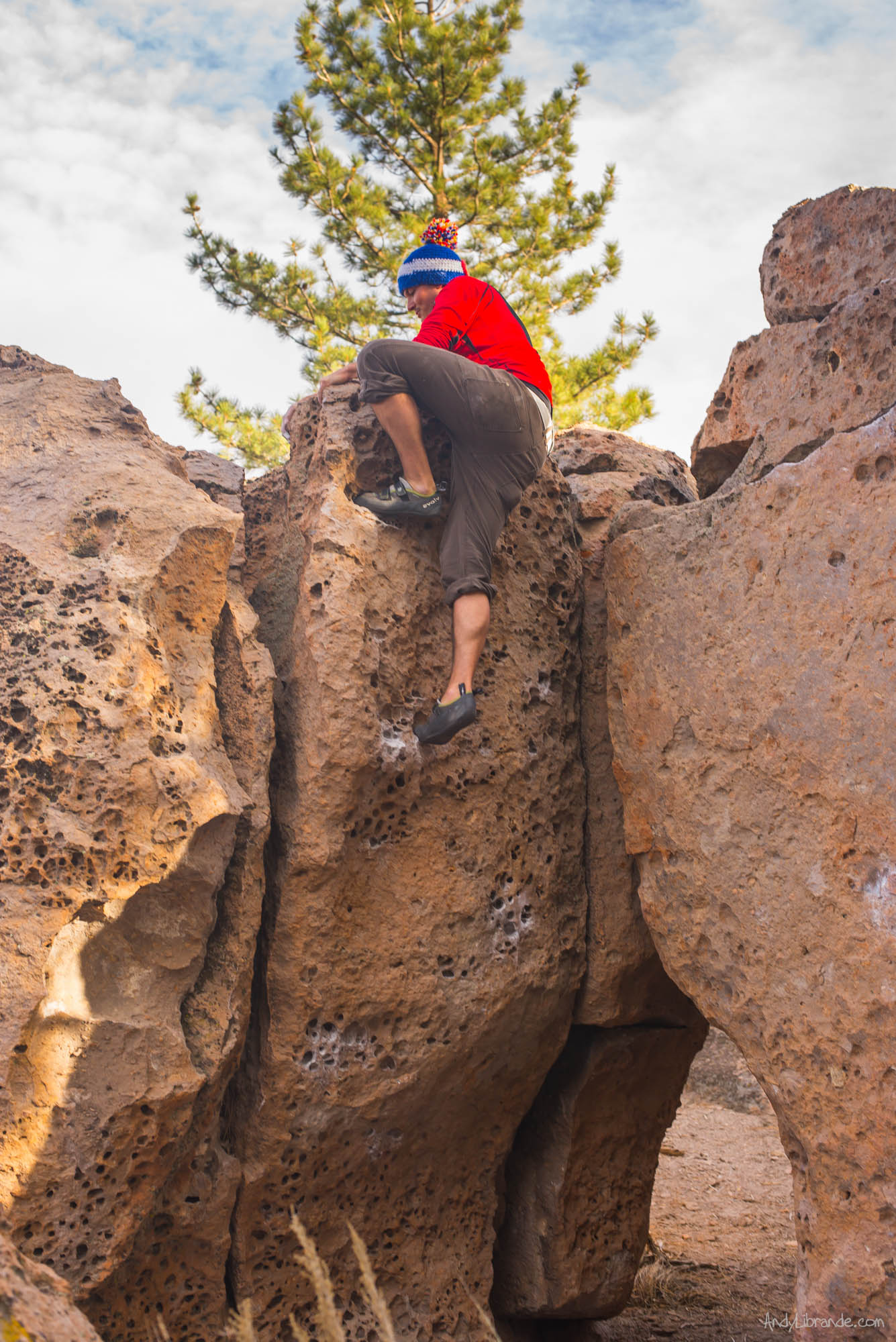
What: Camped at the base of the “The Acres” /Citadel bouldering area on 700L (have climbed here before). Arrived late Sat night and night bouldered until 1AM. Woke up and did trad climbing at the Nautilus all day.
A late Saturday start as we had to work around Caitlin’s new nursing schedule, however it worked out perfectly. We arrived in Vedauwoo right as the sunset started to dip behind the horizon and luckily were able to locate a campsite without issue within walking distance of the Acres Boulders. After quickly establishing our campsite we headed up the trail to the boulders.
Jake about to send this problem under the light of the lantern (please note Caitlin is completely passed out in this photo!):
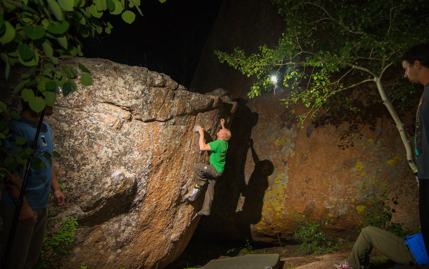
Rambo sending this large slab problem called “Organic” under the cover of darkness (and I am sure my flashes were only hurting and not helping): (Link for full size)
In the dark I had a mishap taking photos an accidentally broke my lens: LINK HERE
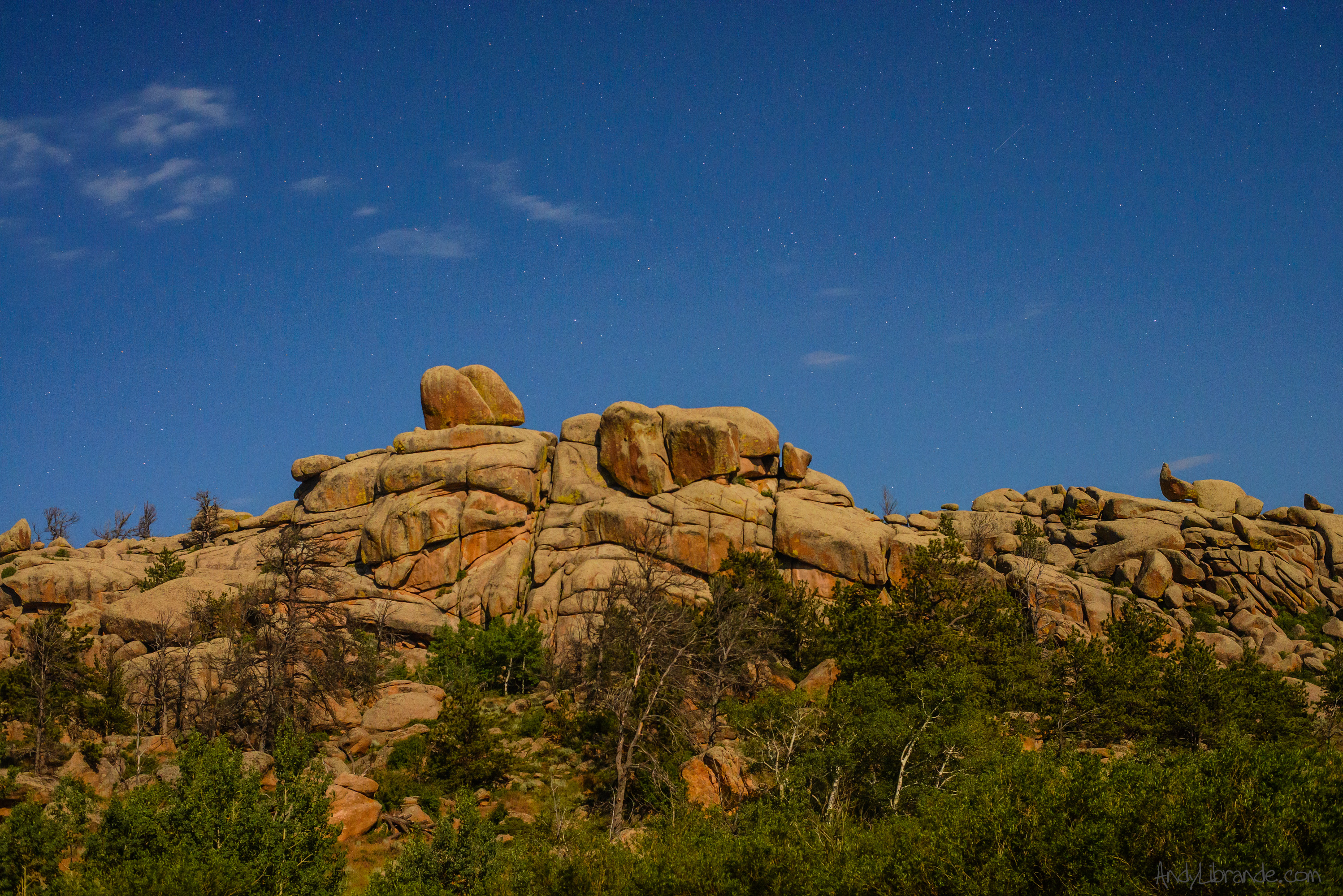
Stars over the Citadel formation where we were climbing. Taken from our campsite:
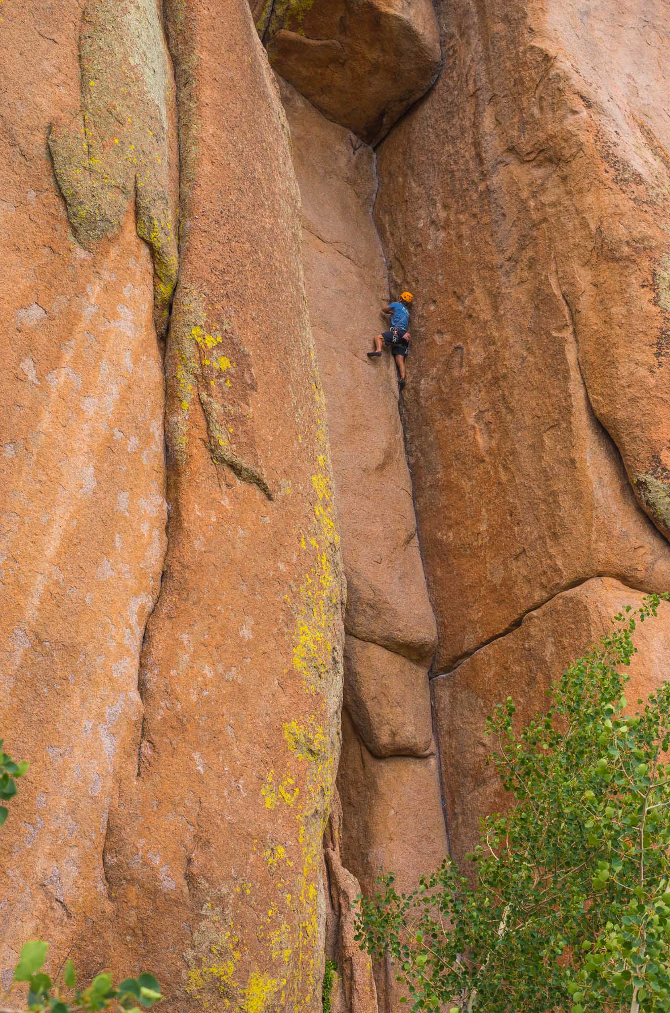
Next morning we cooked breakfast on the back of the truck and headed over to climb at the Nautilus. We were only relying on the Mountain Project app for directions and none of us had spent any time researching so figuring out where we were was not much fun for this vast area. But eventually we just started climbing some cracks where we had no idea of names/grades:
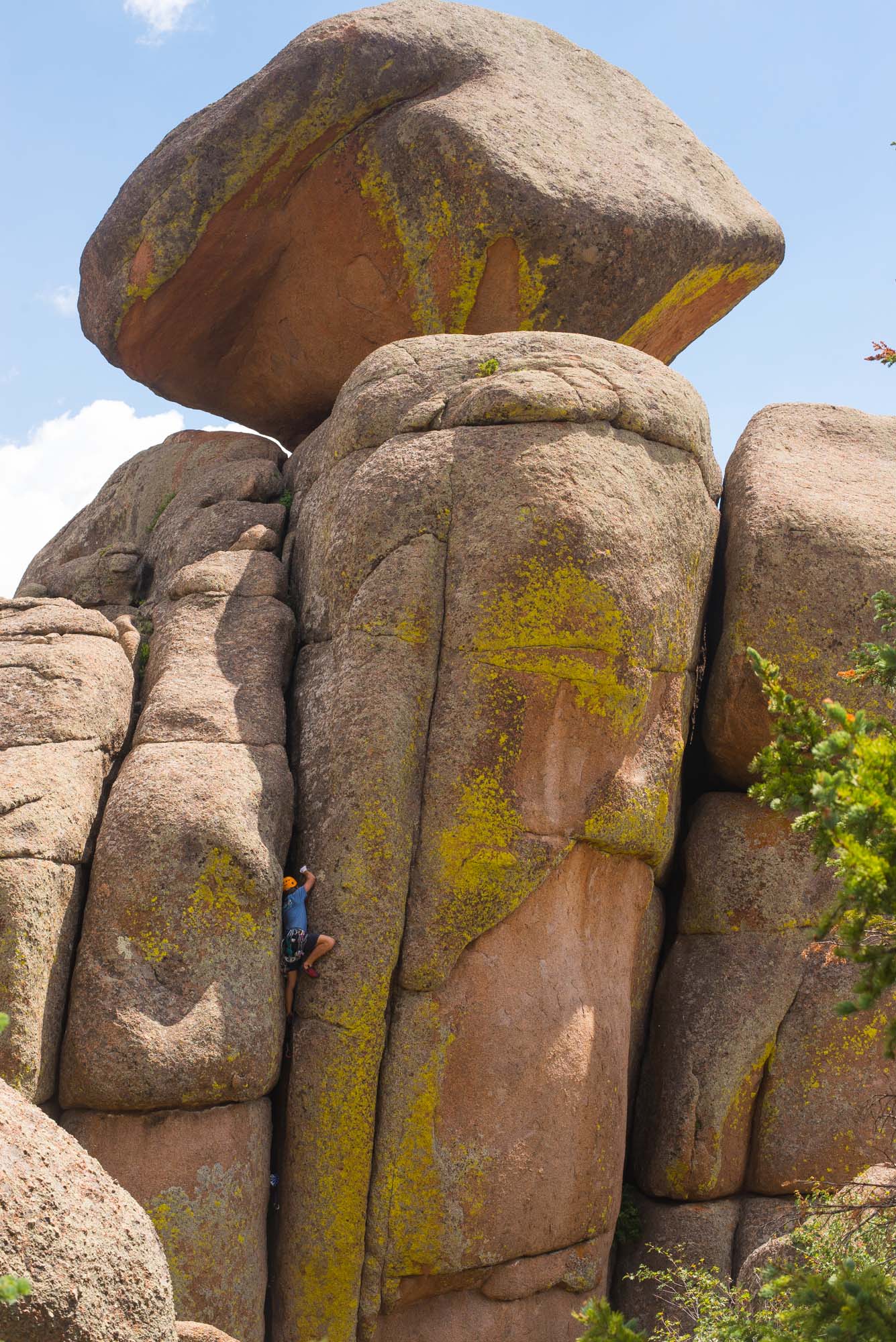
Tough climbing on beautiful rock:
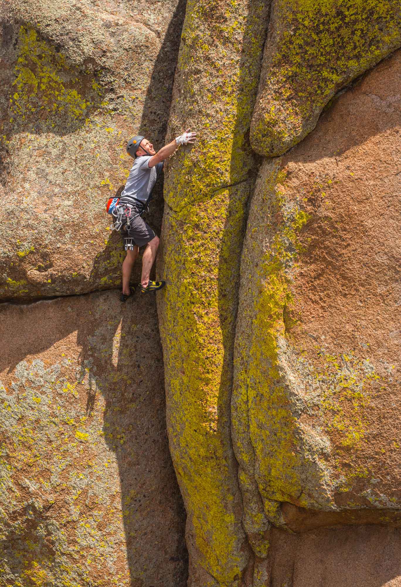
Then we wandered over to a striking crack on one of the faces. It took Rambo a bit to climb it but it was amazing. We all tried it and it kicked all of our asses with Rambo leading it and Jake sending but the rest of us struggled through the crux. It wasn’t until some other guys wandered over that we realized we were on one of the area classics “Friday the 13th“:
Beautiful quick weekend of climbing!
Magic Meadows Disc Golf Course – One of the Last Groups to Play before Closing
- Posted: October 08, 2014
- By: andylibrande
- In: Activity Categories, Colorado, Disc Golf, Front Range, Location Categories
- 1
Who: Andy, Caitlin, Bret, Tweak, and Bubbha.
When: June 15th, 2014
Detailed Course Walk through with photos of nearly every hole! (Click for Link)
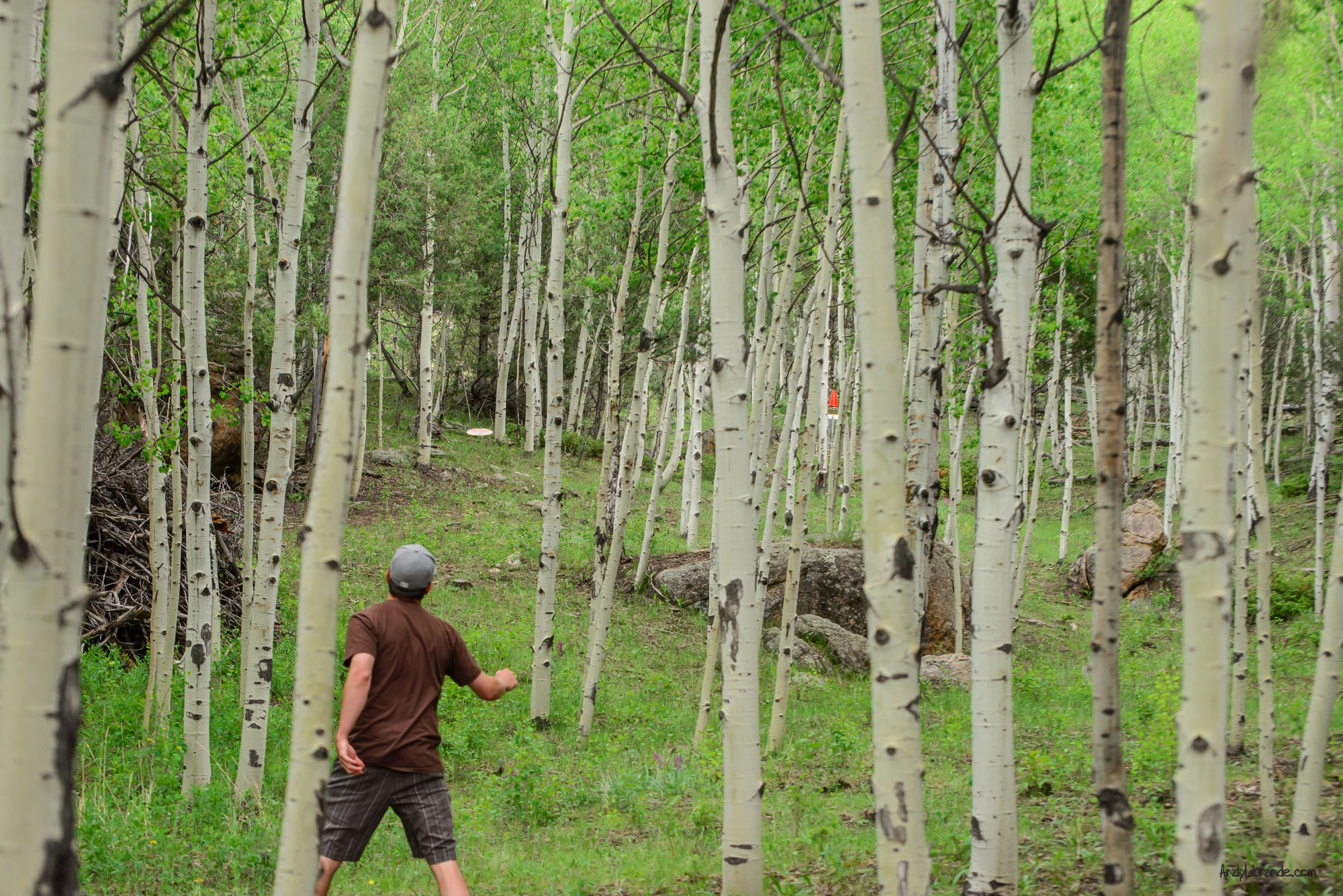
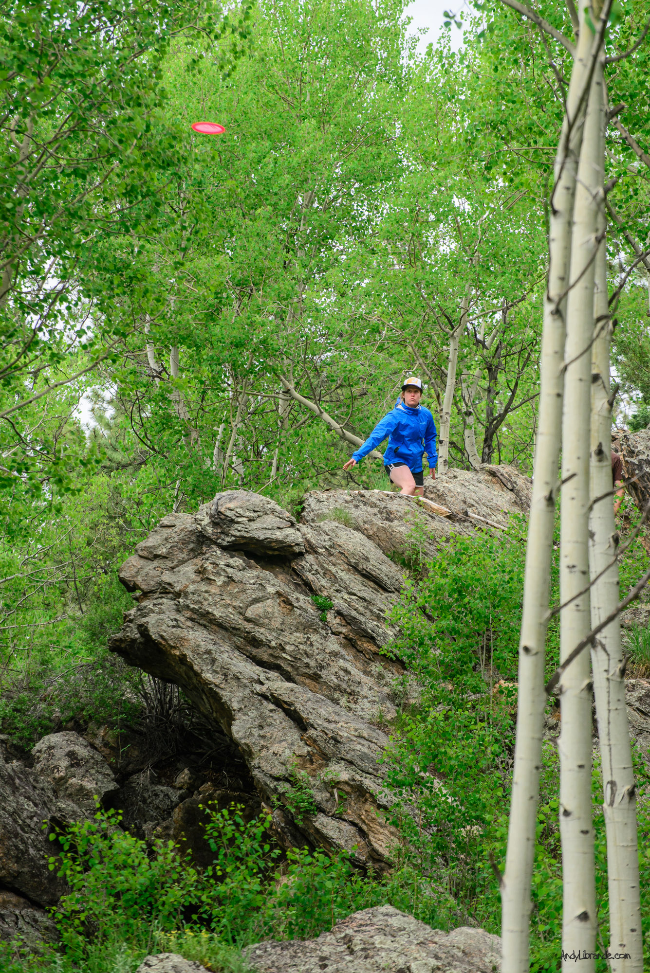
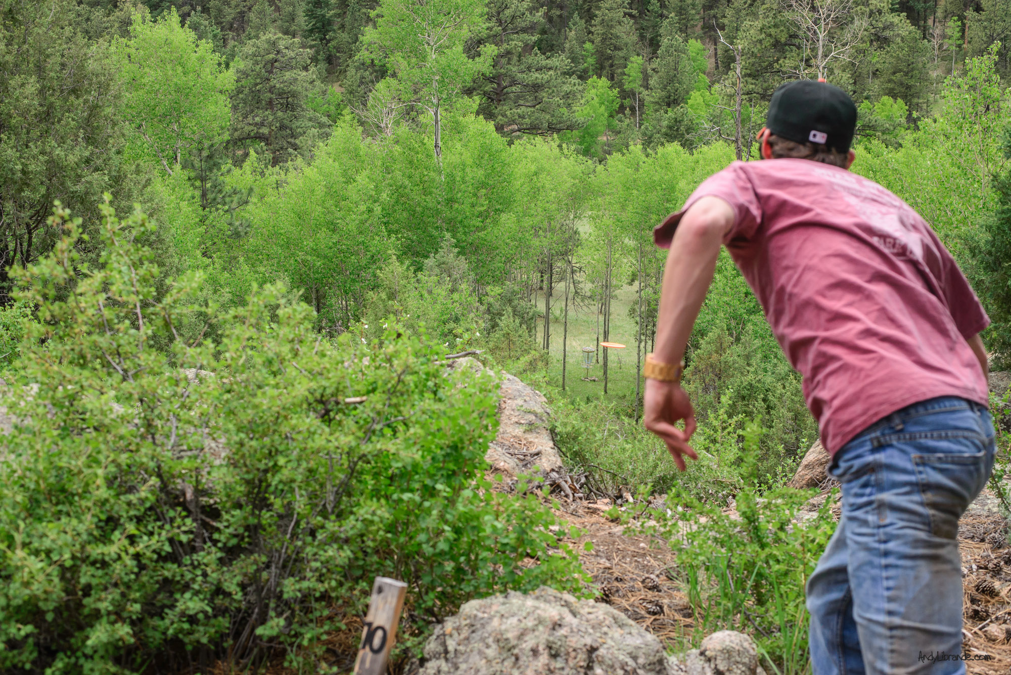
In July 2014 our group of four was one of the last groups to ever get to play the Magic Meadows Disc Golf course located near Pine, Colorado. It may have been one of the most beautiful days of disc golf you could have asked for with perfect weather, flowers blooming in the fairways, thick green aspens, and plenty of throwing.
Tweak throwing through the Aspens on Hole #3. You have two options with tough alleys on either side:
Magic Meadows was built to be a private course that had open tee times and was to feature several courses on one of the most beautiful chunks of property along HWY 285. Unfortunately after opening there was some problems with the family that owns the land and the course was put into flux. Not wanting to deal with the on going issues and uncertainty the course founders decided it was time to close up-shop.
The course had many unique elements that are solely unique to the land it was located upon. This tee box was one of the highlights of the day (and there was a lot of highlights that day!):
Tight Tunnel shots were common:
Quick Aspen Weekend
- Posted: September 24, 2014
- By: andylibrande
- In: Activity Categories, Camping, Colorado, Disc Golf, Location Categories, Rock, Southern Mountains
- 0
Camping under the stars
Bouldering on Independence Pass
Hiking to the Base of the Maroon Bells
Disc Golfing at Colorado Mountain College in Carbondale
Caitlin and I packed a lot of activities into just a weekend. Below are the highlights.
We left Denver late and hit Kenosha Pass right during a beautiful sunset:
On the way up we had a delicious late night dinner at Eddyline Brewery.
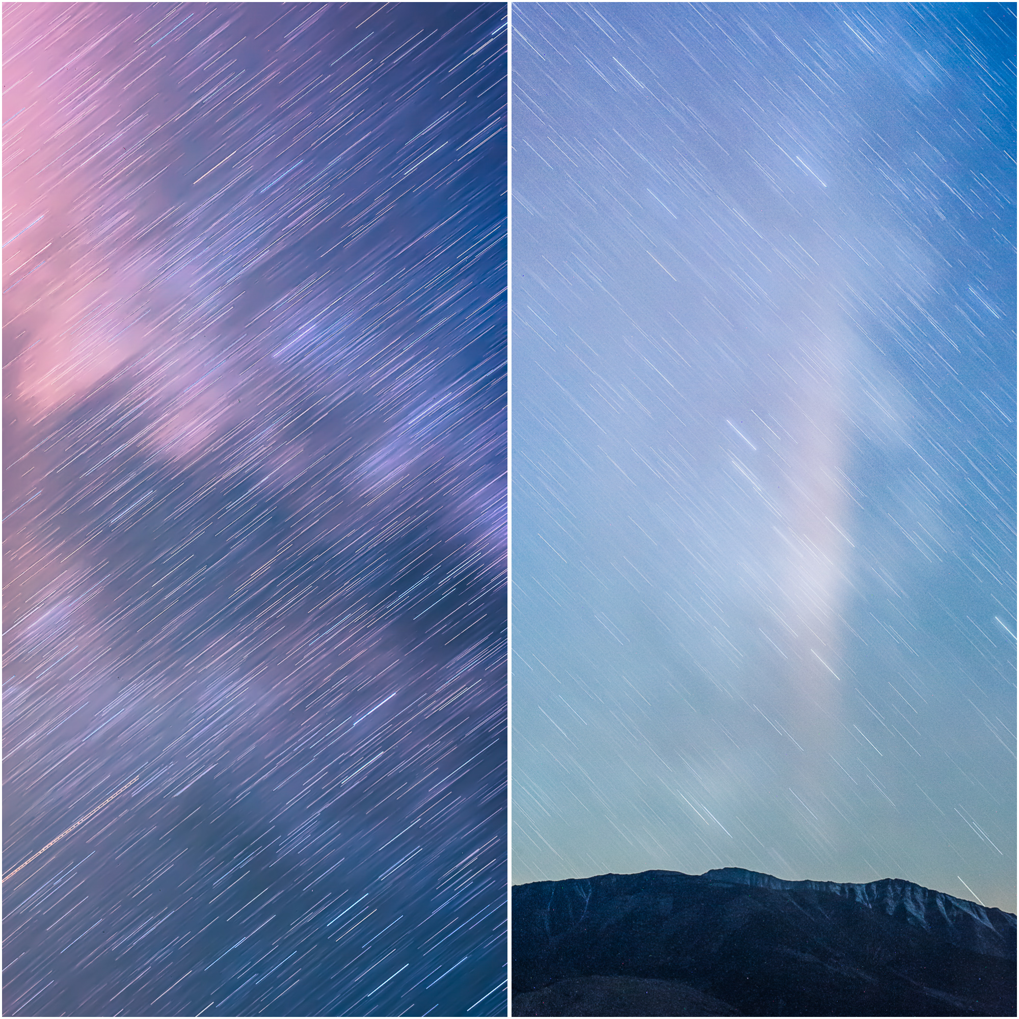
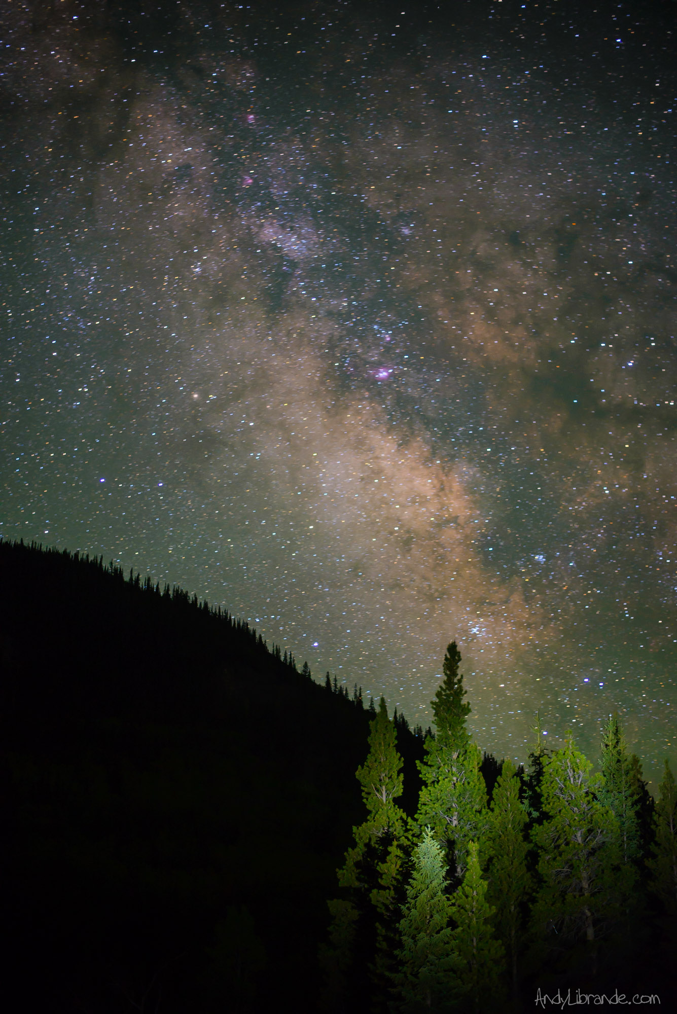
We were planning on camping in the truck so we drove up FS 390 which has a ton of car-camping options and plenty of others were already out there. It was late on a friday but eventually we found a perfect level spot for the truck.The stars were amazing that night and I spent quite some time photographing them and the Milky Way:
Beaver ponds by our campsite the next morning:
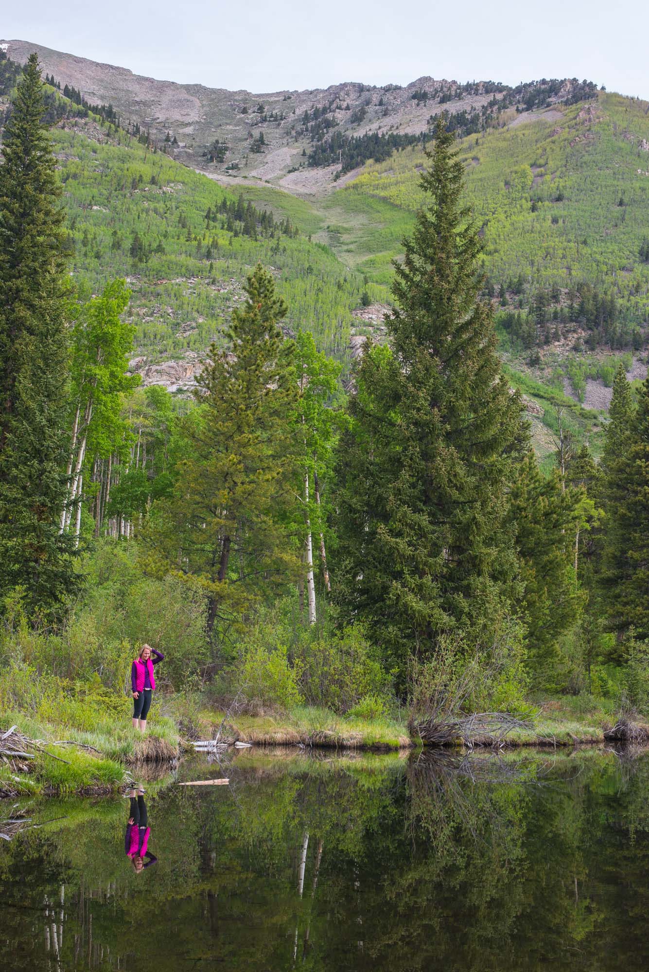
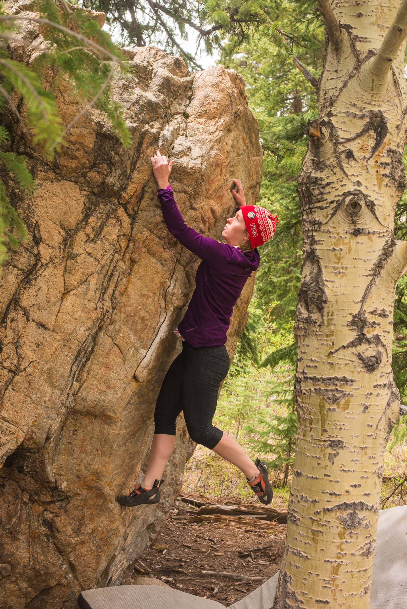
Next morning we got up and drove up and over independence pass stopping at a bouldering area which was perfect for a short session on some easier blocks. After climbing we headed into Snowmass where we met up with the rest of Caitlin’s family.
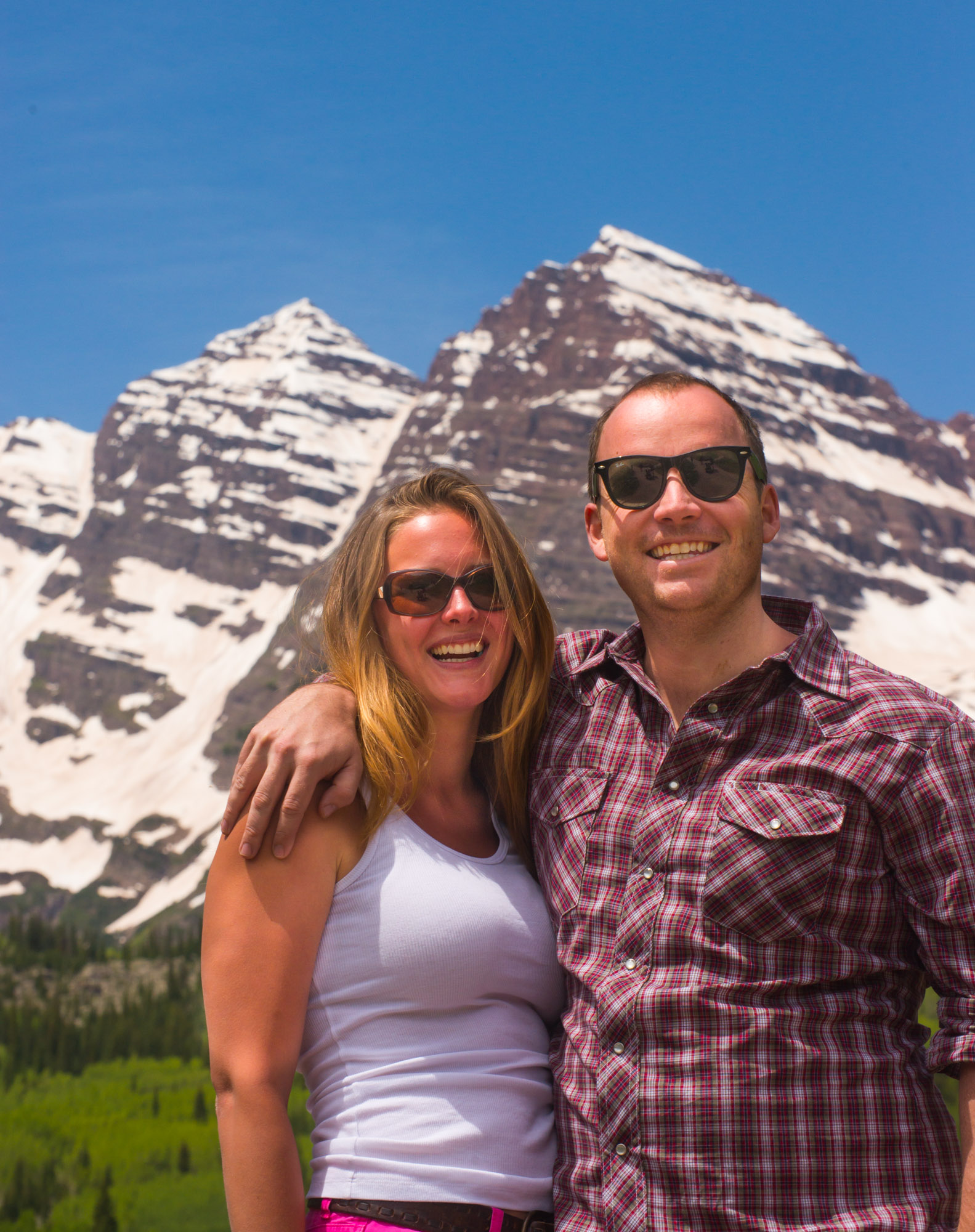
The next day we had a beautiful hike up in the Maroon Bells area. It was my first time in this specific spot as we normally tend to stay away from the tourist parts of Colorado. Glad we went up there as it was totally worth it.
We hiked all the way to Crater Lake (tons of snow for June 22nd!). Jon and Laura:
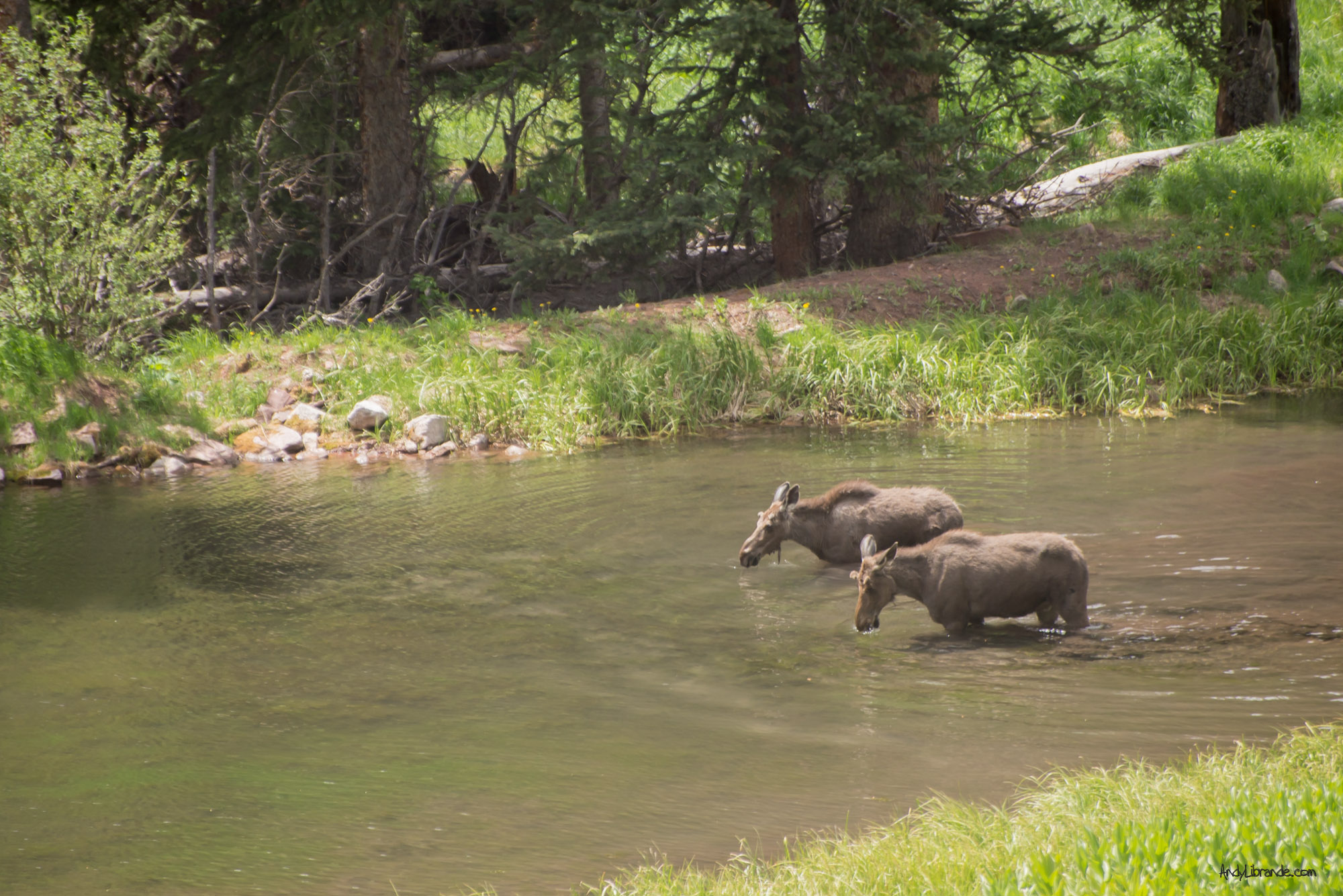
Some some moose on the drive in:
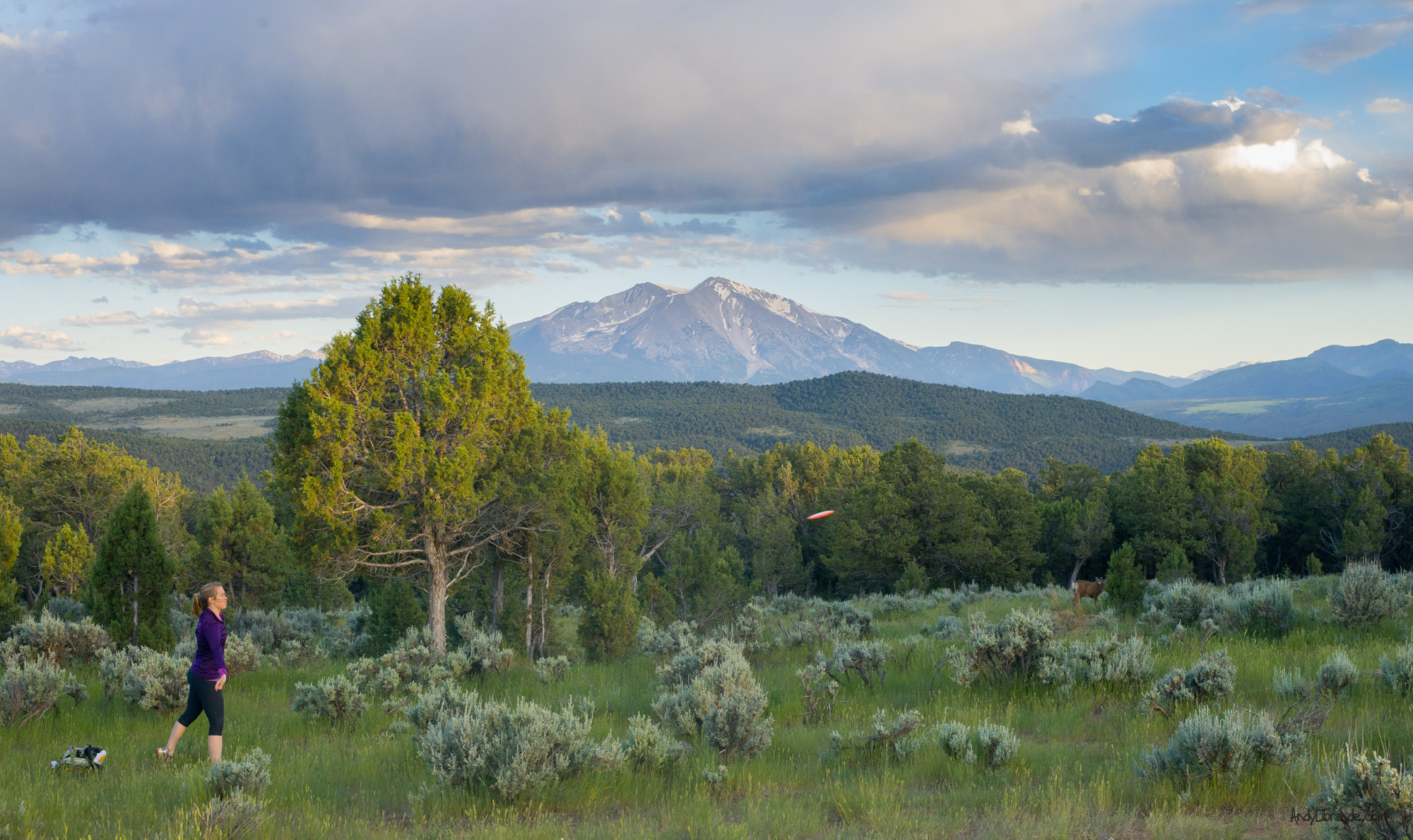
Afterwards we went back to the condo and watched the devastating ending to the USA vs. Germany match. Everyone started heading home, however Caitlin and I stopped in Carbondale to sample the Colorado Mountain College Disc Golf course. We are quite glad we did as the views were amazing (courtesy deer in the background):
Lots of fun stuff in a short period of time.


Recent Comments: