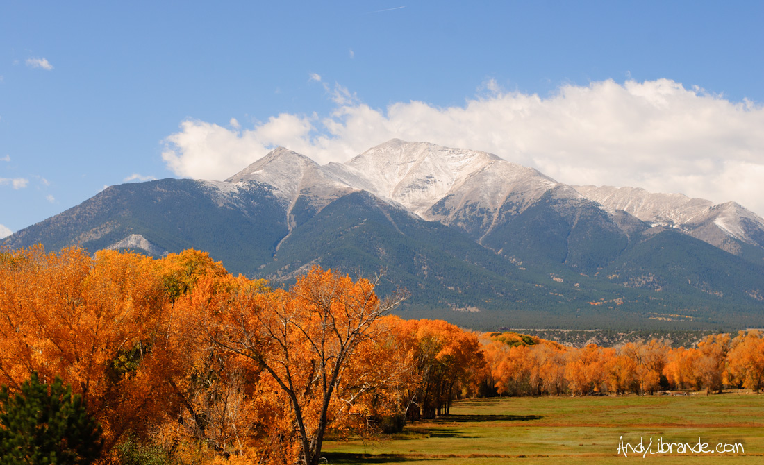
Quick Aspen Weekend
- Posted: September 24, 2014
- By: andylibrande
- In: Activity Categories, Camping, Colorado, Disc Golf, Location Categories, Rock, Southern Mountains
 0
0
Camping under the stars
Bouldering on Independence Pass
Hiking to the Base of the Maroon Bells
Disc Golfing at Colorado Mountain College in Carbondale
Caitlin and I packed a lot of activities into just a weekend. Below are the highlights.
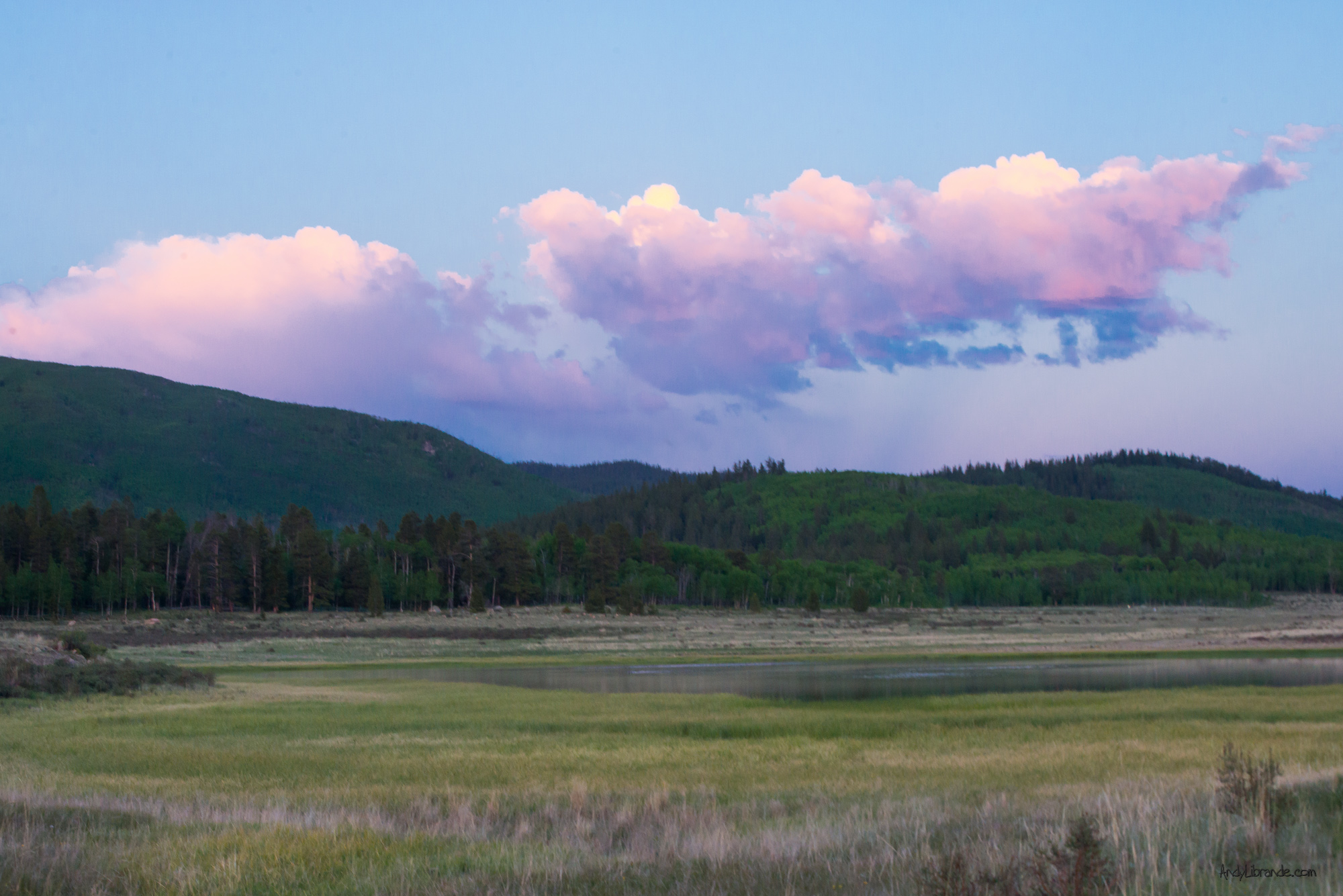
We left Denver late and hit Kenosha Pass right during a beautiful sunset:
On the way up we had a delicious late night dinner at Eddyline Brewery.
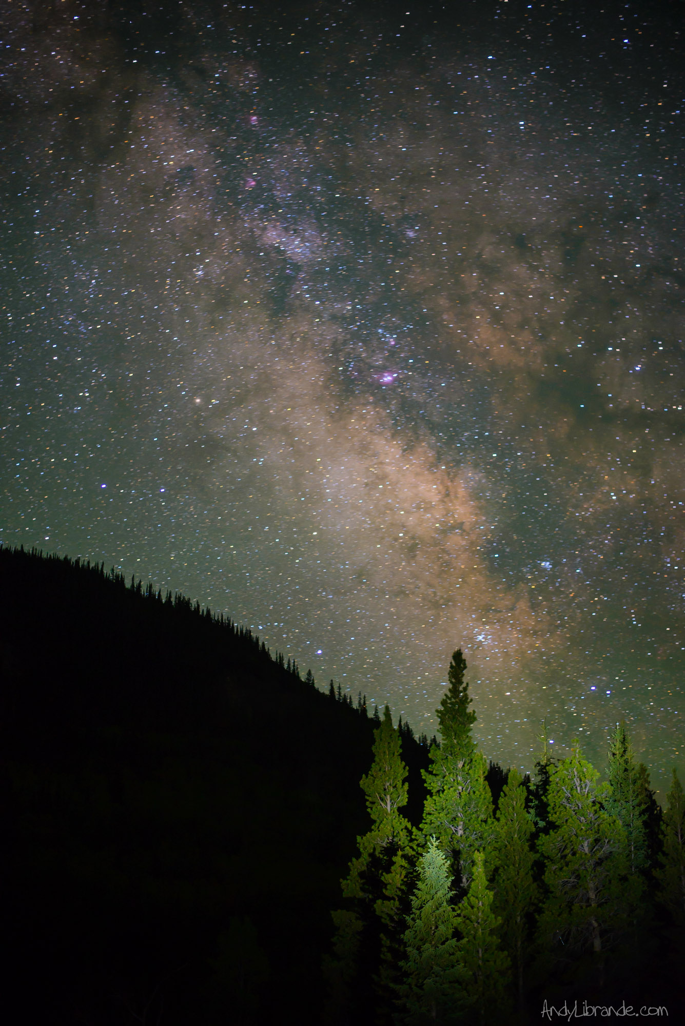
We were planning on camping in the truck so we drove up FS 390 which has a ton of car-camping options and plenty of others were already out there. It was late on a friday but eventually we found a perfect level spot for the truck.The stars were amazing that night and I spent quite some time photographing them and the Milky Way:
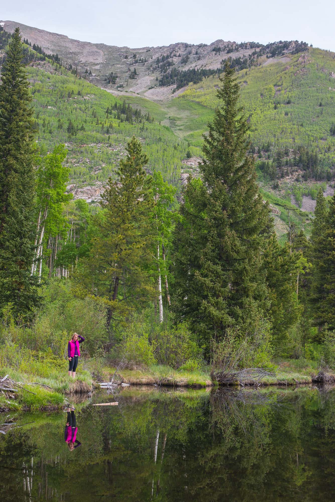
Beaver ponds by our campsite the next morning:
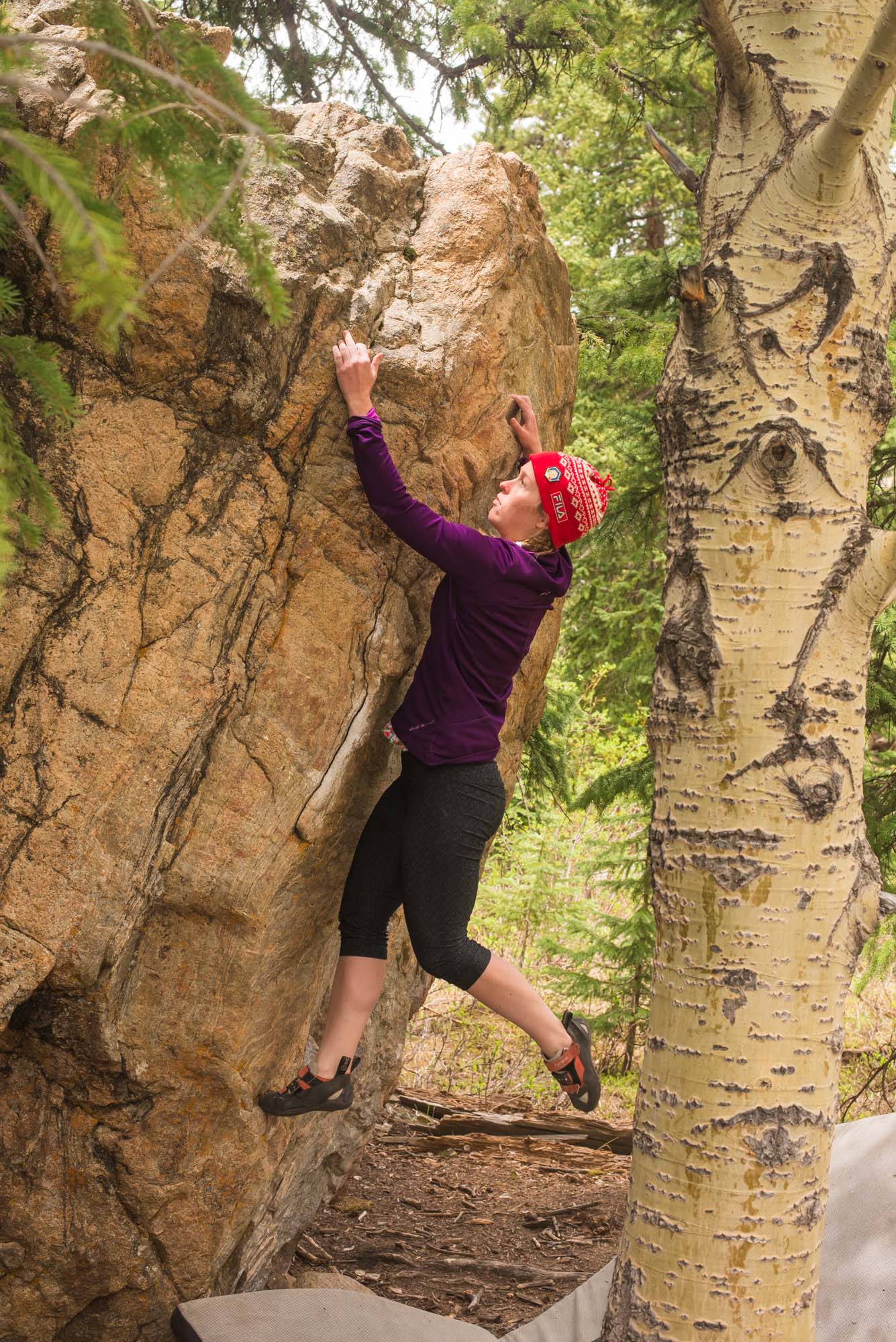
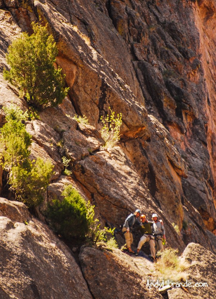
Next morning we got up and drove up and over independence pass stopping at a bouldering area which was perfect for a short session on some easier blocks. After climbing we headed into Snowmass where we met up with the rest of Caitlin’s family.
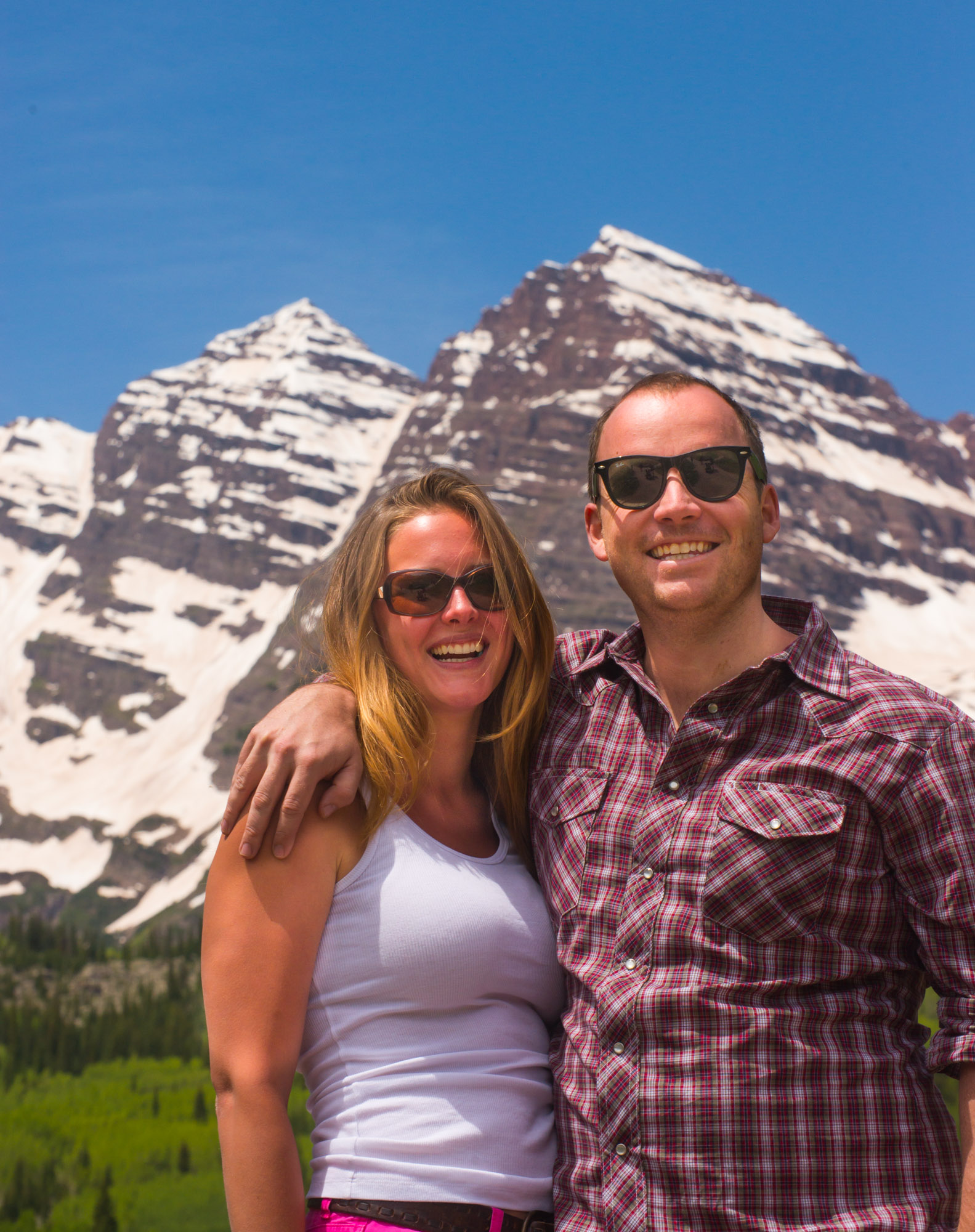
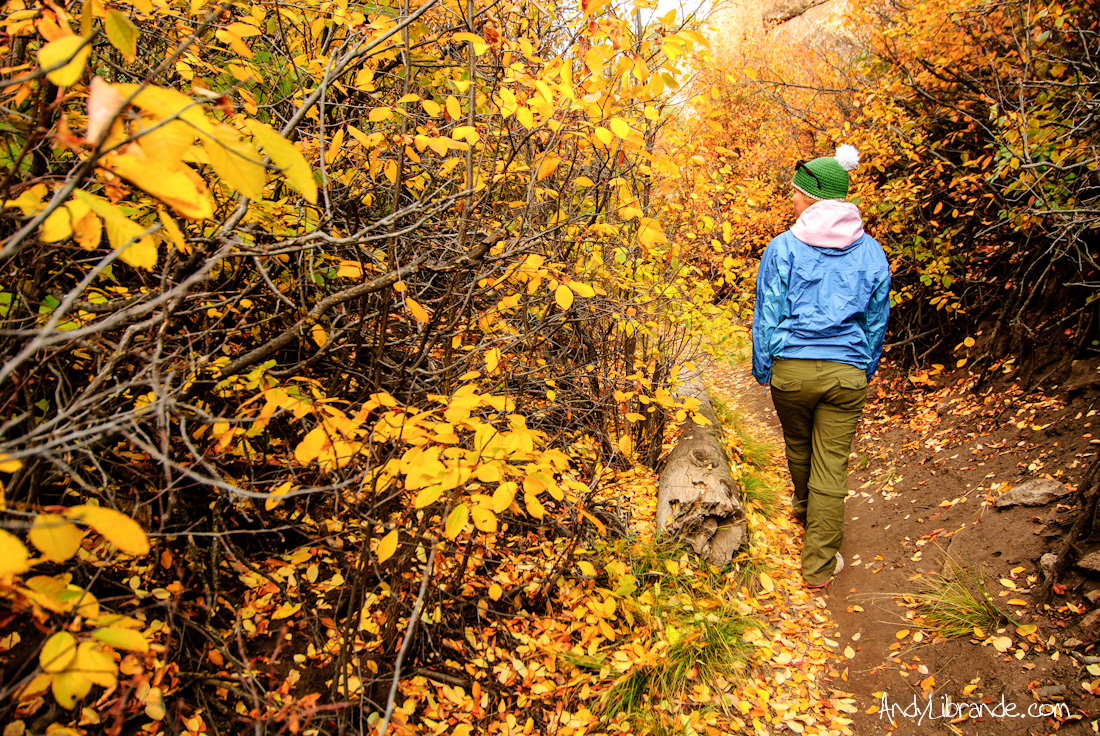
The next day we had a beautiful hike up in the Maroon Bells area. It was my first time in this specific spot as we normally tend to stay away from the tourist parts of Colorado. Glad we went up there as it was totally worth it.
We hiked all the way to Crater Lake (tons of snow for June 22nd!). Jon and Laura:
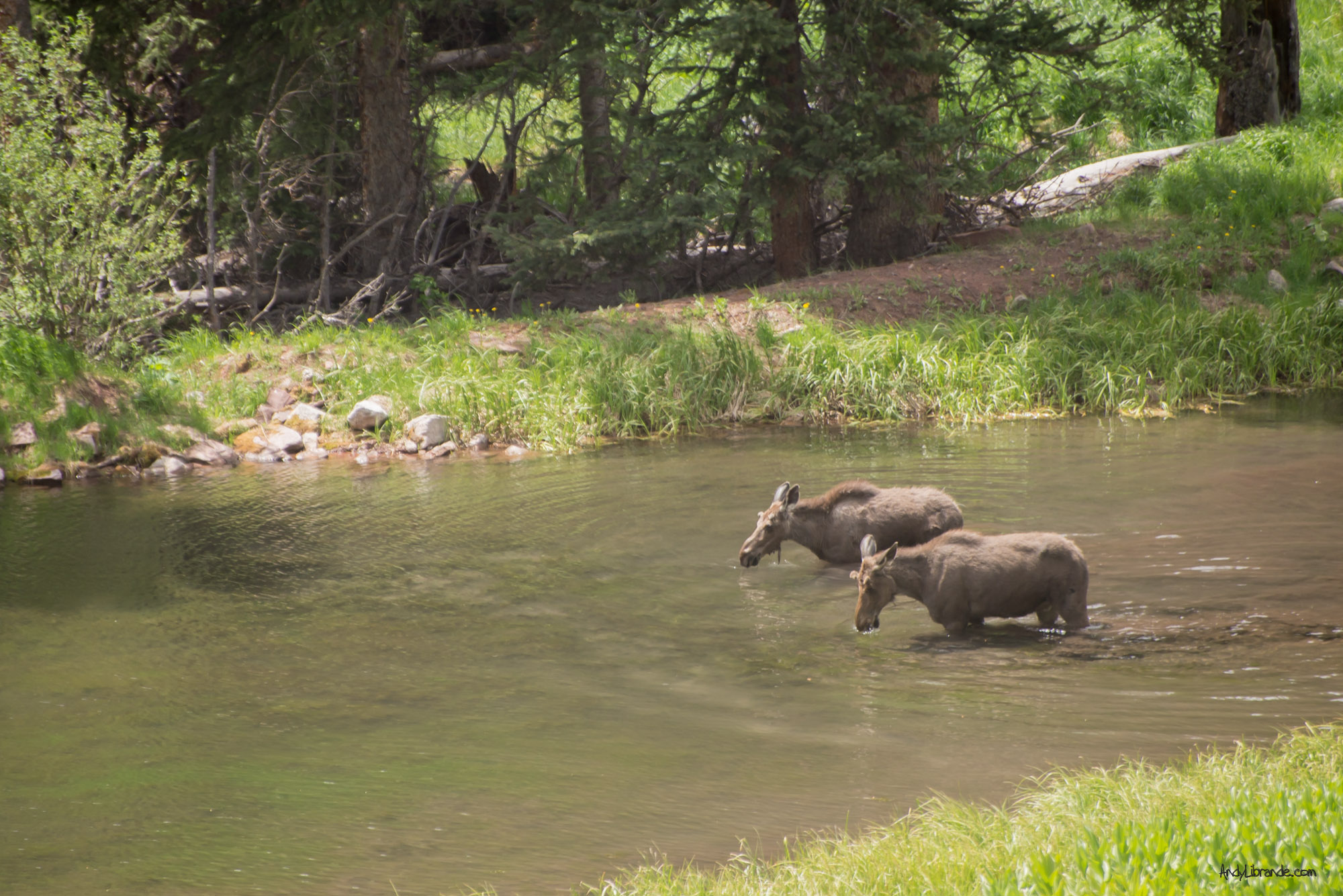
Some some moose on the drive in:
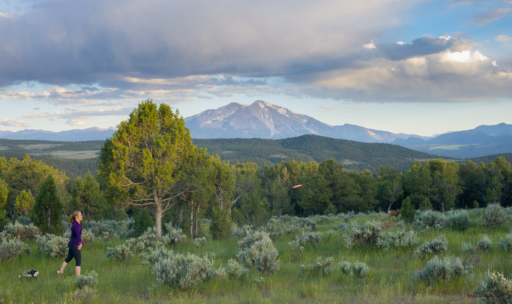
Afterwards we went back to the condo and watched the devastating ending to the USA vs. Germany match. Everyone started heading home, however Caitlin and I stopped in Carbondale to sample the Colorado Mountain College Disc Golf course. We are quite glad we did as the views were amazing (courtesy deer in the background):
Lots of fun stuff in a short period of time.
Chaco Canyon Roadtrip
- Posted: January 07, 2013
- By: andylibrande
- In: Activity Categories, Camping, Colorado, Location Categories, National Parks, New Mexico, Southern Mountains, Travel
- 1
Dates: October 5th thru 8th, 2012 (Friday thru Monday)
Who: Caitlin and I
Roadtrip (Link to Map of Route):
- Stop 1: Penitente Canyon, San Luis Valley, Colorado = Climbing and Camping
- Stop 2: CHACO CANYON, New Mexico = exploring ancient cultures, hiking, camping, mind-exploding
- Stop 3: San Juan Mountains, Durango, Colorado = camping, Aspen leaf watching, ass-freezing
Friday October 5th, Denver saw it’s first snowstorm of the 2012-2013 year as we woke-up to a solid 2 inches of fresh on our lawns and cars. While refreshing to see some of the white-stuff it was a clear sign of a quickly changing season and forced Caitlin and I to head-up to the mountains to experience the last of the Fall season.
Based on some really quick planning and weather watching we ended-up heading south towards the border (and into New Mexico) with several different stops with some unique experiences:
Stop #1: Penitente Canyon in the San Luis Valley, Colorado
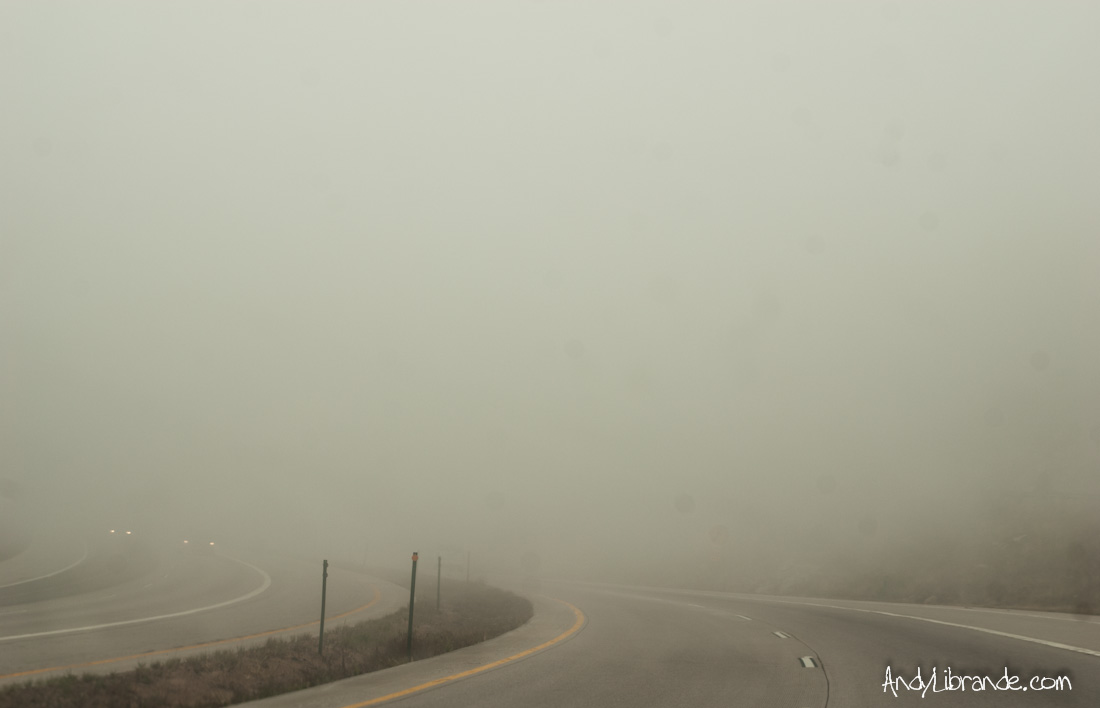
Friday afternoon we rolled into a nearly deserted campground at Penitente allowing us to be able to camp in one of the best spots. The drive in was pretty weird with Denver being ~35 degrees when we left, thick fog on HWY 285, and then clear-blue beautiful skies (plus~20 degrees warmer) once we hit Bailey; classic Colorado. Four hours later we find ourselves preparing to do some sport climbing in one of the most beautiful canyon’s in Colorado:
The weather was perfect (~70 degrees cooling down quickly), but we were able to get a couple routes in before the sun completely left the sky.
The next morning we had an incredible hike through the canyon along a trail I have never hiked. Starting off very cold, it warmed up nicely and the aspen’s back-dropped against the canyon was incredible.
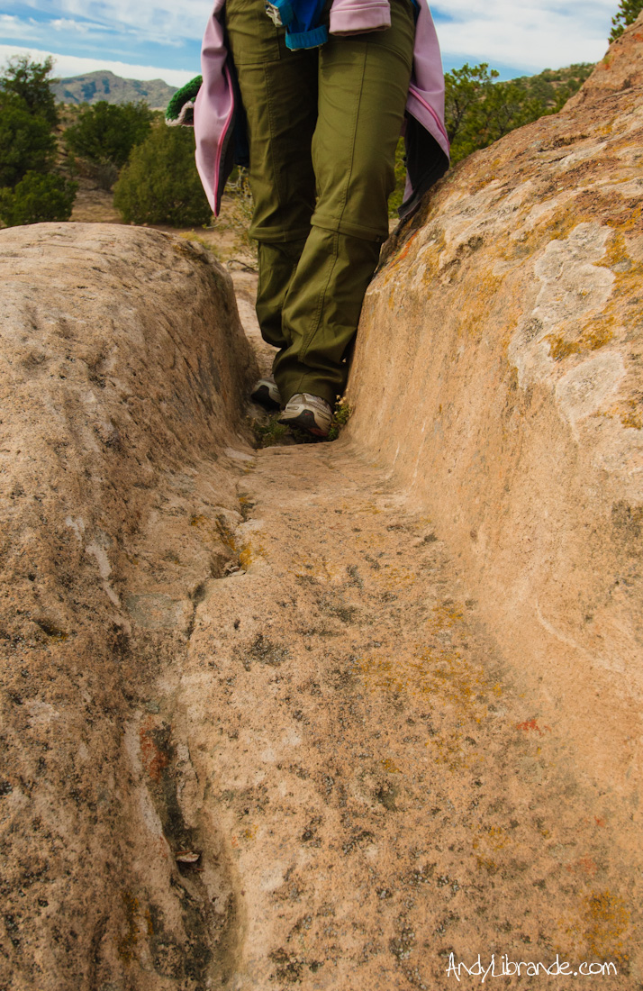
We also stumbled upon an old wagon-rut in the rock from when the early Mexican settlers would use an ox and a small wagon to haul wood out of the area to their homesteads and the size of the erosion was impressive (click for pic here).
On-wards to the next stop we happened to cross over Wolf Creek Pass which had perfect Aspen colors and is a pass that everyone must see at least once during the fall leaf-viewing season:
Stop #2: Chaco Culture National Historic Park, New Mexico
The ever-present shaking of the car, mixed with the dust and grit from driving down 21 miles of wash-boarded road was not helping lift our solemn spirits. At the turn-off to the canyon was an apparent “CAMPGROUND FULL” sign and we found ourselves in the middle of no-man’s-land, bumping down a dirt-road, trying to figure out what to do. After driving 4 hours already that day we decided that we were just going to push-on and confirm if the campground was actually full. Pulling-up to the campground host at 4:45pm on a Saturday (yes our timing wasn’t the best), our suspicions were confirmed that yes, those signs were correct, however, there was a group campsite that was open and as long as no-one reserved it in the next 15 mins we could share it with the other late-comers. The Chacoan gods presented some luck to us and we had a place to camp!!!
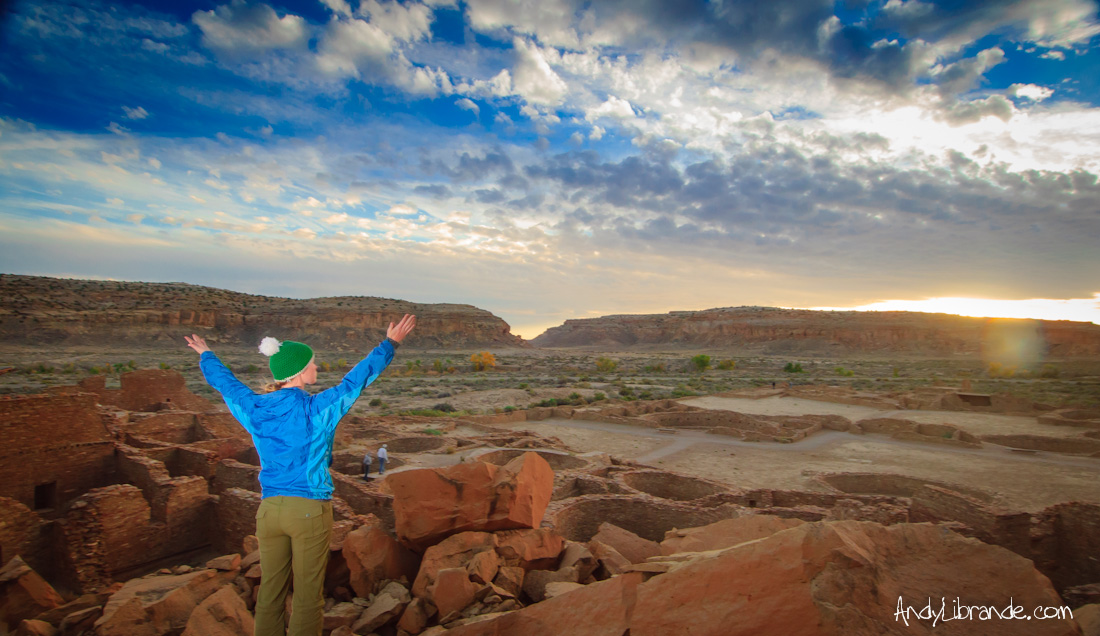
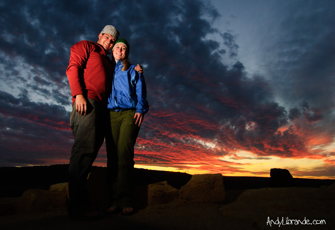
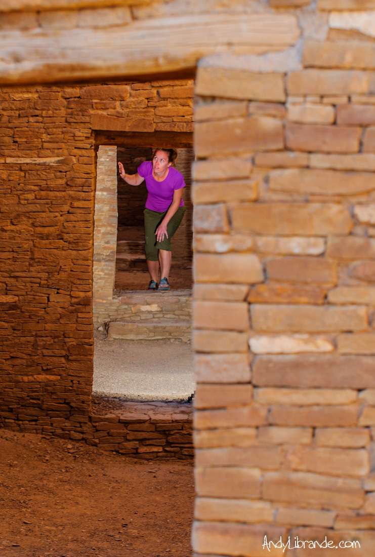
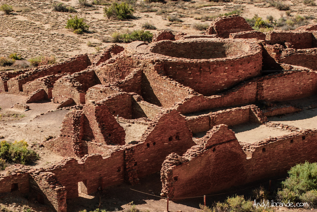
After claiming our tent-pad we rushed over to Pueblo Bonito to experience the sunset that was about to happen. Most people had already left the area leaving Caitlin and I to run-around and experience a powerful place under a powerful sunset. Caitlin summoning the gods over the massive 5 story building with 700+ rooms and 35 kivas, built over 1,000 years ago:
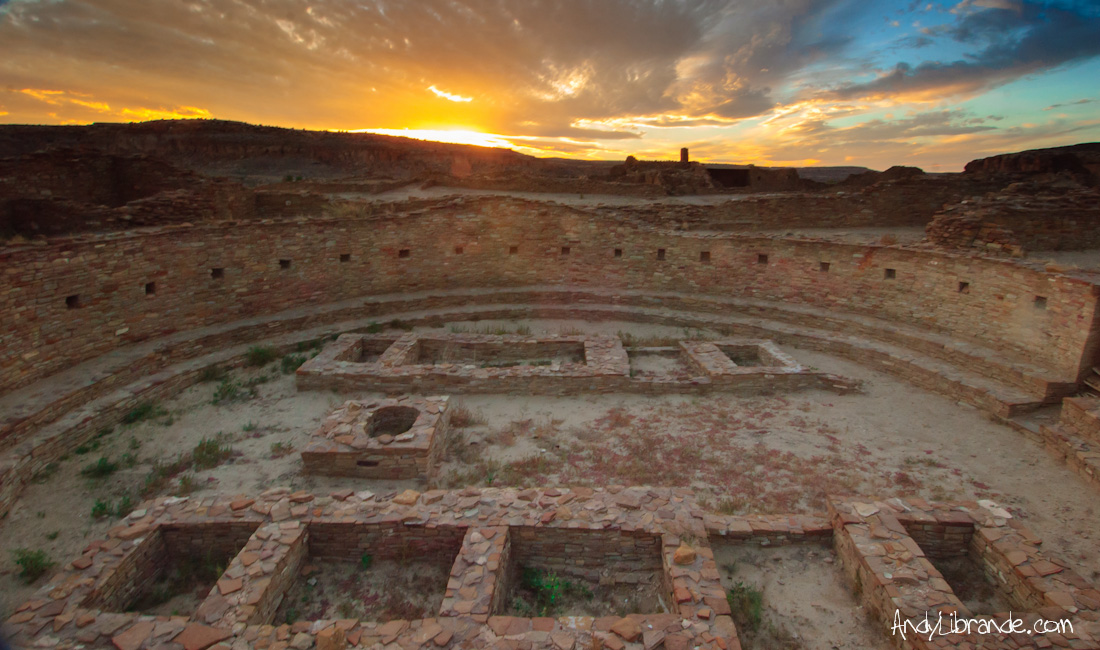
The Great Kiva at Pueblo Bonito:
Caitlin and I:
Timing was again on our side and that night we went to a incredible outdoor presentation provided by park ranger G.B. Cornucopia on the Chaco culture’s obsession with the sun, tracking time, and many of the numerous questions around the park. The complexity of this culture was beginning to be revealed to us and our jaw’s were on the floor the entire time.
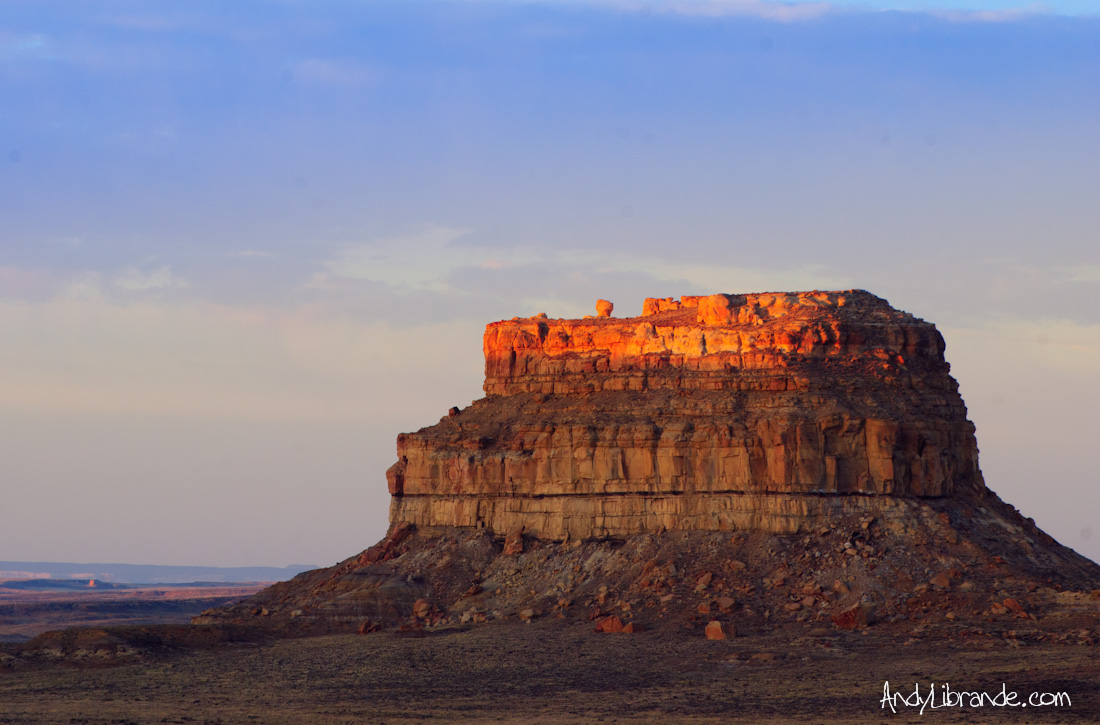
6:45am and the sunrise was just starting to push color into the clear skies and the entire campground was starting to rumble to life. We rushed-up to the nearest butte to experience the morning much like the Chacoan’s would have done everyday in their lives. Caitlin got really excited! Fajada Butte (a major ceremonial spot) under the morning glow:
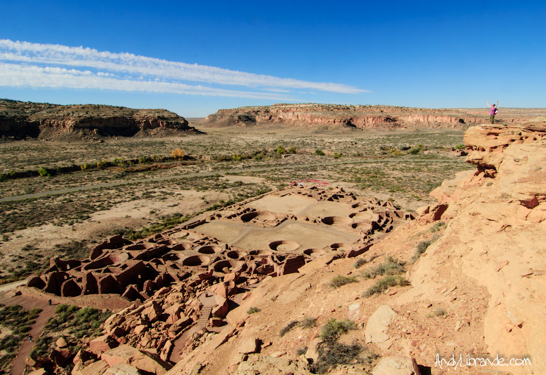
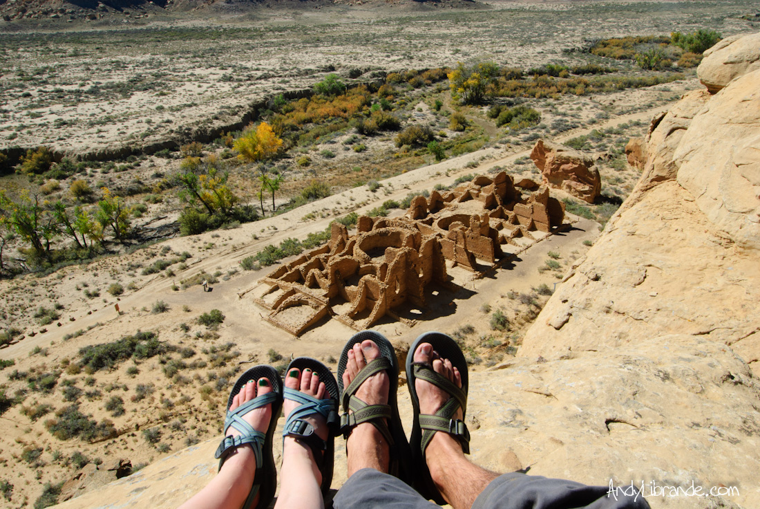
Our major adventure of the day was hiking to the overlook’s of Pueblo Bonito and Chetro Ketl. Viewing the sites from above provides a much needed perspective on the layout and the differences between the different sites and was by far the best views of the sites. Caitlin over Pueblo Bonito:
While on top we also visited the Pueblo Alto and New Alto sites:
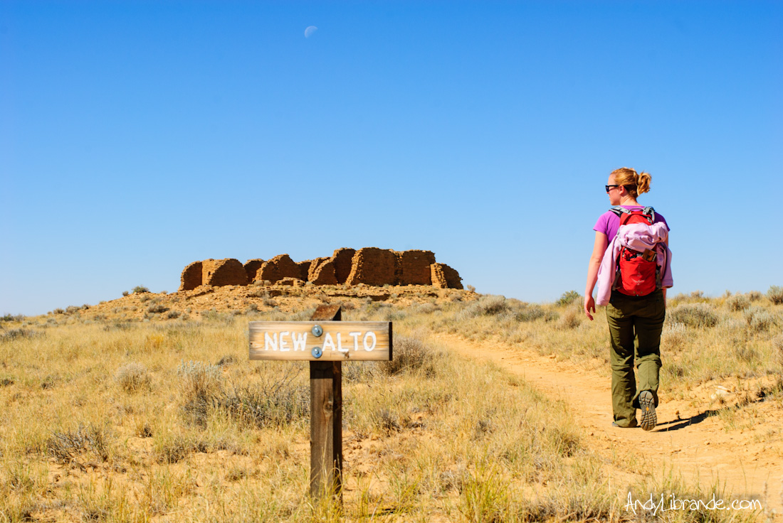
Nothing is more hip then wearing Chaco’s while hiking in Chaco Canyon.
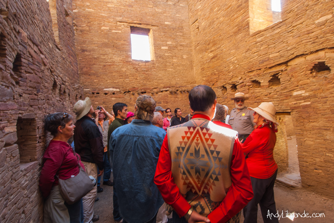
It was nearing 2pm and we rushed back over to Pueblo Bonito to have a walking tour lead by Park Ranger G.B. Cornucopia, who after 2 hours taught us more about the site and the different opinions on what it all meant then we could have ever hoped!!! Exploring the famous dark hallways of Pueblo Bonito:
We showed-up to this park with minimal knowledge of this culture and left being inspired to understand more about this unique place.
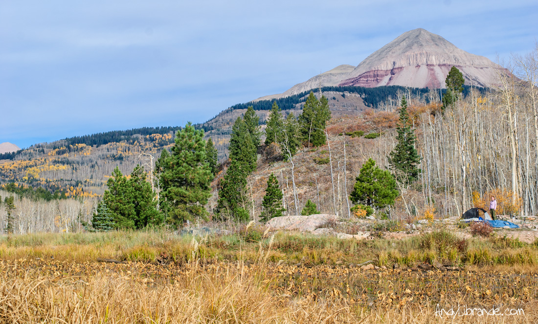
Stop #3: Lime Creek Road, Durango Colorado
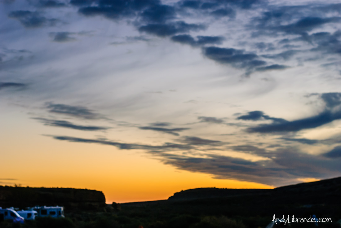
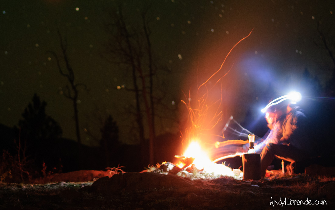
It was now 5 PM on Sunday as we pulled ourselves away from Chaco canyon. With barely more then an hour of sunlight left we headed north as fast as we could to Durango. Having minimal notes on where to car-camp, we bumped up a rocky-forest service road in the pitch-black until we came to an incredible site that had 360-degree’s of star viewing right next to a pond. We quickly built a campfire, cooked dinner, and enjoyed our last night of the trip.
It got extremely cold overnight, enough to start freezing water in certain spots, but the morning sun was a nice relief as we awoke to incredible views:
Driving home over Molas Pass to Silverton, over Red Mountain Pass to Ouray (with a quick stop at Mouse’s chocolates), back through Gunnison and over Monarch and Kenosha passes, we landed back in Denver satisfied with our last-minute, but incredible trip!
Hiking the SOB Gully
- Posted: August 20, 2012
- By: andylibrande
- In: Activity Categories, Camping, Colorado, Location Categories, National Parks, Southern Mountains
- 1
What: S.O.B. Gully of the Black Canyon of the Gunnison
When: 5/12/2012-5/13/2012
Why: It was the rare weekend where it was rainy and cold in Denver but extremely nice in parts of the mountains.
Time: 2 hrs down the gully and 2 hrs up. The downhill is a lot harder then what you would anticipate and in some instances it was easier coming-up then going down.
Painted Wall (2,250 ft of cliff !) at the Black Canyon of the Gunnison from the North Rim, 6:15am, Pink Sunrise:

It’s called the Son of a Bitch Gully for a reason: steep loose rock, man-eating poison ivy, constant ledge climbs, and 1,800 ft of vertical in just over 1.5 miles. Awesome hike down into the heart of one of the most wild canyon’s out there. Rambo navigating the poison ivy and loose rock of the SOB Draw (still a long way to go!):

Having visited the Black Canyon before (trip report here) and watching numerous rock climbing videos of the canyon, I was really excited to do something more then just peek over the rim. Caitlin and I decided to meet up with a group that was down there to climb and we were just going to do the hike. Rambo joined us for the descent and Vinny, Andrew M., and another one of their friends was climbing the Casual route that day as Rambo did Comic Relief the day before.

Hiking into the gut of the S.O.B. gully was hard and slow as the trail consists of loose rock and man-eating poison Ivy bushes. Caitlin more interested in route-finding and not slipping then taking photos (Painted wall in the background):

We arrived to the river just before the sun did and it was beautiful down there. Some really nice campsites sit along the river and that may have to be a future trip:

The three of us stoked about making it to the bottom of the SOB Gully, now just for the hike out:

Hiking out took as long as hiking down but was much easier as you were able to use your hands for balance:

Vinny, Andrew, and their friend several pitches up on the climb they were doing(upper left-hand corner) (close-up pic here):

As we hiked up further it kept getting hotter and we were glad that we started so early and experience the sunrise in such a massive and incredible canyon!
Zion Bryce Ouray Spring Break
- Posted: July 15, 2012
- By: andylibrande
- In: Activity Categories, Camping, Colorado, Location Categories, National Parks, Southern Mountains, Travel, Utah
- 2
Dates: Wednesday March 28th thru Sunday April 1st, 2012
Details of Travel: 1,500 driving miles!
- March 28th-March 30th: Zion National Park (highlights = Angel’s Landing at sunrise, Narrows hike in 44degree water, Hidden Canyon hike, our campsite outside of Zion)
- Night of March 30th: Camping outside Bryce Canyon at the mouth of Casto Canyon in Red Canyon BLM
- March 31st: Sunrise at Bryce Canyon National Park, drive thru highcountry of Southwest Utah
- April 1st: Rock climbing in Ouray with Rambo
Interactive Map of our Quick Journey:
View Zion Trip in a larger map
Mid-afternoon we finally pulled off of I-15 which was bustling and crazy compared to the almost relaxing I-70 section of the trip. Our first stop was to stretch our legs at the North Entrance of Zion National Park known as the Kolob Terrace. It was chilly, dark and dreary due to the storm that was still holding on overhead. The quick hike did not reveal much in the way of photos, however it was great to finally be at our destination.
Insider information always helps and we were pointed to a BLM camping area by my buddy before we left. Timing was on our side and we pulled into one of the best spots in the canyon. Darkness was settling in quickly and right before the sun disappeared it fell below the thick clouds and lit the area up in beautiful light. Here Caitlin takes in the views from our campsite at Smithsonian Butte BLM outside of Zion NP:

Luckily we ran into another couple around our age that had been in the park for the last few days and told us to get up early to get on Angel’s Landing before the normal tourist shit-show happens. An early next-day was planned.
Angel’s Landing: 1,500 vertical ft, ~5 miles RT, ~1:40 to the top
Our first foray into the main canyon was well before the first sunlight and before the park rangers had taken their posts. Quick glimpses of turkey’s and deer were had as we pulled into the trailhead. We were the first to the trailhead that day as we pulled in just before 7:00am, however two other small groups pulled up right behind us and started off before we could get our packs ready. Luckily we did not see them or anyone else for quite some time.
We quickly gained Scout’s Landing where we were greeted with our first sunlight of the day. At this point we passed one of the groups and started-up one of the best hikes I have ever done. The exposure was great and made the relativity simple hiking that much more exciting. Caitlin with the sun just starting to illuminate Angel’s Landing in front of us, 8:30am almost to the top:

We reached the top where we ran into the only person that was in front of us. She was already on her way down and we were left in complete solitary to enjoy a true wonder. Looking back on the hike from the top of Angel’s Landing (the trail runs along the illuminated ridge on the left w/ huge exposure on both sides):

45 mins of complete solitude on top of the world! One can understand where the name Angel’s Landing comes from as we sat watching the sun creep further down the enormous sandstone walls while listening to the sounds of the river and the occasional sound from the wild-turkeys below nearly 1,500 feet below. Once other people showed-up the vibe changed quickly and we headed down. Hiking down was just as exciting as going up:


Back at Scout’s landing we took our time and explored around. We spotted one of the massive California Condor’s that was hanging out watching the crowds on the route (when hiking Angel’s landing in the morning he scared us when he buzzed us once coming around a cliff feature):

Back down to the trailhead we cooked some lunch in the park and planned our next excursion.
Hidden Canyon and Weeping Canyon
We were in the hiking mood and an additional 700 vertical foot climb to the mouth of Hidden Canyon took us into another magical place. Hiking the nice sandy trail we scrambled around this incredible canyon for a couple hours until we finally reached a logical turning point. The hike back down was much quicker since we had already figured out the route around the tough sections.

At the entrance to the canyon were some awesome overhangs. Here Caitlin is getting a feel for ~650 ft of sheer cliff (trail below is the switchbacks for the East Rim/Hidden Canyon and Weeping Rock is in the upper LH side):

Weeping Rock was the last on our list of the day and we spent some time watching the crazy wonders of the desert before heading back to our campsite to watch the sunset (photo link!).
Narrow’s Canyon Hike: 110 CFS, 44 degree water, 75 degree air temp highs, random old-friend encounters
The water was cold and we rented drysuits from the http://www.zionadventures.com/ which had a nice set-up and totally worth every penny that we spent with them. Started the hike late (somewhat intentional due to the cool morning temps). Caitlin hiking through the golden glow of the afternoon light:

We fought our way up the river as the flow was high and strong. This turned out to be the hardest hike of the trip and the rewards were well worth it. Myself and Caitlin enjoying the river:

The world is truly a small place! After hiking for a short-bit another couple was gaining on us and eventually they caught-up and it turned out being my friend Drew and his wife Carrie, whom I originally met in the DU Alpine Club and had not seen in a number of years. Awesome to hike with them for a while and catch-up. Drew, Carrie, Caitlin and Andy photo deep in the canyon:

The river was flowing very heavy at 110 CFS that day and they closed down the canyon the next day as the flows got above 120 CFS. Timing was on our side and we got to experience quite the hike.
Bryce Canyon, Red Canyon BLM and Southwest Utah:
We ate Dinner with Drew and Carrie and did not hit the road to Bryce canyon until dusk. With some very loose ideas of places to camp just outside of Red Canyon we drove up some BLM road and found a place to lay our heads for the night. Night-time photos over Castro Canyon (and a ghost self-portrait):

Another early morning and we arrived to Bryce Canyon where our jaws promptly dropped:

Again there was very few people around which was surprising considering it was a Saturday morning in a park famous for sunrises. Caitlin dancing with the trees of Bryce Canyon:

We did a short hike in chacos and wool socks which was nice to stretch out after the previous two grueling days.

You don’t need to spend much time here as it is relatively small so it was perfect for a nice morning excursion before grabbing lunch at the lodge and then taking the long journey all the way to Ouray, Colorado.
The route through the desert between Bryce Canyon and Hanksville, UT was really quite cool. Some amazing vistas in a place that I had no prior knowledge on (not to mention you drive thru MTN passes at ~10,000 ft, Escalante, Capitol Reef NP, Lake Powell, Cone Mtn, Henry Mountains, etc).
A late arrival in Ouray and we crashed at RAMBO‘s house. The next day we hit up some climbing just outside of town at a place called Colby’s Corner which had some nice routes and expansive views of Sneffel’s and Cimarron peaks. A nice dip in the hot springs plus a Mouse’s Chocolate shake and we were recovered from the hikes and ready to head home!
Looking back in the rear-view mirror of the awesomeness of this part of the world:

Amazing trip!
Perma-Link here: http://andylibrande.com/news/2012/07/zion-bryce-ouray-spring-break/
Ouray Ice Festival 2012
- Posted: April 30, 2012
- By: andylibrande
- In: Activity Categories, Colorado, Location Categories, Rock, Snow, Southern Mountains
- 0
Who: Vinny E., Andrew M., and Myself meeting up with RAMBO
Where: Ouray Colorado
When: Jan 6th-8th, 2012
Last minute Vinny rounded me up and we headed down to Ouray to ice-climb and stay at Rambo’s house who has been living there for the past year doing AmeriCorps for the Uncompahgre Watershed Partnership. We left Denver after work and had a nice night drive all the way to Rambo’s awesome house.
The next morning we geared-up, checked out the Ice Festival and then headed to the New Funtier area. The Ice Festival was way cooler then we were expecting as they have a bunch of free gear demos and clinics; I demo’d a new harness since mine is getting old. Andrew leading the first route of the day:

Lots of people were out that day and with the Ice in the river not being very solid we saw a lot of people punch through. At one point Rambo had to pull some foreigner out of the river (nipples deep) and convince him that he needed to go back down the valley. Vinny leading another one:

The snow picked up quite a bit towards the end of the day. Here is just one of the many climbers in the area that day:

That night we cooked dinner, hit up the hot springs and were hanging out when a huge snowstorm blew through town dumping 6-8 inches in less then two hours. So naturally we decided to tie a rope to a car and pull each other through the side-roads of Ouray at midnight. Rambo’s shit-eating grin just gives an idea of how awesome this was:

Next morning was glorious!
We climbed right at the main competition area the next day right below the main (upper) bridge. Lots of people from all over the place.

Mt Sherman on the drive out:

Always a good time in Ouray!
Independence Pass Bouldering and Camping
- Posted: September 28, 2011
- By: andylibrande
- In: Camping, Rock, Southern Mountains
- 0
When: August 5th-7th, 2011
Where: Independence Pass, Colorado
Caitlin and I took off after work on a Friday to head-up to Independence Pass between Aspen and Leadville. The idea was to check out the bouldering that is all over the area, enjoy the sights, and escape the heat of Denver. We rolled in after dark and after taking Caitlin’s volvo for a little 4-wheelin’ action :-), somehow found free camping up Lincoln Creek road.
After sleeping like logs in the crisp night air (the denver heat was not making sleep easy), we awoke to a beautiful day. Amazingly our friend Terra happened to drive by our campsite as we were getting ready to leave for the day…small world.
Saturday we hit up the James Brown Boulders which we had a little difficulty locating as we were one pull-off too soon. Once we found these great boulders in the shade it was a nice day of trying a number of problems and enjoying the crisp air.
Caitlin working one of the tricky easier problems near the James Brown Boulder (notice the grassy top-out):

Me on the James Brown Boulder (awesome block):

We headed-up to the pass for some sunset viewage. Here is Caitlin showing-off:

Beautiful last chunks of light:

Small pond right next to the road right as the sun disappeared:

The craziest thing happened when we were back at camp and done cooking dinner. We were just sitting there pondering the night sky when a huge tree came crashing down in the forest behind us…scared the living crap out of us and it was pitch black and impossible to investigate. No idea why or how it fell but it was a crazy event that was a little unnerving.
Sunday morning cooking some breakfast:

Playing in the Grottoes:

Cool waterfall formation:

It was 100 degrees when we rolled back in Denver…nice to enjoy some cool weather and experience an awesome place!
Link to blog posting: http://andylibrande.com/news/2011/09/independence-pass-bouldering-and-camping/
Crested Butte Spring in June
- Posted: July 31, 2011
- By: andylibrande
- In: Camping, Southern Mountains
- 0
Who: Caitlin, her sister Lizzy, my sister Lizard, and myself. (Me + 3 women!?!)
When: June 11th-12th
What: A quick overnight camping trip
Randomly both my parents and Caitlin’s parents did the Ride the Rockies tour this year (~400 miles over 6 days on a road bike!) which made for a convenient excuse to drive them to Crested Butte to drop them off.
Caitlin and I thought it would be fun to drop off each of the parental units and then spend a night camping with our sister’s and enjoy the awesomeness that is Crested Butte.

Arriving in the early afternoon on Saturday we stopped for a delicious lunch at the Brick Oven in downtown Crested Butte which has a surprising great selection of beer. After gorging ourselves on a meatball, pepperoni, and pesto pizza my sister and I parted ways with our parents and headed out to Gothic to check out Stupid Falls.
Stupid Falls is a massive waterfall that is really easy to get to (essentially you turn right after the first bridge on the approach to Gothic and drive down the dirt road until you see a large point in the shape of the river). It was running at 2,300 CFS and was just massive.
Here is video of the falls along with a few photos:
Sister in awe at the power of the waterfall:

We finally met-up with Caitlin and her Sister and found a campsite along County RD 734 where the snowline was not much above the campsite.
Long exposure of the valley that night (~5mins long):

The valley was a contradiction of seasons with spring time at it’s fullest in the valley with mid-winter snowpack on the mountains:

We tried to hike near the Ol Be Joyful waterfall however the trail was closed due to a massive river crossing. Instead we went to a trail near Gothic on the Judd Falls trailhead into the Maroon Bell wilderness. Caitlin and I have done this hike before and we knew that it would be good for the sisters.
The girls with Mount Crested Butte (the ski area) in the background:

Lizard hugging a massive Aspen tree:

Black Bear Track right in front of the wilderness sign:

Sister with Spider Peak in the background:

Super green:

Link to full post here: http://andylibrande.com/news/2011/07/crested-butte-spring-in-june/
Ice-Ice-Baby…
- Posted: March 28, 2011
- By: andylibrande
- In: Colorado, Rock, Snow, Southern Mountains
- 0
What: Ice Climbing in Ouray Colorado
When: Feb 11th-13th, 2011
Who: Andrew G, Hoof-Cakes, Caitlin, Brain G, Myself, meeting up with Vinny, Sarah, Andrew M, and some other dude’s whose names I haphazardly forgotten…yeah we had a crew.
Reasons why Ice-Climbing in Ouray is the shizzle:
- Gear: Nothing like playing with sharp-pointy Ice Axes all day
- Technique: The better at hitting/kicking you are the more fun you will have
- Location: Comparing Ouray to the rest of Colorado is like comparing a Salema Hayek to Rosie O’Donnell
- Ice Park: Huge area, easy access, plenty of climbs and beautiful things to look at. I am always impressed when I visit here. Plus you walk from the Motel to the ice-park.
- Ice: Unreal formations everywhere.
- Food: Classic Mexican at Buen Tiempo and a new favorite at Mouse’s Chocolates
- Hot Tub at the Victorian Inn: Best views from any hot-tub I have ever gotten drunk in (here is an idea picture)
- Not Driving on I-70: Well technically you can get here via I-70 but why would anyone want to drive on that road. Instead we enjoyed ~5.5 hours of scenic roadways and saw a incredible sunset over Monarch Pass
Yes. I was pleasantly surprised with how awesome our trip to Ouray turned-out. First off Ouray seems like a little bump in the road on the way to bigger and better things (ie Silverton, Durango, etc); however you only appreciate this town when you have spent some time here.
This is my third Ice adventure to this town with the previous two being on commercially guided trips with the DU Alpine Club back in college. Those were a lot of fun but this time was able to piggy-back on some friends with a bunch of Ice-climbing equipment and were able to explore on our own.
First day was spent at the New Funtier Area. Good area that has a number of concentrated climbs in a narrow canyon.
Vinny leading up some thin ice:

Whitney posing for the camera:

Andrew G. showing us how it is done on a sketchy pillar at the end of the day:

The second day we headed to the excellent South Park area which is much further in the canyon, however the actually area is in a wide-section of the river and makes for a nice place to hang-out and watch climbs.
Amazingly a Bighorn Sheep crossed under the canyon when we were setting-up the climbs. They hung out above us all day too:

Caitlin after cruising through the tough part:

Brian making his mom proud:

Andrew M. doing some leading on beautiful ice:

Andy L. (myself) up on the right with Vinny quickly catching-up:

Solid Trip!
For the original post please visit: http://andylibrande.com/news/2011/03/ice-ice-baby/
Snow Preview
- Posted: February 28, 2011
- By: andylibrande
- In: Colorado, Random, Snow, Southern Mountains, Summit County/I-70 Area
- 0
Updates have been slow as I have been trying to fix my main computer over the last month or so…luckily I am getting close!!!
This doesn’t mean it hasn’t been a hell of a busy winter. Plenty of days out riding great snow, ice-climbing, and other shenanigans has made the time go by quick.
Here is some eye candy to hold you over:
Ice-Climbing in Ouray (only a little pretty):

Caitlin in the side-country at A-Basin:

More to come….
Great Sand Dunes Party!?!
- Posted: September 23, 2010
- By: andylibrande
- In: Camping, Colorado, National Parks, Southern Mountains, Travel
- 0
Where: Great Sand Dunes National Park
When: June 11-13, 2010
Who: Myself, Caitlin, meeting up with Trent, Bethany, Duncan, Cara, Dan, plus the dogs.
So this recap is a little late considering it is now September and this happened back in June. But I couldn’t leave out this trip from the records because it was ridiculous. Let’s start at the beginning and all the photos will be in chronological order just for sake of ease.
We all convened in the Pinyon Flats Campground Friday night on a relatively quick drive from Denver. It is Bethany’s B-day weekend but we were able to reserve only one campground that can’t have more then two tents and two cars; we were not about to let “the man” hold us down so we set-up camp under a beautiful clear night sky with 4 tents and 4 cars (as we were traveling from all over the state). Spirits were high that night we were excited for a awesome weekend on the dunes filled with glorious adventures and abundant amounts of fun. Let’s just say everything changed quickly…
About 2-3am was when we encountered our first challenge: insane winds!!!! We are in the sand dunes so that means where there is wind there is also flying sand; this is not just a little sand, but epic amounts of fine grain sand getting into every little crevice that it could find. Sleep quickly became a luxury as the wind and sand combo was blowing up tiny particles of sand underneath the rain fly and dropping down on us in the tent; it was literally raining sand.
Morning dawns…kinda. It’s cloudy, it’s windy, it’s kinda raining, we are sleep-deprived and it is really early so we do what any logical human being would do in that situation: drink. Out comes the Jack Daniels which we enjoyed alongside numerous fresh cherries and other breakfast goodies; let’s just say each one of us was focused on this activity with Olympic-like intensity.
Several hours later we decide it is time to go do something (not before we had a run-in with vigilante park ranger about the tent situation even though our tents combined took up less space then the tent cities some of the other campers had). We head over the the incredibly busy visitors center (cold, wind and tourons do not mix), which was fun because well, we were intoxicated. Then it was off to suffer on the dunes:
Hiking in wasn’t too bad, a little chilly and a lot windy:

Trent Catching some Air:

The others turned around because they have the dogs and the sand was really messing with their eyes, however Duncan, Caitlin and I keep venturing further. Bad idea as the wind was to out backs but hiking out the wind was in our faces . Right before we decide to turn around:

Luckily the group found an awesome out of wind bank along the river. Some of us caught up on the sleep we were missing:

The low-hanging cloud on the right is part of a small fire that was happening just miles from the campground:

After catching up on sleep (and starting our afternoon hang-over from all the morning drinking) we thought we would get out of the wind and sand and headed to Zapata Falls. Nice little short walk to some freezing cold water (in the deep canyon part ice was still lining the walls). Duncan trying not to fall:

The evening gave us some nice light and you can see how crazy the wind was:

Next morning we awoke to beautiful skies, no wind, and perfect temps. It was such a radical change it was hard to realize that it was the same place. Trent, Bethany, Caitlin and I all found a quite area away from other people and played in the creek, tried some sand-boarding, and just enjoyed the sun:


On the way out Caitlin and I took the scenic route up the San Luis valley eventually hitting up 285 for the ride home. While we were dealing with wind and a little rain in the sand dunes, the I-70 corridor was hit with a very late season snow-storm (most of the snow had already melted off of the peaks and we were sure glad we weren’t camping in that):

Now I can finally say I have been to the sand-dunes (even if I am still scraping sand out of my eyes 3 mos later)!


Recent Comments: