Backpacking the Cirque of Towers in the Wind River Range
- Posted: December 15, 2013
- By: andylibrande
- In: Activity Categories, Backpacking, Location Categories, Wyoming
 0
0
Dates: July 4th-7th, 2013 (extended 4th of July weekend!)
Who: Caitlin and Andy
Where: Wind River Range Wyoming: Sandy Opening Trailhead
Trip Synopsis:
- Day 1: Drive to Trailhead, arrive at 6pm, furiously backpack 6 miles into Big Sandy Lake before sunset
- Day 2: Backpack over Jackass pass (~3.5 miles) into the Cirque of the Towers, explore the area
- Day 3: Backpack over Texas Pass (no official trails), down into the next valley (~6 miles)
- Day 4: Backpack back to the trailhead completing the loop (only 1/2 mile of duplicate trail!), ~9 miles of rolling alpine meadows. Drive home, stop at Farson for ice-cream, get back to Denver at 10pm.
Google Map Link
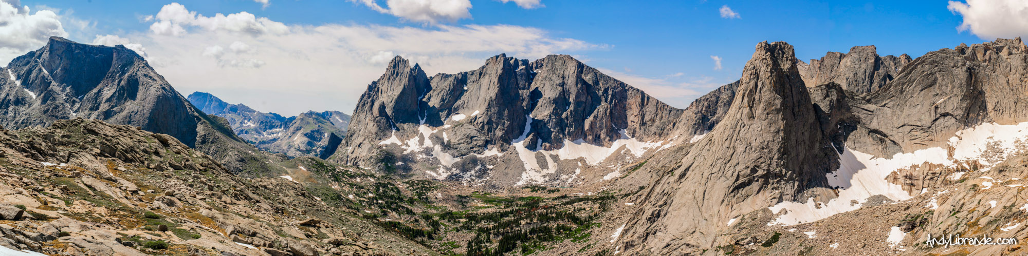
Cirque of the Towers Panoramic as viewed from Texas Pass:
DAY #1:
Six hours of driving through the desolate Wyoming plains and you begin to wonder if these mountains are just some sort of myth, or potentially a trap to lure unsuspecting tourists into the abandoned sections of Wyoming. But, alas…eventually this dirt road turns into rolling hills and glimpses of large granite peaks begin to surface.
The Big Sandy Trail head was full of cars and we had an late arrival and an ambitious goal ahead. Our late arrival at the trail head was partially due to 4th of July celebrations the night before resulting in us not being fully packed until the morning of departure. Once we finally arrived, we threw our packs on, and furiously hiked the gradual steeping trail arriving at Big Sandy Lake just as sunset provided us a colorful evening.
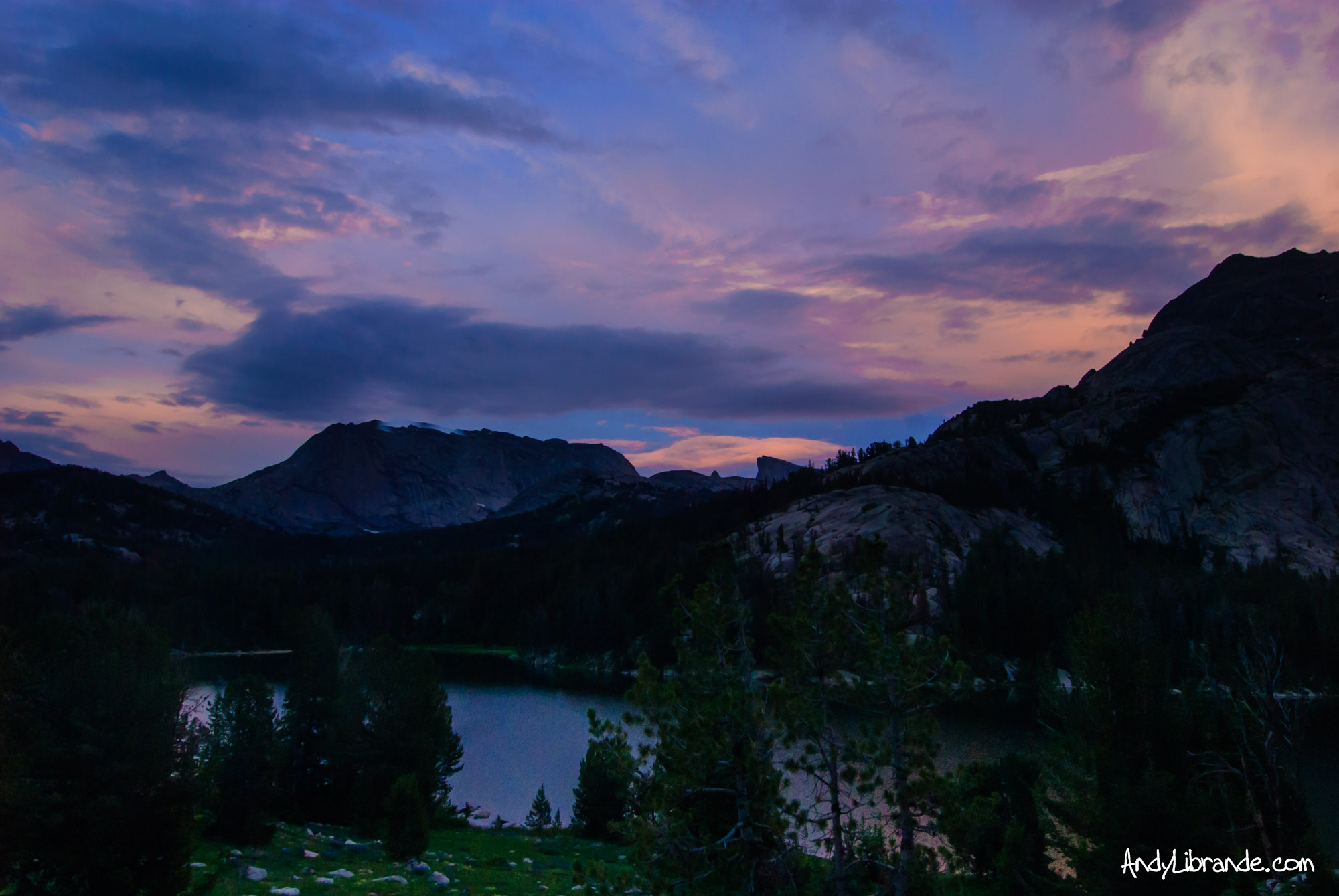
Caitlin typically spends the 4th of July at Big Sandy lake in Minnesota, so she was glad that we made it to this Big Sandy Lake before this year’s 4th of July ended.
Big Sandy Lake with a Purple Sunset on our 1st Night:
DAY #2:
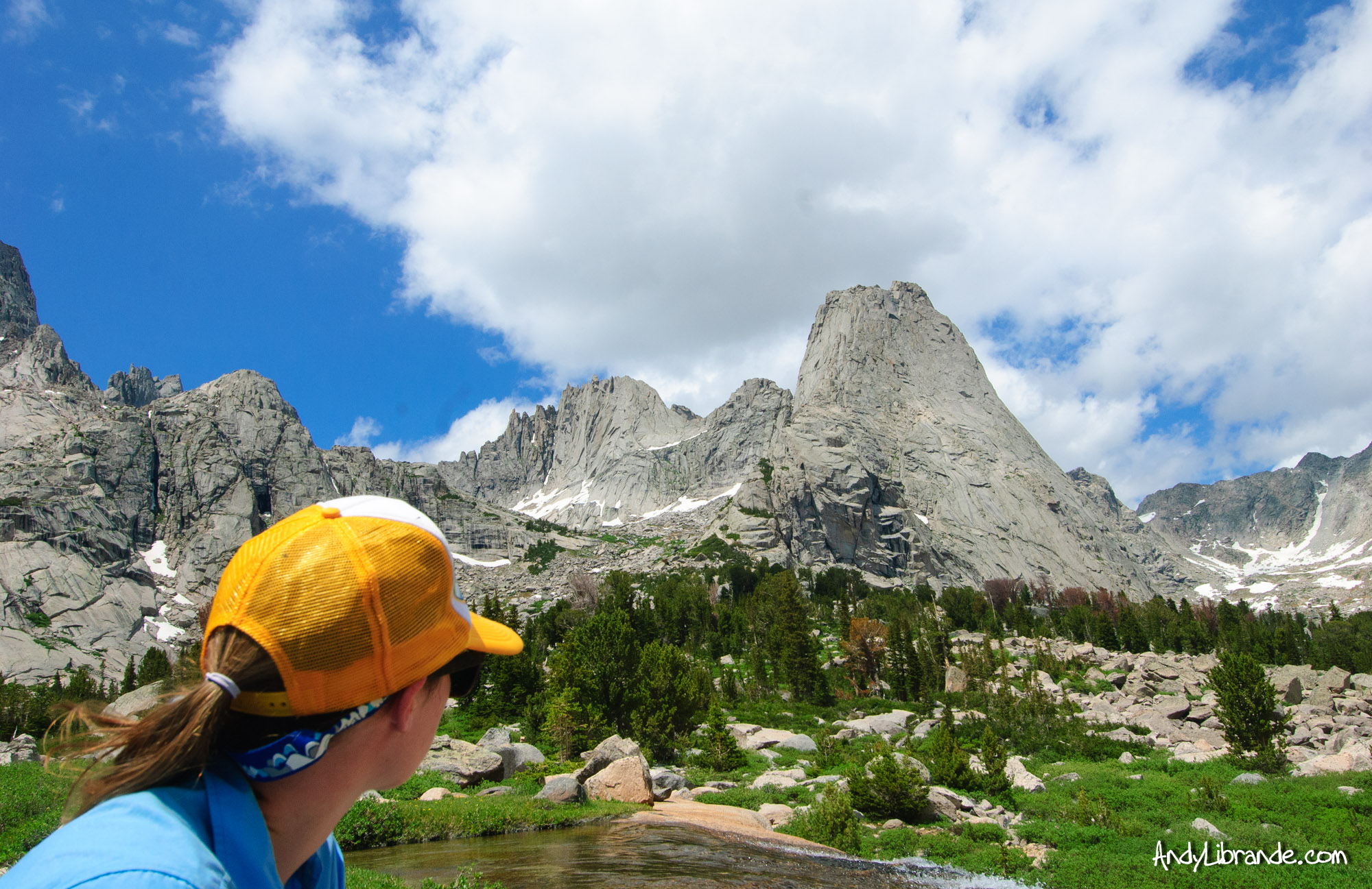
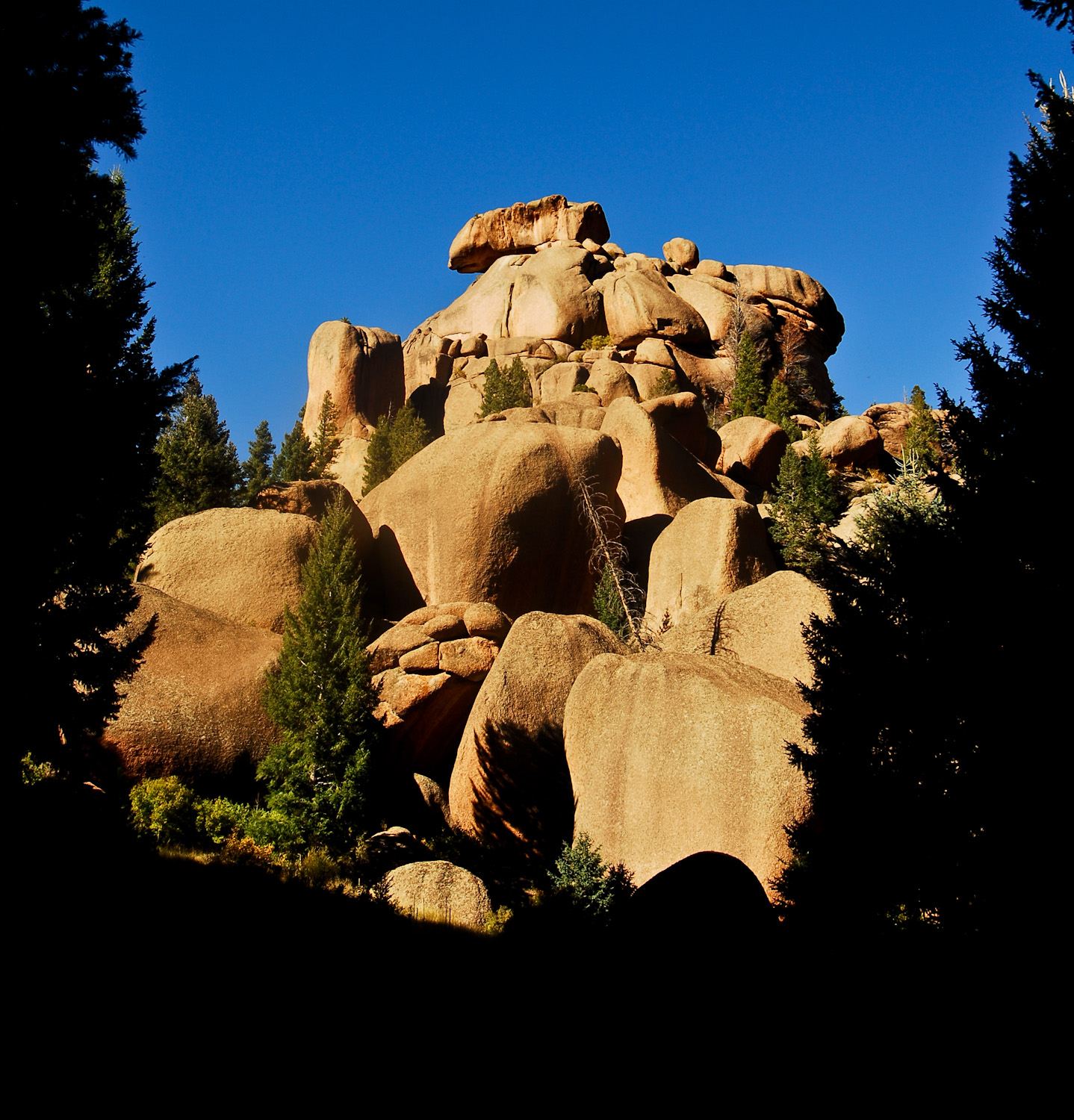
The next morning we had a very specific objective of climbing over Jackass Pass and camping within the actual Cirque. Jackass pass was beautiful and when one hikes it you understand the reasoning behind the name. The many ups and downs of the pass make sure that over the short distance you are getting a serious work-out. But all of that fades away once you catch a glimpse of the cirque. It was like I had never seen granite form such amazing shapes before.
Along the Trail up JackAss Pass:
The 1st Real Overlook of the Cirque with Wolf’s Head formation right behind us (it felt like you were at the top of the pass but there was still one major downhill then uphill before you were on the edge of the Cirque):
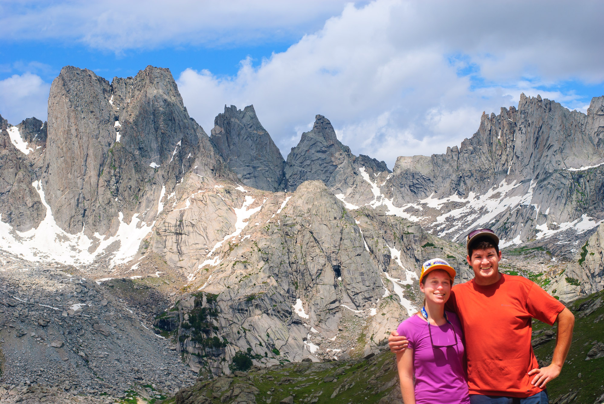
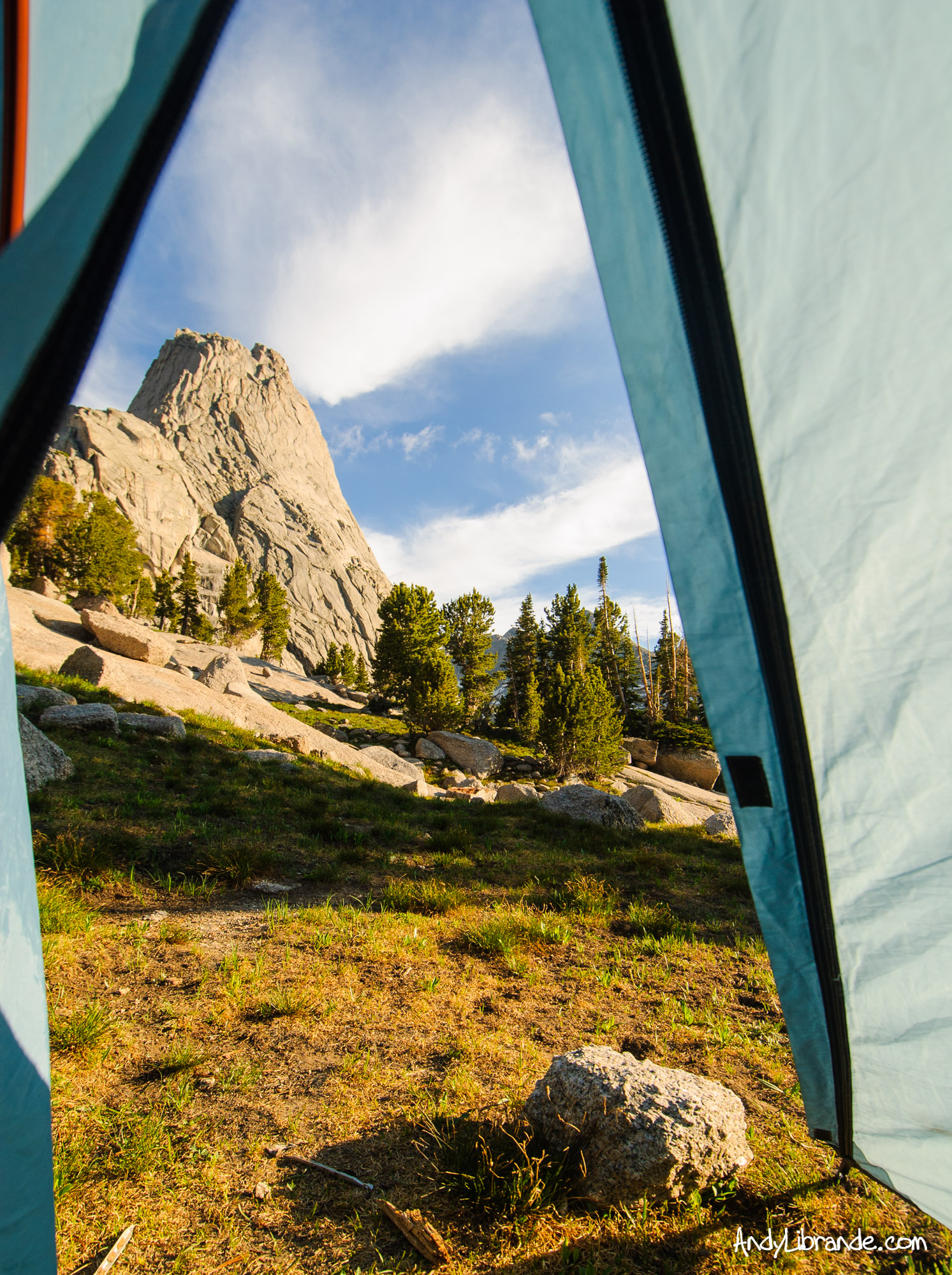
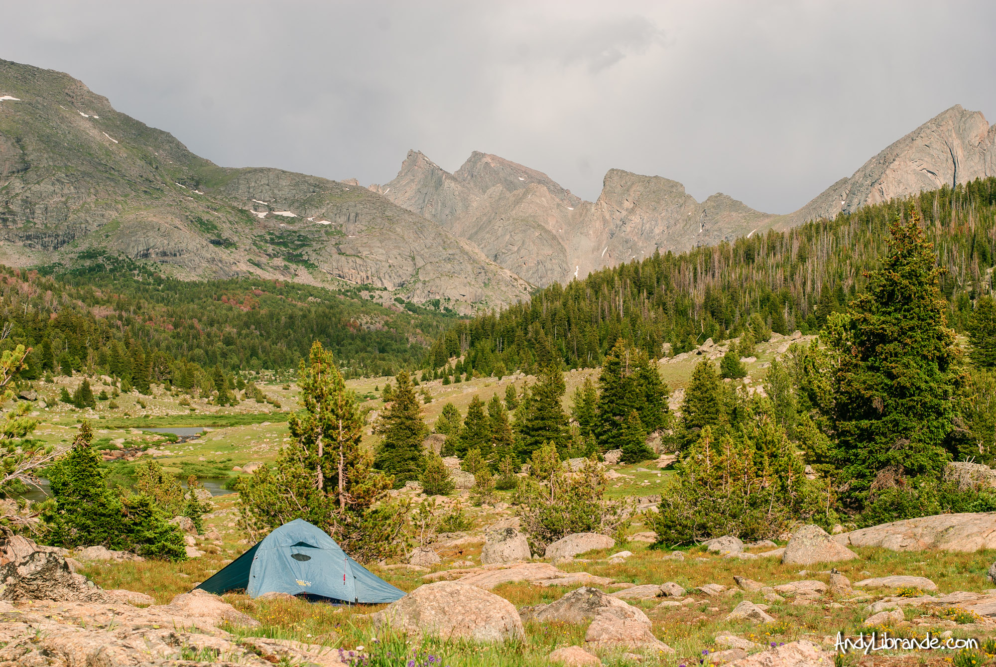
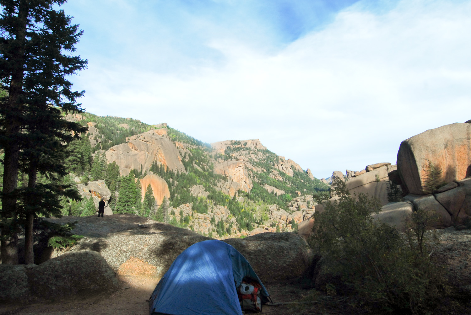
It took us about an hour per mile with breaks to get into the cirque (where the night before we did 1 mile per 20-25 mins). But once we were there it was as if we stepped into an isolated world. We weren’t the only ones there that weekend and it took some time to find a camping spot but where we set-up had some of the best views you could ask for.
Lunch Spot once we crossed over the pass and entered the Cirque:
Talking to a few other backpackers our age we found that there was a route over Texas Pass which was not marked on our map. After spending some time scoping it the night before we decided that we would change our route and go over this pass and make a circle back down to the trail head. We both went to bed excited for the unknown.
Day #3:
The next morning we awoke to a beautiful view and got ready to hit the trail early:
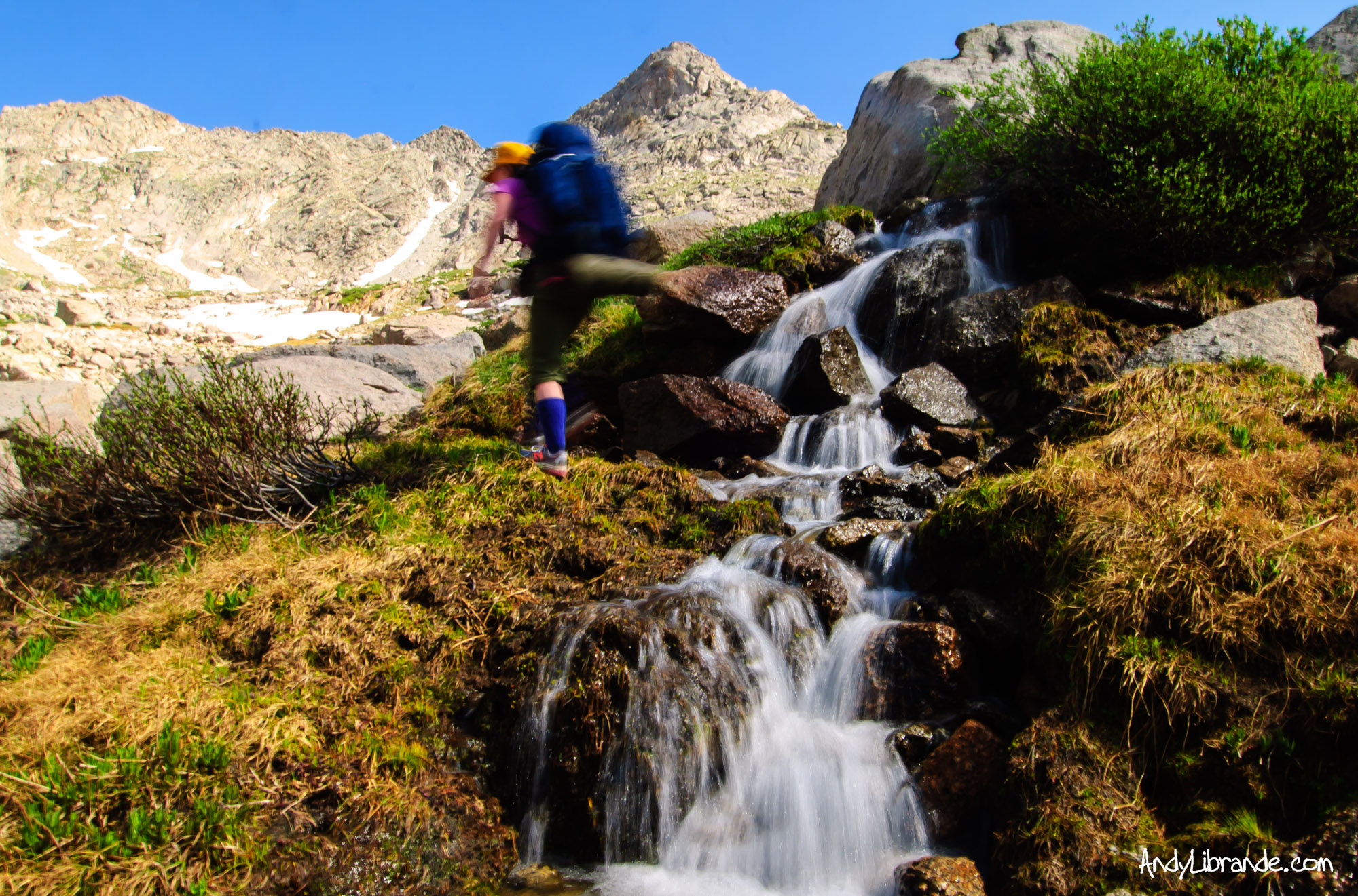
The hike-up Texas Pass was one of the most beautiful sections of the trip. After rock-hopping through a massive boulder-field we criss-crossed a Swiss-like hillside full of flowers, lush grass, marmots, and dozens of little streams. We had joked that if we took a shot of whiskey every-time we crossed a stream we would have only made it 1/4 of the way up!
Caitlin leading the way on one of the many stream-crossings:
At the top of Texas Pass (picture of Texas Pass Continental Divide Sign) we had to cross a large snowfield but the views before that were the most rewarding of the trip. The actual pass is maybe a 100ft wide with steep walls causing quite a bit of wind to blow through there. At the top we saw relatively fresh Bear Scat, which is cool to see humans/animals on the same paths. On the other side it was a steep but relatively straight-forward walk down a massive glacial valley.
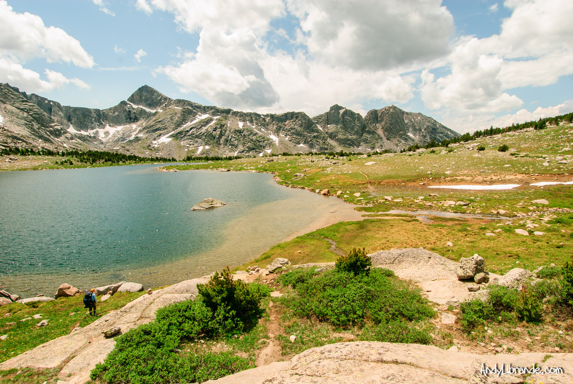
Billy’s Lake on the North side of the Cirque. The elevation change as we continued to head down the valley was subtle but impressive:
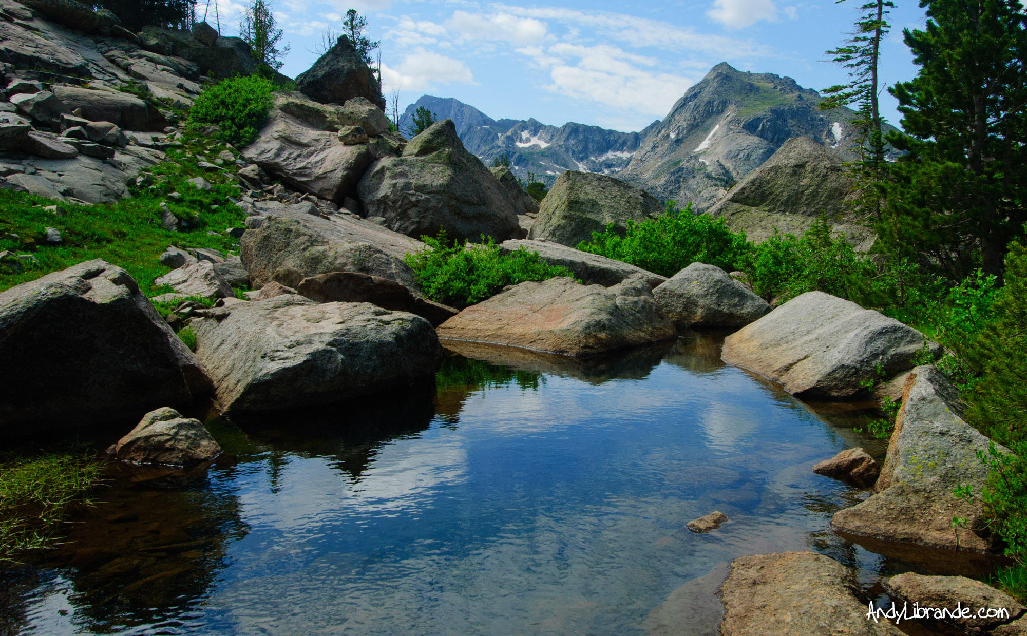
A delicious lunch was had at the foot of Shadow Lake and we continued on the gentle trail for many miles only encountering two different NOLs groups. We set-up camp at the base on the valley in the middle of a number of beautiful little ponds along the river.
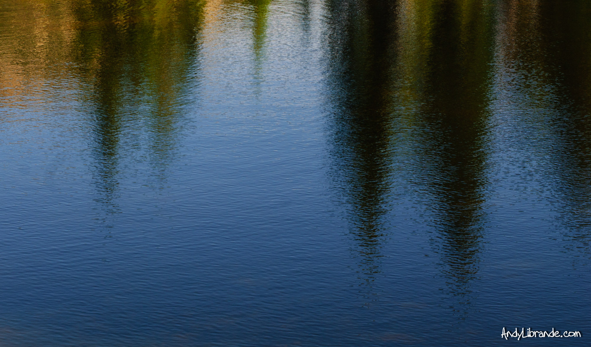
A storm started brewing and we were prepping for dinner when we ran into a guy named Norm who was a good way into his Continental Divide Trail hike (read about his adventure here) (his specific trail-journal entry where he met-us). A few minutes of talking and he was back on the trail trying to outrun the storm. Next thing we knew we were eating dinner under a thick spruce tree as the rain came down hard. The evening ended abruptly and it rained most of the night.
In a Lull in the Storm I caught this Reflection on on of the Small Ponds:
Day 4:
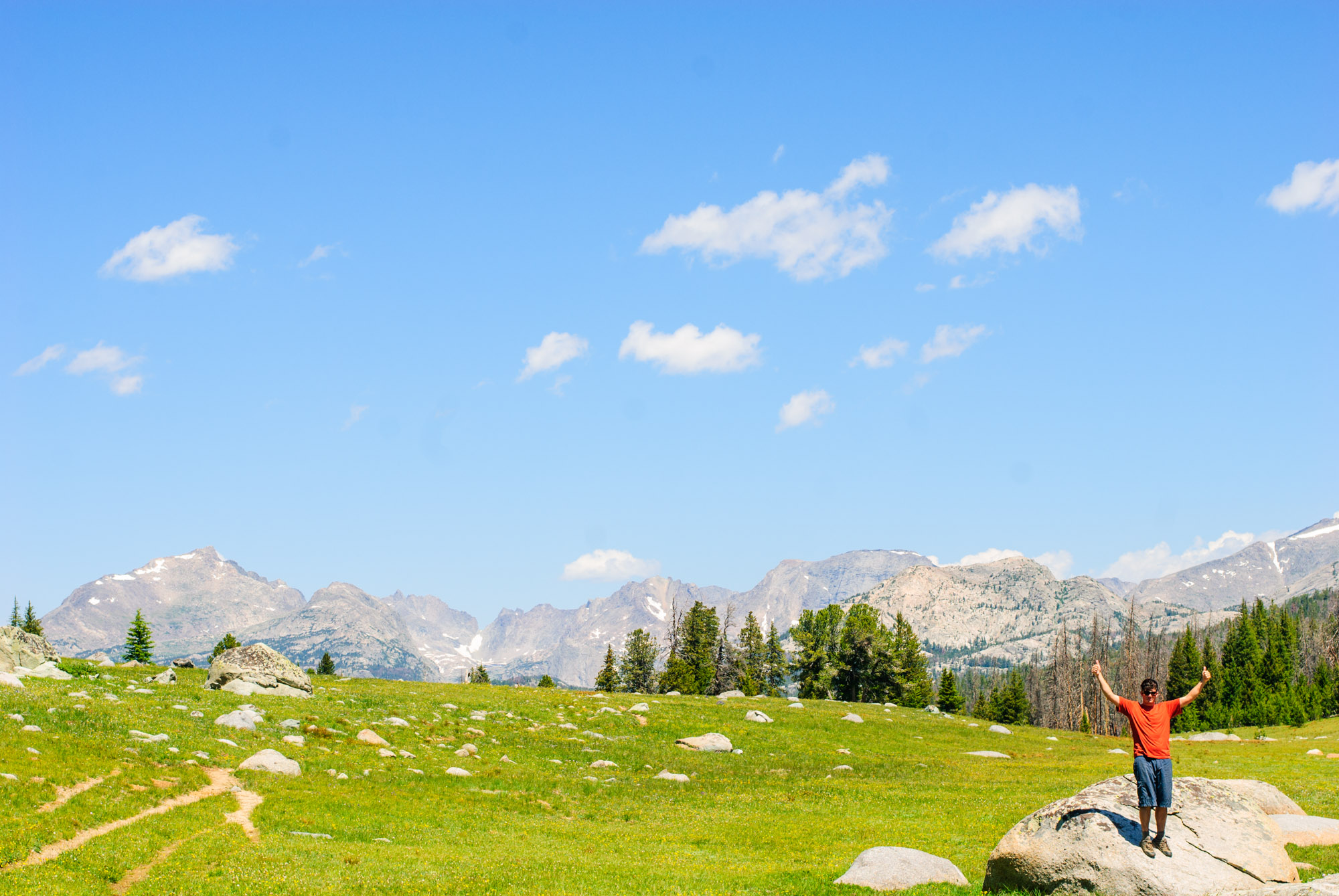
After the persistent rains all night we woke to a beautiful morning that warmed up quickly. We packed up quickly and were grateful for the smart food planning as 4 days of trash fit inside one small zip-lock bag. The hike back caught us off guard. Over 4 hrs to get back to the trail head (roughly 9 miles), however 3hrs were in this high alpine plain and then 1 hr of straight downhill. The high-alpine plain was intense with huge rolling hills and every time you approached a lake you dropped several hundred feet in elevation (hiking out of Dad’s Lake), only to climb back out of it on the other side of the lake. Repeat that 3 or 4 times and what we thought would be a simple down-valley hike turned out to be quite a bit more challenging. Regardless each valley provided amazing views and unique terrain that made the last day well worth the effort.
Myself in one of the large, rolling, never-ending Valleys on our last day:
Finally back to the vehicle we enjoyed a home brew that was mostly cold! Drove to Farson for an ice-cream break and made our way back to Denver.
As a Boy Scout many years ago I had spent a week north of here in another basin. We had a mantra of trying to avoid crowds and people when we were in Scouts and sometimes that left out the incredible places that tend to be popular. While this was 4th of July weekend, outside of Big Sandy Lake and the Cirque we barely saw any other backpackers, adding quite a bit to our experience. This is an incredible piece of the planet and well worth the effort to backpack!
Backpacking in the Eagles Nest Wilderness – Peak C
- Posted: August 29, 2011
- By: andylibrande
- In: Backpacking, Colorado, Summit County/I-70 Area
- 0
When: July 17th – July 18th, 2011
Where: Eagle’s Nest Wilderness, Peak C, Upper Piney River Trail (TOPO MAP LINK)
Caitlin and I decided to add a little fun overnight backpacking trip onto a busy weekend. After going to a quick wedding reception in Frisco we headed over to Vail to embark on a short overnight backpacking trip. After driving down a very long dirt road (which uses the Red and White trailhead that we snowmobile in the winter) we finally reached the Upper Piney Lake Trailhead. Immediately we were greeted by a pretty nasty evening rainstorm which we decided to wait out in the car (and only took about 30 mins).
It quickly turned into a beautiful evening and as we started putting our packs on we were startled when two hudge BULL MOOSE popped-out of the brush 50 yards from us at the parking lot. Of course I had to get some photos of this incredibly rare occurrence (I have only seen moose in Colorado from a very far distance). Moose enjoying the tasty-treats:

Of course I wanted to get as close as possible and luckily we were down-wind from them. I sneaked over to an area with some thicker trees and tried to get as close as possible knowing that these animals are incredibly dangerous. I got this shot through the dense brush:

Right after I took that photo a jeep coming down the road saw them, slammed on their brakes and started taking photos as well. A group of car-campers nearby that were behind a small hill heard the commotion and joined in on the moose watching. I suddenly found myself in close proximity to two potentially dangerous creatures as the tensions quickly increased. The big guy looked around and gave me the stink-eye so I high tailed it out of there before he could test those hooves on me. Unfortunately the two never posed together but you can see both of them in this photo:

Moose distraction aside we started our hike in on an relatively easy trail with incredible views of the valley in front of us.
Caitlin measuring up against the local flauna:

Andy checking out the beautiful Peak C (Rough-rider Couilor is just visible on the notch to the right of the peak) We ran into a group that skied it on Sunday:

We backpacked in a few miles since the sun was setting quickly. Set-up camp and had a great cooking area overlooking two different valley’s. The next morning we got up and hiked around the area up the side of the mountain next to peak C. There are not really any trails in the area (and the ones there are poorly marked as we found ourselves somewhat misplaced).
We were camped at the bottom of this valley. To the Right is where the Trailhead for the Upper Piney is and a very large valley. In front of us in the valley is where the trail continues to Upper Piney Lake (which we missed this trail the night before). On the otherside of the peaks on the left is East Vail. The clouds made it hard to get a solid photo.

After watching the clouds build for a couple of hours a quick moving rainstorm scared us back down to the campsite where we got back just as the weather unleashed for 20-30 mins. Then it was back to clear skies and an awesome hike back to the car.
Beautiful valley views on the way back to the car:

Caitlin and I almost back to the car:

A view of the “Rip Saw” ridge from the road on the drive out:

Nice to get away!
Link to the full post: http://andylibrande.com/news/2011/08/backpacking-in-the-eagles-nest-wilderness-peak-c/
Some Favorites from 2010
- Posted: January 31, 2011
- By: andylibrande
- In: Backpacking, Climbing Wall, Colorado, Random, Rock, Snow, Travel, Wyoming
- 0
Below is a slideshow showing some of my favorite photos from 2010. 2010 was a pretty good year with a number of really cool trips to new locations and old favorites. Hope you enjoy:
If you are following from a feed please follow this link for the full post: http://andylibrande.com/news/2011/01/some-favorites-from-2010/
Backpacking in Lost Creek Wilderness
- Posted: October 18, 2010
- By: andylibrande
- In: Backpacking, Colorado, Front Range
- 0
When: September 10th-12th, 2010
Start: Goose Creek Trailhead, Lost Creek Wilderness
Destination: Shaft House Area
Caitlin and I decided to finally get in a backpacking trip just as the Fall colors were starting. We decided to check-out a place that my roommate was just a few days before us as the scenery looked just amazing.
We took off late on Friday and drove to the trail head as quick as possible (lets just say the Honda Civic tore-up the last 14 miles of dirt-road to the trail head) and arrived to the parking lot with the sun just about to set and darkness setting in really quickly.
We took off down the trail moving as quickly as possible to try to take advantage of the last glowing hints of evening sun, but we quickly found ourselves hiking in the dark. The trail is relatively easy with the first chunk of it on a smooth hillside just above the creek. At one point it does climb far above the valley and with the looming trees (and moonless night) we encountered some seriously dark hiking. Out comes the headlamps and what seems like an eternity of rolling trail we eventually got to the turn-off to the “Shaft House”.
Relieved that we finally hit the turn-off we hiked-up this new trail with no idea of where we would camp. In the pitch dark we occasionally smelled some campfire smoke, hear some bumps in the night, and eventually set-up behind a massive boulder. The sheer darkness and absolute stillness of the night made it challenging to get our bearings.
Morning was an unbelievable site. Huge granite rock-formations everywhere with thick forest and the beautiful fall colors just starting to show.
We hiked out to a overlook over a massive valley with an incredible array of large domes, massive boulders, and a creek wandering through the middle. With the help of some guys that were camped nearby we learned that it was possible to get all the way to the creek bottom. We scrambled all the way to the far stream in the picture below:

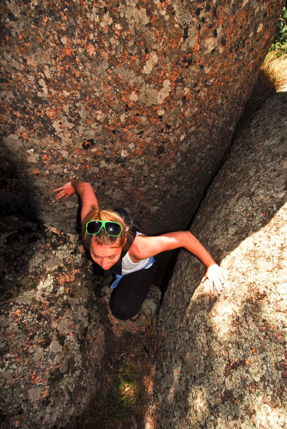
Attempting the get to the creek bottom was a major event in itself. With a significant amount of rock hopping and scrambling (sometimes over great exposure), we had to drop through chimney’s, climb over knife-edges, do some sketchy jumping over crevasses, all while trying to pick out which route would be possible. Awesome stuff!
Once we were at the stream we were rewarded with a Wild Raspberry Bush!!!:

Hanging out down at the stream-bed (ie Andy falling into the stream):

On the hike out we found a little more direct route but had to take this insanely sketchy, rusted-out ladder that was precariously perched between a couple boulders (not bolted into the rock), above a pretty gnarly ravine. Here Caitlin shows her discontentment with me taking photos instead of holding the ladder steady:

Once back to the top we had to relocate our campsite to this one with a phenomenal view of the valley around us. Then off for more exploring.

Caitlin at the old Shaft House (they actually tried to pump concrete into the ground to seal-up all of the rocks to form a reservoir where we hiked earlier in the day; luckily they failed):

We snagged a sweet spot from the guys we ran into previously. Our campsite had to be one of the most scenic locations I have ever slept:

We built a fire on top of the massive rock formation and hung out looking at the stars in a perfect moonless night:

Hiking out of our camping spot was fun. We were completely protected on all sides by rock cliffs, boulders, and tight squeezes. Here is what we had to do to get out of there:

We hiked out with minimal water (the filter was not working well) and towards the end the heat of the day caught-up to us and made the last climb out of the valley very hard. Once back to the car (which was in direct hot sunshine) we raced out of there and headed down the dirt-road to where the road went over the river; we desperately needed to cool off and clean off the grime!
The drive home was a little different as we stopped at Zoka’s for lunch (amazing as usual) and then headed towards Breckenridge over Kenosha and Hoosier Passes as Caitlin needed to go buy some skis on pro-form (she picked up some new Armada JJ’s!!!). The colors were starting to look real nice on both passes and the drive was well worth it.


If you are following from a feed please check out this post on http://andylibrande.com/news/
Backpacking in the Collegiate Peaks
- Posted: November 14, 2009
- By: andylibrande
- In: Backpacking, Colorado, Southern Mountains, Travel
- 1
Where: Collegiate Peaks outside of Buena Vista Colorado. Specifically on the trail that headed North off of the top of Cottonwood Pass on the South Texas Creek trail.
When: 9/29/09- 10/1/09
Who: The old man and me
It had been a few years since me and my old man had gone backpacking together which has always been a favorite pastime for both of us since I was old enough to carry a pack. With short-notice and very quick planning we targeted a few days at the end of September that appeared would hold for weather and provide us with some good fall viewing potential.
Having backpacked pretty extensively in the Collegiate Peaks I picked a trail that we had not done and appeared to be unique as it started at the top of Cottonwood pass, wound all the way down to Texas Creek, and then looped around back to the top of cottonwood pass. With everything set we planned on doing three days with two over-nights on the trail.
After parking at the top of Cottonwood we started on the trail. Here is the official starting point of the trail with some glorious peaks in front of us. Our trail wound along the left side and eventually dropped into the valley where we would head down it and eventually come around back to the car.
Old battered wilderness sign:

The old man hiking on the first day:

View of the main peak that was above our campsite on a very beautiful first day. The valley was lined with beautiful peaks all around 13,000 ft in height:

The next day offered up some unique weather. Waking up to a light drizzle with the peaks completely covered by clouds:

The clouds lifted and revealed the snow they had left behind:

Me with one of the many beautiful peaks in the background:

The Old Man crossing the decent sized Texas Creek. We tried fly-fishing but the wind was so strong in the valley that we had to abandoned that activity:

Right after we crossed the river we realized that the trail we used to cross this massive valley dead-ended at an old cabin. At this point we decided to go off-trail with the intention to try to meet up with the existing trail by traversing up the side of the mountain. Well we never did traverse far enough to get to that trail and ended up heading up the side of the mountain following game trails.
Here is the old man on one of the many established game trails we followed up the side of the hill. The hike turned out to be steeper, longer, and harder then we initially expected. However the solidarity that we experienced was excellent:

For the vast majority of the hike up the hillside we could not see the valley below us or the mountain in front of us due to the dense forest. It was pretty wild hiking up on random game trails without being able to easily tell which direction or how far we needed to go. Additionally we saw numerous signs of wildlife for both predator and prey but unfortnautely did not see any actual wildlife. At one point we the trees parted enough to offer a beautiful view of Ice Mountain across the valley which is just shy of 14,000ft:

Finally after hours of steep climbing (approx 2,000 ft elevation gain and 3 hrs later), we reached the top of the ridgeline. Right before we crossed over I snapped this better view of Ice Mountain:

Once over the ridgeline we fought strong winds, exposed hillside, and the looming sunset to get back to the vehicle as quickly as possible. At this time our plans had changed to hike back to the car, drive down to lower elevation, set-up camp and then leave the next morning. This photo was taken at ~6:30pm as the evening glow started to take over as we hiked to the car:

The last of the sunlight with Taylor Reservoir on the left and the Maroon Bells in the distance on the right (7:00pm approx 1.5 miles to car at this point):

After the sun went down we finally hit the road and were able to ditch our packs and make the final mile slog to the car. Without the sun the temps dropped dramatically with only made it tougher since we were exhausted. After reaching the car we drove down the road and found an area to set-up camp where we finally got some food into our bellies.
The next morning we woke up to about 2-3 inches of snow and were glad that we hiked out the night before as there was probably upwards of 4-6 inches at the top of the pass.
The beautiful Mt. Princton (14,197 ft) the next morning as we were driving home:

The storm did not hit our area as hard as it hit the I-70 corridor. We drove home on beautiful dry roads while Summit County got a few inches. At this point we were heading into the South Park valley and the clouds are all north of us:

Overall a awesome few days spent with my Dad in the beautiful backcountry of Colorado.


Recent Comments: